Category:Laurentiuskerk (Heemskerk)
Jump to navigation
Jump to search
| Object location | | View all coordinates using: OpenStreetMap |
|---|
Heemskerk  | |||||
| Upload media | |||||
| Instance of | |||||
|---|---|---|---|---|---|
| Location | Heemskerk, North Holland, Netherlands | ||||
| Street address |
| ||||
| Architect | |||||
| Heritage designation |
| ||||
| Inception |
| ||||
| Religion or worldview | |||||
 | |||||
|
This is a category about rijksmonument number 21204
|
| Address |
|
Subcategories
This category has the following 3 subcategories, out of 3 total.
I
P
- Panorama Heemskerk, 1963-1964 (13 F)
Media in category "Laurentiuskerk (Heemskerk)"
The following 23 files are in this category, out of 23 total.
-
 Laurentiuskerk aan Anthonie Verherentstraat, Heemskerk c. 1895.jpg 960 × 1,524; 268 KB
-
 Kerk van den H. Laurentius te Heemskerk, 1941.jpg 1,589 × 1,216; 642 KB
-
 Laurentiuskerk aan Anthonie Verherentstraat 2, Heemskerk 1951.jpg 3,984 × 5,543; 2.73 MB
-
 Blik vanaf Laurentiuskerk op St Mariaschool en nieuw Jozef-ziekenhuis, 1964.jpg 2,702 × 2,713; 993 KB
-
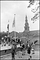 Opening jeugdgebouw, Heemskerk 1967 - 23.jpg 2,323 × 3,511; 1.21 MB
-
 Exterieur naar het noord-oosten - Heemskerk - 20104546 - RCE.jpg 953 × 1,200; 224 KB
-
 Filmploeg van de Nos van Gewest tot Gewest H'kerk, jan. 1979 - 23.jpg 3,459 × 2,286; 789 KB
-
 Filmploeg van de Nos van Gewest tot Gewest H'kerk, jan. 1979 - 24.jpg 3,443 × 2,309; 837 KB
-

-

-
 Exterieur BALUSTER VAN POLYESTER - Heemskerk - 20293731 - RCE.jpg 1,200 × 1,188; 460 KB
-
 Exterieur BALUSTERS VAN DE BALUSTRADE - Heemskerk - 20293727 - RCE.jpg 1,200 × 1,195; 279 KB
-

-

-
 Exterieur OUDE WIJZERPLAAT VAN GEFORCEERD ZINK - Heemskerk - 20293730 - RCE.jpg 1,190 × 1,200; 335 KB
-
 Exterieur TIJDENS RESTAURATIE - Heemskerk - 20293729 - RCE.jpg 1,200 × 1,200; 256 KB
-

-
 Heemskerk H Laurentius kerk.jpg 2,048 × 3,072; 2.42 MB
-
 Heemskerk, Heilige Laurentiuskerk foto3 2011-06-12 16.16.JPG 3,281 × 4,375; 8.58 MB
-
 Laurentiuskerk Heemskerk 2.JPG 1,888 × 2,548; 849 KB
-
 Laurentiuskerk Heemskerk.JPG 1,936 × 2,552; 842 KB
-
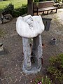 Troost.jpg 3,096 × 4,128; 5.82 MB
-
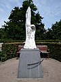 Verrijzenisengel.jpg 3,096 × 4,128; 5.64 MB


