Category:Laupenstrasse (Bern)
Jump to navigation
Jump to search
| Object location | | View all coordinates using: OpenStreetMap |
|---|
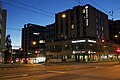
Deutsch: Die Laupenstrasse ist ein Strasse an der nördlichen Grenze des Monbijouquartiers in der Stadt Bern in der Schweiz.
street in the city of Bern, Switzerland | |||||
| Upload media | |||||
| Instance of | |||||
|---|---|---|---|---|---|
| Location | Monbijou, Mattenhof-Weissenbühl, Bern, Bern-Mittelland administrative district, Bernese Mittelland administrative region, Bern, Switzerland | ||||
 | |||||
Subcategories
This category has the following 5 subcategories, out of 5 total.
Media in category "Laupenstrasse (Bern)"
The following 4 files are in this category, out of 4 total.
-
 Bern Canton - panoramio (2).jpg 4,272 × 2,848; 10.71 MB
-
 Bern Canton - panoramio (478).jpg 4,272 × 2,848; 9.8 MB
-
 Bern Canton - panoramio (479).jpg 4,272 × 2,848; 9.53 MB
-
 Villa Marcuard Bern.jpg 1,186 × 900; 319 KB
.jpg)
.jpg)
.jpg)
