Category:Latvian-language SVG maps
Jump to navigation
Jump to search
Subcategories
This category has only the following subcategory.
Media in category "Latvian-language SVG maps"
The following 20 files are in this category, out of 20 total.
-
 Course Channeltunnel lv.svg 472 × 387; 28 KB
-
 Deception Island Map lv.svg 820 × 763; 768 KB
-
 Edgeøya LocationMap-lv.svg 1,480 × 1,950; 953 KB
-
 ESvalodas.svg 709 × 738; 659 KB
-
 Hadrians Wall map-lv.svg 800 × 995; 217 KB
-
 Nordaustlandet LocationMap-lv.svg 1,480 × 1,950; 953 KB
-
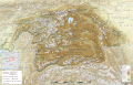 Pamir topographic map-lv.svg 3,543 × 2,271; 4.67 MB
-
 RailBaltica-lv.svg 407 × 495; 366 KB
-
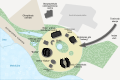 Sochi 2014 olympic coastal cluster map-lv.svg 1,800 × 1,200; 63 KB
-
 Sochi 2014 olympic mountain cluster map-lv.svg 600 × 507; 165 KB
-
 South georgia Islands map-lv.svg 954 × 578; 67 KB
-
 South Orkney Islands-lv.svg 2,878 × 1,713; 1.11 MB
-
 Spitsbergen LocationMap-lv.svg 1,480 × 1,950; 953 KB
-
 Struve Geodetic Arc-zoom-lv.svg 775 × 1,558; 244 KB
-
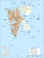
 Svalbard archipelago map-lv.svg 1,480 × 1,950; 883 KB
-
 Svalbard protected areas map with names LV.svg 512 × 654; 424 KB
-
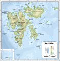 Topographic map of Svalbard lv.svg 2,497 × 2,537; 1.37 MB
-
 United Nations geographical subregions lv.svg 940 × 477; 1.67 MB
-
 Wrangel island lv.svg 800 × 445; 131 KB
-
 Xinjiang prfc map2-lv.png 1,051 × 801; 58 KB


