Category:Latin-language maps of Africa
Jump to navigation
Jump to search
Subcategories
This category has the following 5 subcategories, out of 5 total.
Media in category "Latin-language maps of Africa"
The following 67 files are in this category, out of 67 total.
-
Tabula Moderna Prime Partis Aphricae.jpg 2,611 × 1,960; 1.6 MB
-
1541 waldseemuller map of Africa.jpg 1,746 × 1,353; 2.49 MB
-
Africa Northwest 1561, Girolamo Ruscelli (3824688-recto).png 3,621 × 2,709; 15.08 MB
-
Abisynia 1584.jpg 586 × 509; 119 KB
-
Africa North 1561, Girolamo Ruscelli (3824699-recto).png 3,617 × 2,717; 15.28 MB
-
Africa Northeast 1561, Girolamo Ruscelli (3824953-recto).png 3,645 × 2,741; 15.23 MB
-
Africa Pars Borealis 1699.jpg 9,190 × 6,246; 12.69 MB
-
Africa XXV nova tabula, XVI secolo – BEIC IE8947905.jpg 2,972 × 2,326; 2.16 MB
-
Africa. Nova tabula - Auct. Jud. Hondio ; N. Picart, excudit... - btv1b532236696.jpg 6,946 × 5,262; 7.23 MB
-
Africae antiquae, et quarundam Europae, Asiaeque adiacentium regionum (2673920369).jpg 2,000 × 1,548; 2.91 MB
-
Carte française de l'Océan Indien - btv1b59057849 (1 of 2).jpg 12,177 × 10,217; 18.55 MB
-
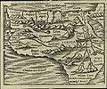
Cosmographia (Sebastian Münster) p 120.jpg 2,000 × 1,455; 477 KB
-
Crop from a French map of Madagascar, dated 1670-1710.jpg 4,096 × 4,080; 2.8 MB
-
Doethicum, Johan (2.) – Insulae et arcis Mocambique descriptio, 1599 – BEIC IE8987178.jpg 4,134 × 3,083; 4.86 MB
-
Ein großer Teil Afrikas zur Illustration der Kirchengeschichte.png 5,260 × 4,556; 38.54 MB
-
Ludolf, Hiob – Jobi Ludolfi, Habessinia seu Abassia, 1683 – BEIC IE8965404.tif 2,456 × 2,000; 14.09 MB
-
Ptolemy Cosmographia 1467 - North Central Africa - Mediterranean Sea.jpg 1,526 × 1,090; 1.2 MB
-
Ptolemy Cosmographia 1467 - North East Africa.jpg 1,532 × 1,087; 1.19 MB
-
Resized-inu-afrmap-3826231-recto-master.png 3,606 × 3,007; 19.99 MB
-
Resized-inu-afrmap-3826232-recto-master.png 3,519 × 3,069; 19.99 MB
-
Resized-inu-afrmap-3826233-recto-master.png 3,520 × 3,106; 20 MB
-
Resized-inu-afrmap-3992815-recto-master.png 3,353 × 2,959; 20 MB
-
Sanctus Iacob, XVII secolo – BEIC IE8941782.jpg 3,141 × 2,153; 2.43 MB
-
Savonarola, Raffaele – Mombaza, 1713 – BEIC IE8981187.jpg 2,035 × 1,355; 970 KB
-
Third map of Africa (eastern Libya and Egypt), in full gold border (NYPL b12455533-427037).tif 4,861 × 3,783; 52.83 MB
-
Blaeu Africae Nova Descriptio 1617 UTA.jpg 6,810 × 5,031; 16.44 MB
-
Bussemacher-Quad Aphrica 1600 UTA.jpg 7,620 × 5,478; 14.94 MB
-
Buy de Mornas Descripcion Generale de l'Afrique 1761 UTA (cropped).jpg 2,973 × 3,211; 3.96 MB
-
Buy de Mornas Descripcion Generale de l'Afrique 1761 UTA.jpg 6,273 × 4,316; 10.48 MB
-
Bünting Africa Tertia Pars Terrae 1580 UTA.jpg 4,328 × 3,496; 6.83 MB
-
Clüver Mauritania et Africa Propria nunc Barbaria c.1624 UTA.jpg 2,696 × 1,708; 1.7 MB
-
Euler Tab. Geogr. Africae 1753 UTA.jpg 4,755 × 3,938; 8.48 MB
-
Henricpetri-Münster, Affricae Tabula Nova-Africa, Lybia Dozenlandt 1580 UTA.jpg 4,568 × 4,025; 8.33 MB
-
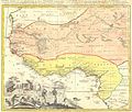
Jansson Guinea 1645 UTA.jpg 6,461 × 4,946; 10 MB
-
Lobeck-Lotter Africa 1760 UTA.jpg 2,057 × 1,643; 1.43 MB
-
Marchetti-Ortelius Africae Tabula Nova1598 UTA.jpg 2,616 × 2,037; 1.45 MB
-
Moll Africa 1701 UTA (cropped).jpg 2,267 × 1,817; 2.12 MB
-
Moll Africa 1701 UTA.jpg 2,349 × 3,551; 2.98 MB
-
Münster Africa 1538 UTA.jpg 2,504 × 1,630; 2.95 MB
-
Münster Africa 1550 UTA.jpg 1,958 × 1,630; 2.69 MB
-
Münster Aphricae Tabula I 1540 UTA.jpg 2,955 × 2,366; 7.1 MB
-
Münster Aphricae Tabula II 1540 UTA.jpg 2,931 × 2,387; 6.95 MB
-
Münster Aphricae Tabula III 1540 UTA.jpg 4,384 × 3,587; 6.94 MB
-
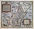
Ortelius Presbiteri Johannis, sive Abissinorum Imperii Descriptio 1584 UTA.jpg 5,565 × 4,822; 12.17 MB
-
Peeters Africae 1692 UTA.jpg 4,596 × 3,849; 4.92 MB
-
Ruscelli Tabula Africae III 1574 UTA.jpg 6,332 × 4,666; 6.84 MB
-
Schreiber Africa 1730 UTA.jpg 2,912 × 2,054; 2.76 MB
-
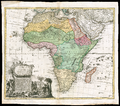
Seutter Africa jjuxta navigationes et observat recentissimas 1744 UTA.jpg 1,600 × 1,183; 932 KB
-
Sylvanus Quarta Africae Tabula 1511 UTA.jpg 4,001 × 2,801; 6.73 MB
-
Van der Aa Andries Battels Scheeptogt na Brasile 1706 UTA.jpg 5,028 × 3,970; 8.08 MB
-
Waldseemüller Tabula Moderna Prime Partis Africae 1513 UTA.jpg 3,024 × 2,340; 3.09 MB
-
Weigel Africa Tabula 1720 UTA.jpg 4,419 × 3,632; 6.85 MB
-
Weigel Africa Vetus 1720 UTA.jpg 5,072 × 4,208; 9.13 MB
-
Wells A New Map of Libya or Old Africk 1699 UTA.jpg 6,026 × 4,706; 10.16 MB


