Category:Latin-language SVG maps
Jump to navigation
Jump to search
Subcategories
This category has only the following subcategory.
L
Media in category "Latin-language SVG maps"
The following 39 files are in this category, out of 39 total.
-
 3rd servile 72 plutarch.svg 3,245 × 3,948; 347 KB
-
 African continent-la.svg 1,525 × 1,440; 741 KB
-
 Ancient Egypt map-la.svg 1,577 × 3,219; 1.57 MB
-
 Balkan topo la.svg 1,400 × 1,278; 472 KB
-
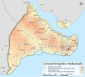
 Byzantine Constantinople regiones.svg 2,085 × 1,889; 648 KB
-
 Byzantine Constantinople viae.svg 2,085 × 1,889; 436 KB
-
 CaldwellStarChart-la.svg 1,000 × 500; 938 KB
-
 General map of Malta-la.svg 502 × 433; 199 KB
-
 Georgia, Ossetia, Russia and Abkhazia (la).svg 676 × 400; 620 KB
-
 Iron Age Italy-la.svg 432 × 525; 267 KB
-
 JJ1 Route la.svg 2,400 × 1,163; 45 KB
-
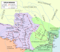
 Latium -5th Century map-la.svg 900 × 675; 336 KB
-
 Local Group Latine.svg 683 × 512; 36 KB
-
 Map of Italy-la.svg 3,245 × 3,948; 199 KB
-
 Map of the fossil sites of the early hominids (4.4-1M BP).svg 1,525 × 1,440; 601 KB
-
 Member States of the European Union (polar stereographic projection) LA.svg 442 × 409; 1.66 MB
-
 MessierStarChart-la.svg 1,000 × 500; 934 KB
-
 MS804 flight path la.svg 692 × 664; 447 KB
-
 Mt Vesuvius 79 AD eruption-la.svg 800 × 480; 86 KB
-
 Nearby Stars (14ly Radius) la.svg 600 × 600; 92 KB
-
 New Siberian Islands la.svg 676 × 547; 609 KB
-
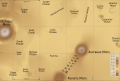
 Olympus Mons Region map-la.svg 2,000 × 1,500; 492 KB
-
 Pannonia.svg 702 × 751; 16 KB
-
 Praevalis 4 c AD.svg 1,052 × 744; 186 KB
-
 Praevalis 4c AD map.svg 1,600 × 1,200; 183 KB
-
 Praevalitana 4c AD 2.svg 1,024 × 768; 183 KB
-
 Roman province of Dacia (106 - 271 AD)-ca.svg 1,500 × 1,300; 395 KB
-
 Roman province of Dacia (106 - 271 AD)-es.svg 1,500 × 1,300; 802 KB
-
 Roman province of Dacia (106 - 271 AD).svg 1,500 × 1,300; 392 KB
-
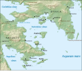 Saronic Gulf map-la.svg 1,490 × 1,280; 801 KB
-
 Seven churches of asia-hu.svg 623 × 944; 17 KB
-
 Seven churches of asia.svg 623 × 944; 58 KB
-
 Seven-churches-of-asia.svg 765 × 990; 20 KB
-
 South america la.svg 505 × 670; 559 KB
-
 Tharsis Quadrangle map-la.svg 1,217 × 813; 489 KB
-
 The boundary of the Western and Eastern Roman Empire on the Adriatic Sea.svg 744 × 1,052; 270 KB
-
 Vilkitsky Strait-la.svg 529 × 478; 12 KB
-
 Visigotic mints.svg 473 × 415; 320 KB
-
 World map ocean locator-la.svg 1,200 × 684; 674 KB


.svg)


.svg)
_LA.svg)


_la.svg)


-ca.svg)
-es.svg)
.svg)


