Category:Latchingdon
Jump to navigation
Jump to search
English: Latchingdon is a village situated in Essex, England. It is situated near the town of Chelmsford.
village in Essex, England, UK  | |||||
| Upload media | |||||
| Instance of | |||||
|---|---|---|---|---|---|
| Location | Maldon, Essex, East of England, England | ||||
| Population |
| ||||
 | |||||
Subcategories
This category has the following 2 subcategories, out of 2 total.
B
- Bridgemarsh Island (5 F)
M
Media in category "Latchingdon"
The following 128 files are in this category, out of 128 total.
-
 A Bend in Green Lane - geograph.org.uk - 5163391.jpg 424 × 640; 59 KB
-
 Agricultural land near the Crouch - geograph.org.uk - 3238444.jpg 3,648 × 2,736; 2.82 MB
-
 Arable land near Grange Farm - geograph.org.uk - 3239131.jpg 2,667 × 1,500; 1.21 MB
-
 Arable land, Latchingdon parish - geograph.org.uk - 5496617.jpg 640 × 480; 127 KB
-
 B1010 Lower Burnham Road - geograph.org.uk - 5486078.jpg 640 × 480; 134 KB
-
 B1018, Burnham Road - geograph.org.uk - 4037444.jpg 640 × 480; 109 KB
-
 Bluehouse Farm Nature Reserve - geograph.org.uk - 5486056.jpg 640 × 480; 128 KB
-
 Borrow dyke - geograph.org.uk - 5490738.jpg 640 × 480; 137 KB
-
 Bridgemarsh Island at High Tide - geograph.org.uk - 3835527.jpg 3,648 × 2,736; 2.61 MB
-

-
 Bungalow on Burnham Road, Latchingdon - geograph.org.uk - 6340161.jpg 1,872 × 1,204; 1.39 MB
-
 Bungalow on Lower Burnham Road west of Althorne - geograph.org.uk - 6340704.jpg 1,848 × 1,162; 1.33 MB
-
 Channel to Bridgemarsh Creek - geograph.org.uk - 3238470.jpg 3,648 × 2,052; 2.54 MB
-
 Christ Church, Latchingdon - geograph.org.uk - 5091779.jpg 1,173 × 1,600; 547 KB
-

-

-
 Clayhill Vineyard - geograph.org.uk - 2173963.jpg 1,024 × 768; 195 KB
-
 Clayhill Vineyard - geograph.org.uk - 2174039.jpg 1,024 × 725; 261 KB
-
 Cows in the field - geograph.org.uk - 3239157.jpg 3,648 × 2,736; 2.4 MB
-
 Crouch Valley - geograph.org.uk - 2822923.jpg 1,280 × 791; 185 KB
-
 Dedication on the Latchingdon Village sign - geograph.org.uk - 2173831.jpg 1,024 × 683; 96 KB
-
 Difficult access footbridge - geograph.org.uk - 2719390.jpg 3,648 × 2,255; 2.85 MB
-
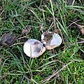 Discarded shells (bird feeding area) - geograph.org.uk - 3239154.jpg 1,280 × 1,280; 1.01 MB
-
 Drainage ditches on the marshes - geograph.org.uk - 3250727.jpg 1,600 × 1,064; 442 KB
-
 Entrance to Scatterbrook Farm - geograph.org.uk - 2173900.jpg 1,024 × 768; 363 KB
-
 Entrance to Snoreham Hall. - geograph.org.uk - 2173859.jpg 1,024 × 768; 211 KB
-
 Entrance to Ulehams farm, North Fambridge - geograph.org.uk - 3003161.jpg 1,600 × 1,200; 591 KB
-
 Essex, St. Michael's Churchyard, Latchingdon - geograph.org.uk - 2334102.jpg 3,456 × 2,304; 5.58 MB
-
 Evening low tide, Mundon Creek - geograph.org.uk - 4011550.jpg 640 × 480; 121 KB
-
 Farm track - geograph.org.uk - 3239197.jpg 3,648 × 2,736; 2.08 MB
-
 Farm View - geograph.org.uk - 2173930.jpg 1,024 × 682; 135 KB
-
 Farmland south of Lower Burnham Road - geograph.org.uk - 5486084.jpg 640 × 480; 147 KB
-
 Field gateway near Grange Farm - geograph.org.uk - 5227280.jpg 1,600 × 1,067; 322 KB
-
 Field view - geograph.org.uk - 2174038.jpg 1,024 × 793; 260 KB
-
 Fields west of Rectory Lane - geograph.org.uk - 4413240.jpg 800 × 521; 99 KB
-
 Fleet, RSPB Bluehouse Farm - geograph.org.uk - 5496910.jpg 640 × 480; 132 KB
-
 Football pitch - geograph.org.uk - 2679895.jpg 2,777 × 1,716; 1.51 MB
-
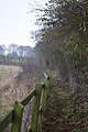 Footpath north of Latchingdon churchyard - geograph.org.uk - 5227268.jpg 1,067 × 1,600; 431 KB
-
 Footpath through cornfield, Mayland - geograph.org.uk - 3553993.jpg 3,648 × 2,736; 2.3 MB
-
 Footpath to the B1018 - geograph.org.uk - 5179777.jpg 424 × 640; 119 KB
-
 Gate, stile, footpath marker - geograph.org.uk - 2679922.jpg 3,066 × 1,895; 2.4 MB
-
 Gateway to Rosedale - geograph.org.uk - 2173846.jpg 1,024 × 683; 127 KB
-
 Goats at Scatterbrook Farm - geograph.org.uk - 5227273.jpg 1,600 × 1,067; 317 KB
-
 Goats, Scatterbrook Farm - geograph.org.uk - 5486076.jpg 640 × 480; 184 KB
-
 Green Lane, Mayland - geograph.org.uk - 3013559.jpg 1,600 × 1,200; 341 KB
-
 Groynes in Bridgemarsh Creek - geograph.org.uk - 3238493.jpg 3,623 × 2,038; 1.68 MB
-
 Head of the creek at Althorne - geograph.org.uk - 3250742.jpg 1,600 × 1,064; 342 KB
-
 Housing near farm on Green Lane - geograph.org.uk - 2679940.jpg 3,648 × 2,255; 1.93 MB
-
 Huntsman and Hounds - geograph.org.uk - 5227305.jpg 1,600 × 1,067; 300 KB
-
 Huntsman ^ Hounds - geograph.org.uk - 5179758.jpg 640 × 424; 72 KB
-
 Latchingdon cemetery - geograph.org.uk - 5486074.jpg 640 × 480; 176 KB
-
 Latchingdon Football Club - geograph.org.uk - 2173528.jpg 1,024 × 682; 199 KB
-
 Latchingdon Hall - geograph.org.uk - 2173911.jpg 1,024 × 682; 232 KB
-
 Latchingdon Parish Hall - geograph.org.uk - 2173781.jpg 1,024 × 682; 135 KB
-
 Latchingdon Stores and Three-Eight - geograph.org.uk - 4008157.jpg 640 × 428; 86 KB
-
 Latchingdon Village Sign - geograph.org.uk - 2173824.jpg 791 × 1,024; 226 KB
-
 Lawling Hall - geograph.org.uk - 2148324.jpg 1,024 × 597; 119 KB
-
 Looking across the Crouch - geograph.org.uk - 3240178.jpg 640 × 430; 49 KB
-

-
-

-

-
 Looking over fields towards farm buildings - geograph.org.uk - 2680178.jpg 3,243 × 2,004; 1.68 MB
-

-
 Looking towards Bridgemarsh Marina - geograph.org.uk - 3239208.jpg 3,247 × 1,826; 1.26 MB
-
 Lower Burnham Road (B1010) - geograph.org.uk - 3239128.jpg 3,648 × 2,052; 2.22 MB
-
 Lower Burnham Road - geograph.org.uk - 2173919.jpg 682 × 1,024; 162 KB
-
 Lower Burnham Road - geograph.org.uk - 2173922.jpg 741 × 1,024; 192 KB
-
 Lower Burnham Road, North Fambridge - geograph.org.uk - 6340909.jpg 1,826 × 1,128; 1.14 MB
-
 Maldon Road junction with The Street, Latchingdon - geograph.org.uk - 2718009.jpg 2,992 × 1,849; 1.36 MB
-
 Minor tidal sluice - geograph.org.uk - 5490569.jpg 640 × 480; 142 KB
-
 Mundon Creek - geograph.org.uk - 2425337.jpg 640 × 430; 74 KB
-
 North of Bridgemarsh Creek - geograph.org.uk - 3250736.jpg 1,600 × 1,064; 294 KB
-
 Old Police House, Latchingdon - geograph.org.uk - 4008139.jpg 640 × 480; 102 KB
-
 Power line over a barley field - geograph.org.uk - 5486082.jpg 640 × 480; 134 KB
-
 Pull^ - geograph.org.uk - 130385.jpg 640 × 480; 109 KB
-
 Pylon on field boundary - geograph.org.uk - 2680181.jpg 2,154 × 2,154; 1.19 MB
-
 Rectory Lane - geograph.org.uk - 2173866.jpg 768 × 1,024; 388 KB
-
 Rectory Lane - geograph.org.uk - 2173881.jpg 682 × 1,024; 138 KB
-
 Rectory Lane - geograph.org.uk - 2173888.jpg 682 × 1,024; 184 KB
-
 Rectory Lane - geograph.org.uk - 2173913.jpg 682 × 1,024; 289 KB
-
 Rectory Lane Junction with Lower Burnham Road ^ Water Tower - geograph.org.uk - 2822450.jpg 3,648 × 2,736; 3.13 MB
-

-

-

-
 Roadside trees and fence, Green Lane - geograph.org.uk - 5227303.jpg 1,600 × 1,067; 334 KB
-
 Round "Pond" in the borrowdyke - geograph.org.uk - 3742300.jpg 2,990 × 1,988; 1.36 MB
-
 Rubbish and saltings, River Crouch - geograph.org.uk - 5490752.jpg 640 × 480; 169 KB
-
 Saltings, Bridgemarsh Creek - geograph.org.uk - 5486063.jpg 640 × 480; 132 KB
-
 Sea Wall and Bridgemarsh Creek - geograph.org.uk - 3834473.jpg 3,648 × 2,736; 2.51 MB
-
 Sea wall stile - geograph.org.uk - 5486066.jpg 640 × 480; 140 KB
-
 Sea wall, Mundon Creek - geograph.org.uk - 4011575.jpg 640 × 480; 97 KB
-
 Seawall north of Bridgemarsh Island - geograph.org.uk - 3250739.jpg 1,600 × 1,064; 348 KB
-
 Sheep at Stamfords sluice - geograph.org.uk - 3743470.jpg 2,952 × 1,962; 1.27 MB
-
 Sheep on the marsh - geograph.org.uk - 3239160.jpg 3,648 × 2,052; 1.59 MB
-

-
 Sluices, Mundon Creek - geograph.org.uk - 4011545.jpg 640 × 480; 119 KB
-
 Snoreham Hall - geograph.org.uk - 2165398.jpg 1,024 × 634; 150 KB
-
 Spiny Restharrow, Ononis spinosa - geograph.org.uk - 5490548.jpg 640 × 480; 244 KB
-
 St Michael's Churchyard - geograph.org.uk - 2175189.jpg 1,024 × 683; 472 KB
-
 St Michael's Churchyard - geograph.org.uk - 2175206.jpg 727 × 1,024; 267 KB
-
 Swans on the dyke - geograph.org.uk - 3239153.jpg 3,648 × 2,052; 2.01 MB
-
 The Street in Latchingdon - geograph.org.uk - 759577.jpg 640 × 480; 65 KB
-
 Track towards Snorehamall Grove - geograph.org.uk - 5486089.jpg 640 × 480; 124 KB
-
 Traditional timber-clad house, Latchingdon - geograph.org.uk - 2473726.jpg 1,024 × 768; 110 KB
-
 Transformation on the B1010 - geograph.org.uk - 5165661.jpg 640 × 424; 62 KB
-
 Tree on field boundary - geograph.org.uk - 2718030.jpg 2,759 × 1,705; 1.04 MB
-
 Tyle Hall Sluice 1 - geograph.org.uk - 3238458.jpg 3,648 × 2,736; 2.97 MB
-
 Ulehams Farm - geograph.org.uk - 2173928.jpg 1,024 × 653; 159 KB
-
 Ulehams farm, North Fambridge - geograph.org.uk - 3003162.jpg 1,600 × 1,200; 589 KB
-
 Unadopted road, with rural housing - geograph.org.uk - 2719438.jpg 3,648 × 2,736; 3.63 MB
-
 View from bird hide, Blue House Farm Nature Reserve - geograph.org.uk - 3835557.jpg 3,648 × 1,520; 1.71 MB
-
 View from Lower Burnham Road - geograph.org.uk - 5227264.jpg 1,600 × 1,067; 169 KB
-
 View from the Churchyard - geograph.org.uk - 2175194.jpg 1,024 × 683; 342 KB
-
 View from the Churchyard - geograph.org.uk - 2175201.jpg 1,024 × 682; 128 KB
-
 View from the Churchyard - geograph.org.uk - 2175205.jpg 1,024 × 682; 99 KB
-
 View towards Lawling Hall - geograph.org.uk - 4042056.jpg 1,600 × 1,064; 424 KB
-
 Water Tower - geograph.org.uk - 2173904.jpg 1,024 × 682; 190 KB
-

-
 Winter hedgerow - geograph.org.uk - 2718109.jpg 3,648 × 2,255; 3.51 MB
-
 Game Cover - geograph.org.uk - 281312.jpg 640 × 426; 105 KB
-
 Global Warming^ - geograph.org.uk - 281389.jpg 640 × 432; 141 KB
-
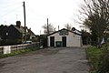
 Industrial Units in Latchingdon - geograph.org.uk - 281303.jpg 426 × 640; 154 KB
-
 Latchingdon Sign - geograph.org.uk - 130393.jpg 640 × 480; 71 KB
-
 Lawlings Farm - geograph.org.uk - 281357.jpg 640 × 426; 83 KB
-
 Red Lions Business Centre - geograph.org.uk - 130389.jpg 640 × 480; 63 KB
-
 Steeple Rd - geograph.org.uk - 281373.jpg 640 × 426; 98 KB
-
 Workshop - geograph.org.uk - 281293.jpg 640 × 426; 94 KB


_-_geograph.org.uk_-_3239154.jpg)


_-_geograph.org.uk_-_3239128.jpg)


