Category:Larkhill
Jump to navigation
Jump to search
garrison town in the civil parish of Durrington, Wiltshire, England  | |||||
| Upload media | |||||
| Instance of | |||||
|---|---|---|---|---|---|
| Location | Durrington, Wiltshire, South West England, England | ||||
| Operator | |||||
 | |||||
English: Larkhill is a garrison town]in the civil parish of Durrington, Wiltshire, England. It is a short distance west of Durrington village, one mile north of the prehistoric monument of Stonehenge and about 10 miles north of Salisbury.
Subcategories
This category has the following 2 subcategories, out of 2 total.
R
Media in category "Larkhill"
The following 78 files are in this category, out of 78 total.
-
-

-
 Afghan Training Village, Larkhill, Salisbury MOD 45152741.jpg 4,500 × 3,000; 1.31 MB
-
 Afghan Training Village, Larkhill, Salisbury MOD 45152742.jpg 4,500 × 3,000; 1.76 MB
-
 Alton Barn - geograph.org.uk - 457161.jpg 640 × 480; 112 KB
-
 Arable land south of Stonehenge - geograph.org.uk - 32263.jpg 640 × 480; 440 KB
-

-

-
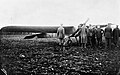
 Aviation in Britain Before the First World War RAE-O834.jpg 800 × 492; 73 KB
-
 Aviation in Britain Before the First World War RAE-O835.jpg 800 × 497; 57 KB
-
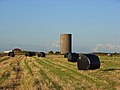 Bales and water tower near Stonehenge - geograph.org.uk - 491362.jpg 640 × 480; 111 KB
-
 Bales and water tower near Stonehenge - geograph.org.uk - 491369.jpg 640 × 480; 135 KB
-
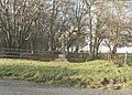
 Barn near Stonehenge - geograph.org.uk - 491375.jpg 640 × 480; 121 KB
-
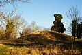 Barrow Near Stonehenge - geograph.org.uk - 1626605.jpg 3,872 × 2,592; 5.85 MB
-
 Bird's Resting Place, Stonehenge - geograph.org.uk - 34449.jpg 640 × 480; 420 KB
-
 Bridleway to King Barrow from Fargo Road - geograph.org.uk - 336788.jpg 640 × 480; 124 KB
-
 Broomrape - geograph.org.uk - 457124.jpg 480 × 640; 219 KB
-
 Byway on Durrington Down - geograph.org.uk - 1622125.jpg 640 × 480; 80 KB
-
 Byway towards Stonehenge - geograph.org.uk - 1621197.jpg 574 × 640; 103 KB
-
 Byway, Normanton Down - geograph.org.uk - 491257.jpg 640 × 480; 133 KB
-
 Crop at Larkhill - geograph.org.uk - 1621459.jpg 640 × 480; 115 KB
-
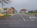
 Crossroads, Larkhill - geograph.org.uk - 1621482.jpg 640 × 410; 48 KB
-
 Downland and copses, Larkhill - geograph.org.uk - 453575.jpg 640 × 480; 161 KB
-
 Downland, Larkhill - geograph.org.uk - 453579.jpg 640 × 480; 154 KB
-
 Entrance to Horne Barracks, Larkhill - geograph.org.uk - 336804.jpg 640 × 480; 91 KB
-
 Farm road, Durrington Down - geograph.org.uk - 491386.jpg 640 × 480; 115 KB
-
 Farmland near Stonehenge - geograph.org.uk - 491357.jpg 640 × 480; 180 KB
-
 Farmland, Durrington - geograph.org.uk - 453582.jpg 640 × 480; 177 KB
-
 Farmland, Larkhill - geograph.org.uk - 489496.jpg 640 × 480; 171 KB
-
 Farmland, Larkhill - geograph.org.uk - 489499.jpg 640 × 480; 146 KB
-
 Frost shadows, Larkhill - geograph.org.uk - 1621178.jpg 480 × 640; 125 KB
-
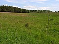
 Grassland at Larkhill - geograph.org.uk - 1621455.jpg 640 × 480; 82 KB
-

-
 Junction of Fargo Road and Strangways - geograph.org.uk - 336792.jpg 640 × 480; 125 KB
-
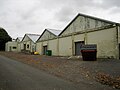 Larkhill Hangars.jpg 2,048 × 1,536; 1.65 MB
-
 Larkhill point-to-point course - geograph.org.uk - 453578.jpg 640 × 480; 139 KB
-

-

-
 Married Quarters at Larkhill - geograph.org.uk - 336797.jpg 640 × 480; 84 KB
-
-
 Mounds, Stonehenge - geograph.org.uk - 34455.jpg 640 × 480; 406 KB
-
 Netheravon Down - geograph.org.uk - 453576.jpg 640 × 480; 123 KB
-
-
 Normanton Down - geograph.org.uk - 491260.jpg 640 × 480; 154 KB
-
 Past the Stones, Stonehenge - geograph.org.uk - 34294.jpg 640 × 480; 415 KB
-
 Picnic in the henge - geograph.org.uk - 111969.jpg 640 × 431; 78 KB
-
 Plantation, Durrington Down - geograph.org.uk - 1622176.jpg 480 × 640; 107 KB
-
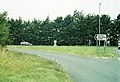
 Road junction, Larkhill - geograph.org.uk - 1622057.jpg 640 × 480; 105 KB
-

-

-
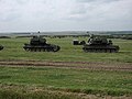
 Tank on a track, Larkhill Artillery Range - geograph.org.uk - 457037.jpg 640 × 480; 107 KB
-
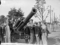
 The Bhurtpoor Gun at Woolwich. ILN 1861.jpg 600 × 439; 152 KB
-
 The British Army in the United Kingdom 1939-45 H244.jpg 800 × 596; 66 KB
-
 The British Army in the United Kingdom 1939-45 H78.jpg 800 × 602; 82 KB
-
 Through the Stones, Stonehenge - geograph.org.uk - 34293.jpg 450 × 600; 193 KB
-
 Water trough, Durrington Down - geograph.org.uk - 1622102.jpg 640 × 480; 90 KB
-
 Wells Road, Larkhill - geograph.org.uk - 489540.jpg 640 × 480; 129 KB
-
 By-way west of Stonehenge - geograph.org.uk - 32261.jpg 640 × 480; 428 KB
-
 Byway, Larkhill Artillery Range - geograph.org.uk - 457108.jpg 640 × 480; 129 KB
-

-
 Cranes Folly - geograph.org.uk - 453571.jpg 640 × 480; 124 KB
-
 Crescent Copse - geograph.org.uk - 457050.jpg 640 × 480; 163 KB
-
 Downland, Netheravon - geograph.org.uk - 453570.jpg 640 × 480; 152 KB
-
 Downland. Larkhill - geograph.org.uk - 453572.jpg 640 × 480; 119 KB
-
 Field of ripe wheat, west of Stonehenge - geograph.org.uk - 32262.jpg 640 × 480; 490 KB
-

-
 Gate on the A344 east of Stonehenge - geograph.org.uk - 32270.jpg 640 × 480; 490 KB
-
 Horton's Folly - geograph.org.uk - 453574.jpg 640 × 480; 138 KB
-
 Larkhill - geograph.org.uk - 328078.jpg 640 × 480; 44 KB
-
 Larkhill - geograph.org.uk - 328082.jpg 640 × 480; 27 KB
-
 Pine, Larkhill Artillery Range - geograph.org.uk - 456981.jpg 640 × 480; 129 KB
-
 Stonehenge - geograph.org.uk - 111986.jpg 544 × 406; 133 KB
-
 Stonehenge - geograph.org.uk - 221861.jpg 640 × 480; 73 KB
-
 Stonehenge - geograph.org.uk - 90079.jpg 640 × 480; 44 KB
-

-
 Tank on a track, Larkhill Artillery Range - geograph.org.uk - 457010.jpg 640 × 480; 140 KB
-
 Track, beside Newfoundland Farm Wood - geograph.org.uk - 453569.jpg 640 × 480; 113 KB
-
 Tumulus and Reservoir - geograph.org.uk - 328185.jpg 640 × 480; 67 KB


