Category:Laridae distribution maps
Jump to navigation
Jump to search
Subcategories
This category has the following 2 subcategories, out of 2 total.
L
T
- Thalasseus (distribution maps) (16 F)
Media in category "Laridae distribution maps"
The following 47 files are in this category, out of 47 total.
-
 Black Noddy ebird data map.png 3,718 × 1,861; 440 KB
-
 Black-headed Gull ebird data map.png 3,762 × 1,902; 735 KB
-
 Chlidonias niger map.svg 940 × 477; 1.79 MB
-
 Chroicocephalus cirrocephalus distribution.jpg 1,200 × 801; 100 KB
-
 ChroicocephalusRidibundusIUCN2019-2.png 3,461 × 1,700; 1.03 MB
-
 CommonTernmap.png 2,438 × 1,232; 71 KB
-

-

-

-

-

-
 Ichthyaetus leucophthalmus range.png 600 × 711; 912 KB
-
 Larus armenicus range map in Armenia (Armenian).png 7,870 × 6,540; 896 KB
-
 Larus armenicus range map.png 823 × 509; 82 KB
-
 Larus armenicus range.png 1,425 × 745; 30 KB
-
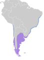
 Larus atlanticus map.svg 454 × 608; 658 KB
-
 Larus belcheri map.svg 740 × 800; 258 KB
-
 Larus brachyrhynchus map.svg 1,712 × 1,992; 313 KB
-
 Larus californicus map.svg 1,712 × 1,992; 453 KB
-
 Larus canus & Larus brachyrhynchus combined map.svg 3,100 × 1,600; 1.73 MB
-
 Larus canus map.svg 3,100 × 1,600; 1.73 MB
-
 Larus delawarensis map.svg 1,712 × 1,992; 516 KB
-
 Larus fuliginosus map.svg 6,378 × 4,606; 172 KB
-
 Larus fuscus map.svg 3,100 × 1,600; 1.79 MB
-
 Larus heermanni distr.png 395 × 708; 13 KB
-
 Larus maculipennis map.svg 454 × 608; 709 KB
-
 Larus michahellis map.png 1,200 × 900; 230 KB
-
 Larus michahellis map.svg 940 × 477; 1.75 MB
-
 Larus minutus distribution.png 911 × 445; 25 KB
-
 Larus ridibundus distribution map.png 1,425 × 625; 44 KB
-
 Larus serranus map.svg 454 × 608; 726 KB
-
 LarusCachinnansIUCN2019-2.png 3,507 × 2,480; 823 KB
-
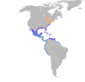 Leucophaeus atricilla map.svg 389 × 377; 802 KB
-
 Leucophaeus modestus map.svg 454 × 608; 176 KB
-
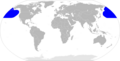
 Leucophaeus scoresbii map.svg 1,418 × 2,412; 1.85 MB
-
 Mapa Rissa brevirostris.png 2,753 × 1,400; 141 KB
-
 RangeMap Lmarinus.jpg 505 × 280; 66 KB
-
 Rissa tridactyla area all.PNG 1,357 × 628; 57 KB
-
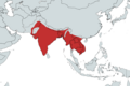 Sterna aurantia.png 1,800 × 1,200; 258 KB
-
 Sterna dougallii map.svg 3,100 × 1,600; 1.54 MB
-
 Sterna forsteri map.svg 1,712 × 1,992; 526 KB
-
 Sterna hirundinacea map.svg 454 × 608; 722 KB
-
 Sterna paradisaea distribution and migration map.png 1,301 × 730; 53 KB
-
 Sterna trudeaui map.svg 454 × 608; 659 KB
-
 Sterna vittata map.svg 940 × 477; 1.23 MB
-
 Sternula lorata map.svg 454 × 608; 650 KB
-
 Xema sabini map.svg 3,100 × 1,600; 1.42 MB


_(14596486307).jpg)
_(14759989656).jpg)
_(14779845911).jpg)
_(14780639604).jpg)
_(14782649862).jpg)

.png)


