Category:Lapford
Jump to navigation
Jump to search
village in United Kingdom  | |||||
| Upload media | |||||
| Instance of | |||||
|---|---|---|---|---|---|
| Location | Mid Devon, Devon, South West England, England | ||||
| Population |
| ||||
| Said to be the same as | Lapford (Wikimedia duplicated page, civil parish) | ||||
 | |||||
Subcategories
This category has the following 7 subcategories, out of 7 total.
E
- Eastington, Devon (13 F)
L
- Lapford War Memorial (3 F)
O
- The Old Malt Scoop, Lapford (3 F)
R
- Lapford railway station (3 F)
T
Media in category "Lapford"
The following 200 files are in this category, out of 338 total.
(previous page) (next page)-
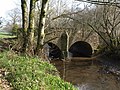
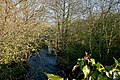
 A bridge over the River Yeo at Lapford - geograph.org.uk - 5342432.jpg 6,000 × 4,000; 6.22 MB
-
 A bridge over the River Yeo at Lapford - geograph.org.uk - 5342436.jpg 6,000 × 4,000; 6 MB
-
 A hedgebank near Lapford Cross - geograph.org.uk - 4224523.jpg 1,600 × 1,200; 1.91 MB
-
 A plaque on Bury Bridge on the River Yeo - geograph.org.uk - 5343492.jpg 6,000 × 4,000; 4.21 MB
-
 A plaque on Lapford Bridge on the River Yeo - geograph.org.uk - 5342077.jpg 5,751 × 3,835; 4.8 MB
-
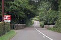
 A377 at Lapford Cross - geograph.org.uk - 2329075.jpg 640 × 480; 87 KB
-
 A377 at Lapford Cross - geograph.org.uk - 5524869.jpg 2,054 × 1,351; 1.46 MB
-
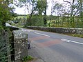
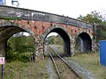 A377 bridge over the Tarka Line at Lapford (2) - geograph.org.uk - 4224559.jpg 1,600 × 1,200; 1.44 MB
-
 A377 bridge over the Tarka Line at Lapford - geograph.org.uk - 4224546.jpg 1,600 × 1,200; 1.27 MB
-
 A377 over Lapford Bridge - geograph.org.uk - 5524878.jpg 1,892 × 1,244; 1.53 MB
-
 A377 parallel with River Yeo and railway - geograph.org.uk - 5524888.jpg 2,100 × 1,320; 1.79 MB
-
 A377 towards Lapford - geograph.org.uk - 5524857.jpg 2,104 × 1,444; 1.33 MB
-
 Allotments near Nymet Rowland - geograph.org.uk - 4224513.jpg 1,600 × 1,200; 1.28 MB
-
 Approaching Burridge Moor Cross - geograph.org.uk - 6773027.jpg 1,024 × 768; 228 KB
-
 Approaching Deneridge Cross - geograph.org.uk - 1193836.jpg 640 × 426; 91 KB
-
 Arable land in the Yeo valley - geograph.org.uk - 1587898.jpg 640 × 426; 85 KB
-
 Autumn colour at Pennycotts - geograph.org.uk - 2700227.jpg 600 × 800; 486 KB
-
 Autumn Colour by the Roadside - geograph.org.uk - 1042495.jpg 640 × 480; 87 KB
-
 B3042 on Burridge Moor - geograph.org.uk - 3853530.jpg 1,536 × 1,152; 1,016 KB
-
 B3042 on Burridge Moor - geograph.org.uk - 4707681.jpg 1,920 × 1,440; 901 KB
-
 Barn, near Little Hole Farm - geograph.org.uk - 1745962.jpg 768 × 1,024; 184 KB
-
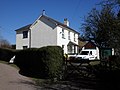
 Barris House, Lapford - geograph.org.uk - 1744551.jpg 1,600 × 1,236; 417 KB
-
 Bend on A377 - geograph.org.uk - 5524862.jpg 2,164 × 1,416; 1.82 MB
-
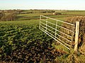
 Blackberry Gate, near Lapford - geograph.org.uk - 1745393.jpg 1,600 × 1,200; 385 KB
-
 Bonfire at Bugford Bridge - geograph.org.uk - 2878124.jpg 640 × 427; 78 KB
-

-

-
 Bugford Bridge and the River Yeo - geograph.org.uk - 2694259.jpg 800 × 600; 523 KB
-
 Bugford Bridge on the River Yeo - geograph.org.uk - 5342614.jpg 6,000 × 4,000; 4.75 MB
-
 Bugford Bridge on the River Yeo - geograph.org.uk - 5342617.jpg 6,000 × 4,000; 6.04 MB
-
 Buildings used by a removals and storage company - geograph.org.uk - 4224563.jpg 1,600 × 1,200; 1.3 MB
-
 Bungalows, at Highfield, Lapford - geograph.org.uk - 1746815.jpg 1,024 × 732; 133 KB
-
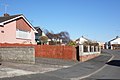 Bungalows, in Highfield, Lapford - geograph.org.uk - 1746793.jpg 1,024 × 686; 148 KB
-
 Burridge Moor Cross - geograph.org.uk - 2077793.jpg 640 × 480; 77 KB
-
 Burridge Moor Cross - geograph.org.uk - 3853541.jpg 1,536 × 1,023; 1,022 KB
-
 Bury Barton - geograph.org.uk - 2328509.jpg 488 × 640; 92 KB
-
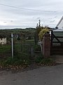
 Bus shelter, Lapford - geograph.org.uk - 1744599.jpg 1,024 × 768; 192 KB
-
 Calves Bridge - geograph.org.uk - 2328815.jpg 640 × 480; 135 KB
-
 Calves Bridge - geograph.org.uk - 4106070.jpg 640 × 480; 124 KB
-
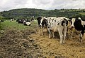 Cattle near Lapford - geograph.org.uk - 4310921.jpg 1,920 × 1,329; 702 KB
-
 Cobley Lane - geograph.org.uk - 2328964.jpg 640 × 480; 114 KB
-
 Cobley Lane, Eastington - geograph.org.uk - 3279854.jpg 680 × 1,024; 256 KB
-
 Cobley Oak, near Lapford - geograph.org.uk - 145703.jpg 640 × 426; 147 KB
-
 Cottage, at Forches Cross - geograph.org.uk - 1745894.jpg 1,024 × 768; 241 KB
-
 Country road near Filleigh - geograph.org.uk - 1193337.jpg 640 × 426; 80 KB
-
 Countryside north of Lapford - geograph.org.uk - 2245960.jpg 640 × 375; 69 KB
-
 Dalch valley - geograph.org.uk - 1193282.jpg 640 × 426; 91 KB
-
 Deneridge Cross - geograph.org.uk - 2077768.jpg 640 × 480; 43 KB
-
 Deneridge Cross - geograph.org.uk - 6405612.jpg 1,024 × 787; 173 KB
-
 Derelict yard, Lapford - geograph.org.uk - 4310905.jpg 1,920 × 1,334; 586 KB
-
 Detail of rood screen, Lapford church - geograph.org.uk - 4470365.jpg 800 × 531; 168 KB
-
 Detail of rood screen, Lapford church - geograph.org.uk - 4470367.jpg 800 × 531; 154 KB
-
 Detail of rood screen, Lapford church - geograph.org.uk - 4470368.jpg 800 × 531; 142 KB
-
 Detail of rood screen, Lapford church - geograph.org.uk - 4470369.jpg 800 × 531; 154 KB
-
 Eastington , Cobley Lane - geograph.org.uk - 5428700.jpg 6,000 × 4,000; 6.6 MB
-
 Eastington , Eastington Cross - geograph.org.uk - 5428699.jpg 6,000 × 4,000; 6.26 MB
-
 Eastington , Eastington Cross - geograph.org.uk - 5428706.jpg 6,000 × 4,000; 6.72 MB
-
 Eastington Cross - geograph.org.uk - 4106095.jpg 640 × 480; 137 KB
-
-
 Farm building at Kelland Barton - geograph.org.uk - 6608799.jpg 1,024 × 768; 252 KB
-
 Farm buildings at Deneridge Cross - geograph.org.uk - 6405593.jpg 1,024 × 738; 146 KB
-
 Farm gateway, near Forches Cross - geograph.org.uk - 1745870.jpg 1,024 × 768; 257 KB
-
 Farm track at Lower Filleigh - geograph.org.uk - 1193330.jpg 640 × 426; 85 KB
-
 Farm track north-west of Eastington - geograph.org.uk - 2699754.jpg 800 × 600; 316 KB
-
 Farmland above Cobley - geograph.org.uk - 1193286.jpg 640 × 426; 88 KB
-
 Farmland between Eastington and Lapford - geograph.org.uk - 2699745.jpg 600 × 800; 462 KB
-
 Farmyard at Lower Filleigh - geograph.org.uk - 6772998.jpg 1,024 × 768; 229 KB
-
 Field east of Filleigh Barton - geograph.org.uk - 2245695.jpg 640 × 409; 57 KB
-
 Field entrance near Lapford - geograph.org.uk - 4310941.jpg 1,920 × 1,390; 529 KB
-
 Field near Bowerthy - geograph.org.uk - 4082824.jpg 1,848 × 1,287; 519 KB
-
 Field near Lapford - geograph.org.uk - 4310954.jpg 1,920 × 1,325; 701 KB
-
 Field, Broomsmead - geograph.org.uk - 2245684.jpg 640 × 354; 57 KB
-
 Fields near Filleigh Moor Cross - geograph.org.uk - 2245791.jpg 640 × 480; 121 KB
-
 Filleigh Barton - geograph.org.uk - 6772988.jpg 1,024 × 784; 345 KB
-
 Filleigh House - geograph.org.uk - 6773005.jpg 1,024 × 768; 178 KB
-
 Filleigh Moor Cross - geograph.org.uk - 2077784.jpg 640 × 480; 66 KB
-
 Filleigh Moor Cross, West Filleigh - geograph.org.uk - 126423.jpg 640 × 426; 104 KB
-
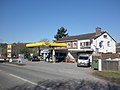
 Filling station at Lapford Cross - geograph.org.uk - 2700137.jpg 800 × 600; 371 KB
-
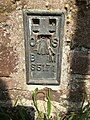 Flush Bracket OSBM S5171, Lapford, Old School - geograph.org.uk - 6118348.jpg 960 × 1,280; 374 KB
-
 Footpath above Cobley - geograph.org.uk - 1193280.jpg 640 × 426; 101 KB
-
 Footpath from Lapford Cross to Nymet Rowland - geograph.org.uk - 4224527.jpg 1,200 × 1,600; 1.89 MB
-
 Footpath gate near Lower Filleigh - geograph.org.uk - 1193293.jpg 640 × 426; 90 KB
-
 Footpath near Kelland Cross - geograph.org.uk - 2700155.jpg 800 × 600; 401 KB
-
 Footpath to Lapford railway station - geograph.org.uk - 2700110.jpg 480 × 640; 55 KB
-
 Footpath to Lapford Station - geograph.org.uk - 1053409.jpg 426 × 640; 85 KB
-
 Footpath to Lapford Station - geograph.org.uk - 2245967.jpg 640 × 480; 105 KB
-
 Footpath, to Parsonage Farm - geograph.org.uk - 1746192.jpg 1,024 × 768; 409 KB
-
 Forches Cross - geograph.org.uk - 1745518.jpg 1,600 × 1,200; 403 KB
-
 Former bakery in Lapford - geograph.org.uk - 2700105.jpg 600 × 800; 266 KB
-
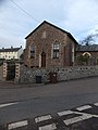 Former chapel, now a dwelling - geograph.org.uk - 2699730.jpg 600 × 800; 360 KB
-
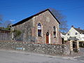 Former Chapel.Lapford - geograph.org.uk - 1744641.jpg 1,600 × 1,200; 490 KB
-
 Former mill buildings, Lapford Cross - geograph.org.uk - 1747448.jpg 816 × 1,024; 161 KB
-
 Former restaurant at Lapford Cross - geograph.org.uk - 4224566.jpg 1,600 × 1,200; 1.18 MB
-
 French postbox, Lapford - geograph.org.uk - 2246104.jpg 640 × 480; 75 KB
-

-
 Garage by the A377 in Lapford - geograph.org.uk - 1703907.jpg 640 × 480; 75 KB
-
 Gate on footpath near Lapford - geograph.org.uk - 145716.jpg 640 × 426; 129 KB
-
 Gateway near Lapford - geograph.org.uk - 4310983.jpg 1,920 × 1,435; 821 KB
-
 Great Hole Farm - geograph.org.uk - 145711.jpg 640 × 426; 116 KB
-
 House, on Rensey Lane, Lapford - geograph.org.uk - 1745325.jpg 1,600 × 1,200; 316 KB
-
 Industrial estate at Lapford Cross - geograph.org.uk - 6774617.jpg 1,024 × 768; 191 KB
-
 Jet Petrol Station, Lapford Cross - geograph.org.uk - 1744547.jpg 1,600 × 1,200; 313 KB
-
 Junction for Nymet Rowland on the A377, heading north - geograph.org.uk - 6419916.jpg 1,600 × 1,080; 858 KB
-
 Kelland Barton - geograph.org.uk - 2700207.jpg 800 × 600; 335 KB
-
 Kelland Cross - geograph.org.uk - 2700164.jpg 600 × 800; 433 KB
-
 Lane east of Filleigh - geograph.org.uk - 2245706.jpg 640 × 462; 89 KB
-
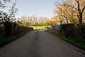
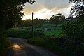
 Lane to Lapford - geograph.org.uk - 2328385.jpg 640 × 512; 112 KB
-
 Lane to Lapford - geograph.org.uk - 2328393.jpg 640 × 459; 86 KB
-
 Lane, to Lower Eastington - geograph.org.uk - 1746137.jpg 1,600 × 1,200; 561 KB
-
 Lapford , Barris - geograph.org.uk - 5426001.jpg 6,000 × 4,000; 7.13 MB
-
 Lapford , Congregational Church - geograph.org.uk - 5432936.jpg 6,000 × 4,000; 5.42 MB
-
 Lapford , Cottage - geograph.org.uk - 5432953.jpg 6,000 × 4,000; 7 MB
-
 Lapford , Eastington Lane - geograph.org.uk - 5432938.jpg 6,000 × 4,000; 7.76 MB
-
 Lapford , Eastington Lane - geograph.org.uk - 5432939.jpg 6,000 × 4,000; 6.36 MB
-
 Lapford , Electricity Sub Station - geograph.org.uk - 5426025.jpg 4,000 × 6,000; 5.07 MB
-
 Lapford , Foxlease - geograph.org.uk - 5426006.jpg 6,000 × 4,000; 7.46 MB
-
 Lapford , Grassy Track - geograph.org.uk - 5425997.jpg 6,000 × 4,000; 7.23 MB
-
 Lapford , Highfield - geograph.org.uk - 5432954.jpg 6,000 × 4,000; 6.37 MB
-
 Lapford , Houses - geograph.org.uk - 5426022.jpg 6,000 × 4,000; 5.76 MB
-
 Lapford , Lapford Community Primary School - geograph.org.uk - 5432935.jpg 6,000 × 4,000; 6.12 MB
-
 Lapford , Lapford Cross - geograph.org.uk - 5426018.jpg 6,000 × 4,000; 5 MB
-
 Lapford , Lapford MOT ^ Service Centre - geograph.org.uk - 5426017.jpg 6,000 × 4,000; 4.78 MB
-
 Lapford , Moorland View - geograph.org.uk - 5432937.jpg 6,000 × 4,000; 7.74 MB
-
 Lapford , Moorland View - geograph.org.uk - 5432940.jpg 6,000 × 4,000; 7.04 MB
-
 Lapford , Moorland View - geograph.org.uk - 5432941.jpg 6,000 × 4,000; 6.74 MB
-
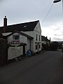
 Lapford , Old Malt Scoop Inn - geograph.org.uk - 5432948.jpg 6,000 × 4,000; 5.53 MB
-
 Lapford , Old Sunday School - geograph.org.uk - 5432942.jpg 6,000 × 4,000; 6.28 MB
-
 Lapford , Orchard Cross - geograph.org.uk - 5432943.jpg 6,000 × 4,000; 6.14 MB
-
 Lapford , Railway Line - geograph.org.uk - 5426014.jpg 4,000 × 6,000; 6.37 MB
-
 Lapford , Road - geograph.org.uk - 5426012.jpg 6,000 × 4,000; 5.47 MB
-
 Lapford , Road - geograph.org.uk - 5426015.jpg 6,000 × 4,000; 5.24 MB
-
 Lapford , Sparrow - geograph.org.uk - 5426005.jpg 6,000 × 4,000; 6 MB
-
 Lapford , St Thomas of Canterbury C of E Church - geograph.org.uk - 5432951.jpg 4,000 × 6,000; 4.74 MB
-
 Lapford , St Thomas of Canterbury C of E Church - geograph.org.uk - 5432952.jpg 6,000 × 4,000; 5.3 MB
-
 Lapford , The A377 - geograph.org.uk - 5426019.jpg 5,552 × 3,702; 6.12 MB
-
 Lapford , The A377 - geograph.org.uk - 5426020.jpg 6,000 × 4,000; 6.36 MB
-
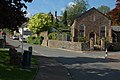
 Lapford , Village Hall - geograph.org.uk - 5432945.jpg 6,000 × 4,000; 5.88 MB
-
 Lapford , Village Hall - geograph.org.uk - 5432946.jpg 6,000 × 4,000; 6.21 MB
-
 Lapford , Village Road - geograph.org.uk - 5425996.jpg 6,000 × 4,000; 4.65 MB
-
 Lapford , Village Sign - geograph.org.uk - 5426003.jpg 6,000 × 4,000; 6.1 MB
-
 Lapford , War Memorial - geograph.org.uk - 5432950.jpg 6,000 × 4,000; 5.68 MB
-
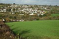 Lapford - geograph.org.uk - 1587892.jpg 640 × 426; 97 KB
-
 Lapford - geograph.org.uk - 2245963.jpg 640 × 397; 58 KB
-
 Lapford - geograph.org.uk - 811597.jpg 640 × 426; 85 KB
-
 Lapford Bridge - geograph.org.uk - 4224543.jpg 1,600 × 1,200; 1.69 MB
-
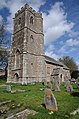 Lapford church - geograph.org.uk - 4470342.jpg 531 × 800; 141 KB
-
 Lapford Mill - geograph.org.uk - 2246099.jpg 640 × 406; 76 KB
-
 Lapford Mill - geograph.org.uk - 2700124.jpg 800 × 600; 401 KB
-
 Lapford Northern Wood - geograph.org.uk - 6774642.jpg 1,024 × 768; 297 KB
-
 Lapford Northern Wood - geograph.org.uk - 6774838.jpg 1,024 × 768; 385 KB
-
 Lapford Post Office - geograph.org.uk - 2699130.jpg 600 × 800; 338 KB
-
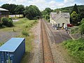
 Lapford railway line - geograph.org.uk - 26103.jpg 640 × 480; 117 KB
-
 Lapford Railway Station - geograph.org.uk - 6774620.jpg 1,024 × 768; 166 KB
-
 Lapford railway station, Devon - geograph.org.uk - 4567062.jpg 1,600 × 1,200; 496 KB
-
 Lapford station - geograph.org.uk - 3262427.jpg 1,024 × 692; 120 KB
-
 Lapford station - geograph.org.uk - 4312478.jpg 1,878 × 2,417; 1.01 MB
-
 Lapford station - geograph.org.uk - 4312497.jpg 1,920 × 1,431; 756 KB
-

-
 Lapford War Memorial - geograph.org.uk - 4470348.jpg 531 × 800; 187 KB
-
 Lapford, Bury Barton - geograph.org.uk - 214279.jpg 640 × 427; 202 KB
-
 Lapford, horse chestnut at Kelland - geograph.org.uk - 214667.jpg 640 × 427; 233 KB
-
 Lapford, near Broomsmead - geograph.org.uk - 360208.jpg 640 × 427; 226 KB
-
 Lapford, near Kelland Barton - geograph.org.uk - 214275.jpg 640 × 427; 211 KB
-
 Lapford, Old School - geograph.org.uk - 6118350.jpg 1,280 × 960; 387 KB
-
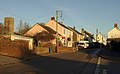
 Lapford, towards the village - geograph.org.uk - 214277.jpg 640 × 427; 200 KB
-
 Lapfordwood House - geograph.org.uk - 6774637.jpg 1,024 × 795; 207 KB
-
 Little Hole Farm - geograph.org.uk - 1746098.jpg 784 × 1,024; 266 KB
-
 Little Hole Farm - geograph.org.uk - 2699760.jpg 600 × 800; 253 KB
-
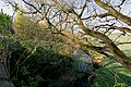
 Looking down the River Yeo from a Bridge at Lapford - geograph.org.uk - 5342458.jpg 6,000 × 4,000; 6.01 MB
-
 Looking down the River Yeo from Bugford Bridge - geograph.org.uk - 5342627.jpg 6,000 × 4,000; 5.67 MB
-
 Looking down the River Yeo from Bury Bridge - geograph.org.uk - 5343496.jpg 6,000 × 4,000; 5.44 MB
-
 Looking down the River Yeo from Lapford Bridge - geograph.org.uk - 5342089.jpg 6,000 × 4,000; 5.79 MB
-
 Looking towards Lapford, through the trees - geograph.org.uk - 4569511.jpg 1,600 × 1,200; 482 KB
-
 Looking towards Lower Eastington - geograph.org.uk - 4106079.jpg 640 × 480; 55 KB
-
 Looking up the River Yeo from a Bridge at Lapford - geograph.org.uk - 5342452.jpg 6,000 × 4,000; 6.06 MB
-
 Looking up the River Yeo from Bury Bridge - geograph.org.uk - 5343500.jpg 6,000 × 4,000; 5.24 MB
-
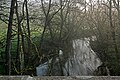 Looking up the River Yeo from Lapford Bridge - geograph.org.uk - 5342085.jpg 6,000 × 4,000; 4.94 MB
-
 Meadow by Calves Bridge - geograph.org.uk - 171611.jpg 640 × 426; 138 KB
-
 Meanders of the Yeo - geograph.org.uk - 1303943.jpg 640 × 480; 246 KB
-
 Mid Devon , Bury Cross - geograph.org.uk - 5196461.jpg 6,000 × 4,000; 5.64 MB
-
 Mid Devon , Country Lane - geograph.org.uk - 5428719.jpg 6,000 × 4,000; 5.5 MB
-
 Mid Devon , Country Lane - geograph.org.uk - 5428722.jpg 6,000 × 4,000; 5.33 MB
-
 Mid Devon , Country Lane - geograph.org.uk - 5432837.jpg 6,000 × 4,000; 7.13 MB
-
 Mid Devon , Countryside Scenery - geograph.org.uk - 5426098.jpg 6,000 × 4,000; 5.95 MB
-
 Mid Devon , Countryside Scenery - geograph.org.uk - 5428708.jpg 6,000 × 4,000; 5.26 MB
-
 Mid Devon , Eastington Hill - geograph.org.uk - 5428690.jpg 6,000 × 4,000; 6.14 MB
-
 Mid Devon , Eastington Hill - geograph.org.uk - 5428694.jpg 6,000 × 4,000; 7.06 MB
-
 Mid Devon , Eastington Hill - geograph.org.uk - 5428695.jpg 4,000 × 6,000; 7.23 MB
-
 Mid Devon , Eastington Hill - geograph.org.uk - 5428696.jpg 6,000 × 4,000; 6.58 MB
-
 Mid Devon , Grassy Field - geograph.org.uk - 5196456.jpg 6,000 × 4,000; 6.6 MB
-
 Mid Devon , Grassy Field - geograph.org.uk - 5426032.jpg 6,000 × 4,000; 5.22 MB
-
 Mid Devon , Grassy Field - geograph.org.uk - 5426035.jpg 6,000 × 4,000; 6.73 MB
-
 Mid Devon , Grassy Field - geograph.org.uk - 5426094.jpg 6,000 × 4,000; 5.65 MB
-
 Mid Devon , Grassy Field - geograph.org.uk - 5426099.jpg 6,000 × 4,000; 6.32 MB
-
 Mid Devon , Grassy Field - geograph.org.uk - 5426102.jpg 6,000 × 4,000; 6.91 MB
-
 Mid Devon , Grassy Field - geograph.org.uk - 5426106.jpg 6,000 × 4,000; 5.35 MB
-
 Mid Devon , Grassy Field - geograph.org.uk - 5426117.jpg 6,000 × 4,000; 6.26 MB
-
 Mid Devon , Grassy Field - geograph.org.uk - 5426120.jpg 6,000 × 4,000; 6.06 MB
-
 Mid Devon , Grassy Field - geograph.org.uk - 5428692.jpg 6,000 × 4,000; 5.6 MB
-
 Mid Devon , Grassy Field - geograph.org.uk - 5428698.jpg 6,000 × 4,000; 5.7 MB


_-_geograph.org.uk_-_4224559.jpg)


