Category:Lanton, Scottish Borders
Jump to navigation
Jump to search
village in Scottish Borders, Scotland, UK  | |||||
| Upload media | |||||
| Instance of | |||||
|---|---|---|---|---|---|
| Location |
| ||||
 | |||||
Media in category "Lanton, Scottish Borders"
The following 36 files are in this category, out of 36 total.
-
 A farm road on Lanton Hill - geograph.org.uk - 370298.jpg 640 × 480; 117 KB
-

-
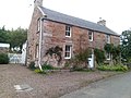
 And Lanton, Old Manor Inn.jpg 4,608 × 3,456; 6.79 MB
-
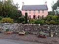
 Beeswing Cottage, Lanton.jpg 4,608 × 3,456; 6.36 MB
-
 Farmland - geograph.org.uk - 394852.jpg 640 × 480; 112 KB
-
 Farmland at Lantonhall - geograph.org.uk - 391962.jpg 640 × 480; 116 KB
-
 Lanton - geograph.org.uk - 198653.jpg 640 × 480; 343 KB
-
 Lanton Mill - geograph.org.uk - 409711.jpg 640 × 480; 96 KB
-
 Lanton Place Cottage.jpg 4,608 × 3,456; 6.14 MB
-
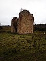
 Lanton Tower.jpg 4,608 × 3,456; 6.79 MB
-
 Lanton, Old Manor Inn.jpg 4,608 × 3,456; 7.01 MB
-
 Rimg0060.jpg 1,280 × 960; 334 KB
-
 The A698 at Knowesouth - geograph.org.uk - 427615.jpg 640 × 480; 113 KB
-
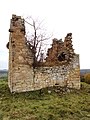 Timpledean Tower .jpg 3,120 × 4,160; 4.24 MB
-
 Timpledean Tower is near Jedburgh.jpg 3,120 × 4,160; 4.73 MB
-
 Timpledean Tower near Jedburgh.jpg 3,120 × 4,160; 3.13 MB
-
 Timpledean Tower view near Jedburgh.jpg 3,120 × 4,160; 3.6 MB
-
 A High-seat in the Lanton Moor Wood - geograph.org.uk - 1176005.jpg 640 × 480; 113 KB
-
-
 Arable farmland near Lanton - geograph.org.uk - 255035.jpg 640 × 480; 72 KB
-
 Culvert near Gleadscleugh - geograph.org.uk - 1426518.jpg 640 × 480; 248 KB
-
 Dead elm trees by the Lanton Road - geograph.org.uk - 255031.jpg 640 × 480; 61 KB
-
 Farm track, Campfield - geograph.org.uk - 569403.jpg 640 × 457; 71 KB
-
 Gleadscleugh from the south-east - geograph.org.uk - 1426704.jpg 640 × 480; 151 KB
-
 Grazing field - geograph.org.uk - 351423.jpg 640 × 399; 89 KB
-
 Grazing field - geograph.org.uk - 352830.jpg 640 × 477; 102 KB
-
 Grazing field with tussocks - geograph.org.uk - 371416.jpg 640 × 444; 113 KB
-
 Houses at Ruecastle Farm - geograph.org.uk - 255029.jpg 640 × 480; 63 KB
-
 Inside the ruined Barnhills Tower - geograph.org.uk - 753172.jpg 640 × 480; 176 KB
-
 Oil seed rape field - geograph.org.uk - 428604.jpg 636 × 438; 119 KB
-
 Overgrown field - geograph.org.uk - 494690.jpg 593 × 470; 108 KB
-

-

-
 Rough grazing near Ruecastle Farm - geograph.org.uk - 255025.jpg 640 × 346; 42 KB
-
 The River Teviot - geograph.org.uk - 394812.jpg 627 × 444; 99 KB
-
 Woodland path - geograph.org.uk - 370302.jpg 640 × 480; 152 KB


