Category:Lanlivery
Jump to navigation
Jump to search
hamlet in Cornwall, UK  Eglwys Sant Bryvyth, Lanlivery | |||||
| Upload media | |||||
| Instance of | |||||
|---|---|---|---|---|---|
| Location | Cornwall, South West England, England | ||||
 | |||||
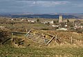
English: Lanlivery is a village and civil parish in Cornwall, United Kingdom. The village, through which the Saints' Way runs, is located approximately 1.5 miles West of Lostwithiel.
Subcategories
This category has the following 12 subcategories, out of 12 total.
B
- Boslymon (1 F)
C
- Countryside around Lanlivery (14 F)
- Crown Inn, Lanlivery (3 F)
H
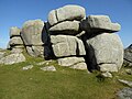
- Helman Tor, Cornwall (81 F)
M
- Milestone at SX 089611 (2 F)
- Milltown, Lanlivery (10 F)
- Minerals of Wheal Maudlin (2 F)
P
- Perrose (4 F)
- Puddle, Cornwall (1 F)
S
T
- Transport in Lanlivery (2 F)
Media in category "Lanlivery"
The following 163 files are in this category, out of 163 total.
-
 A converted barn at Churchtown Farm - geograph.org.uk - 2764927.jpg 640 × 480; 59 KB
-
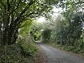 A tunnel of greenery south of Trebell Green - geograph.org.uk - 6017652.jpg 1,600 × 1,201; 1.1 MB
-
 Above Treverran Tunnel - geograph.org.uk - 1551265.jpg 640 × 415; 85 KB
-
 Approaching Lanlivery - geograph.org.uk - 1760816.jpg 640 × 480; 66 KB
-
 Benchmark on trig point, Helman Tor - geograph.org.uk - 4871599.jpg 768 × 1,024; 382 KB
-
 Breney Common, west of Helman Tor - geograph.org.uk - 6017581.jpg 1,600 × 1,200; 958 KB
-
 Chark - geograph.org.uk - 151703.jpg 640 × 427; 104 KB
-
 Colcerrow - geograph.org.uk - 195959.jpg 640 × 480; 105 KB
-
 Converted barn at Lancrow - geograph.org.uk - 2708712.jpg 640 × 480; 71 KB
-
 Converted chapel near Sweetshouse - geograph.org.uk - 2279162.jpg 640 × 480; 77 KB
-
 Cornish Hillside - geograph.org.uk - 5634678.jpg 640 × 426; 42 KB
-
 Cornish pylon - geograph.org.uk - 6025922.jpg 1,024 × 681; 89 KB
-
 Cottages at Strickstenton - geograph.org.uk - 2118273.jpg 640 × 480; 64 KB
-
 Crift - geograph.org.uk - 195976.jpg 640 × 480; 116 KB
-

-
 Entrance to Sweetshouse - geograph.org.uk - 3413865.jpg 640 × 480; 52 KB
-
 Farmhouse, Trethevey - geograph.org.uk - 1760764.jpg 640 × 456; 98 KB
-
 Field edge near Colcerrow - geograph.org.uk - 2708722.jpg 640 × 480; 85 KB
-
 First quarter moon viewed from Helman Tor - geograph.org.uk - 4871591.jpg 680 × 1,024; 145 KB
-
 Fork in the road on edge of Penpillick - geograph.org.uk - 6000611.jpg 1,600 × 1,561; 942 KB
-
 Helman Tor - geograph.org.uk - 4871550.jpg 1,024 × 680; 350 KB
-
 Helman Tor - geograph.org.uk - 6017595.jpg 1,600 × 1,200; 865 KB
-
 Helman Tor from the Saints' Way - geograph.org.uk - 5371488.jpg 4,608 × 3,456; 3.96 MB
-
 Helman Tor from the south - geograph.org.uk - 6017587.jpg 1,600 × 1,200; 921 KB
-
 Higher Trevilmick (Helman Tor Cottages) from Helman Tor - geograph.org.uk - 6017644.jpg 1,600 × 1,200; 1,010 KB
-
 Higher Trevilmick Farm - geograph.org.uk - 4182344.jpg 1,600 × 1,064; 371 KB
-
 Information board and Helman Tor - geograph.org.uk - 4871582.jpg 800 × 531; 139 KB
-
 Isolated Cross - geograph.org.uk - 195957.jpg 640 × 480; 82 KB
-
 Junction near Sweetshouse - geograph.org.uk - 5293503.jpg 2,167 × 1,377; 644 KB
-
 Lane at Trethevey - geograph.org.uk - 1760052.jpg 480 × 640; 145 KB
-
 Lane to Lanivery - geograph.org.uk - 3983834.jpg 640 × 480; 113 KB
-
 Lanlivery Board School - geograph.org.uk - 56432.jpg 640 × 447; 75 KB
-
 Lanlivery Community Primary School - geograph.org.uk - 2764917.jpg 640 × 480; 73 KB
-
 Lanlivery Community Primary School - geograph.org.uk - 3107995.jpg 3,264 × 2,448; 1.5 MB
-
 Lanlivery Millennium Stone - geograph.org.uk - 2764902.jpg 480 × 640; 146 KB
-
 Lanlivery Millennium Stone - geograph.org.uk - 6279290.jpg 4,027 × 6,039; 7.03 MB
-
 Lanlivery War Memorial - geograph.org.uk - 2765001.jpg 640 × 480; 88 KB
-
 Lanlivery, 'War memorial' seat with a ferocious guard - geograph.org.uk - 6279287.jpg 5,829 × 3,886; 6.42 MB
-
 Lanlivery, A small part of an enormous pink rose bush - geograph.org.uk - 6279292.jpg 6,679 × 4,453; 4.91 MB
-
 Lanlivery, approaching Lower Penhale - geograph.org.uk - 2381165.jpg 640 × 427; 522 KB
-
 Lanlivery, Bokiddick - geograph.org.uk - 2381274.jpg 640 × 427; 325 KB
-
 Lanlivery, St Brevita's church - geograph.org.uk - 5373391.jpg 4,608 × 3,456; 5.27 MB
-
 Lanlivery, St. Brevita's Church entrance - geograph.org.uk - 6279286.jpg 6,066 × 4,044; 7.66 MB
-
 Lanlivery, St. Brevita's Church, Grotesques on the tower 1 - geograph.org.uk - 6279275.jpg 6,093 × 4,062; 6.13 MB
-
 Lanlivery, St. Brevita's Church, Grotesques on the tower 2 - geograph.org.uk - 6279278.jpg 5,661 × 3,775; 7.25 MB
-
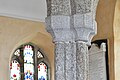 Lanlivery, St. Brevita's Church, Nave capital - geograph.org.uk - 6279652.jpg 6,948 × 4,632; 6.25 MB
-

-

-

-

-

-

-

-

-
 Lanlivery, St. Brevita's Church, South porch roof - geograph.org.uk - 6279648.jpg 7,389 × 4,926; 7.49 MB
-
 Lanlivery, St. Brevita's Church, Southern aspect - geograph.org.uk - 6279270.jpg 6,885 × 4,590; 7.22 MB
-
 Lanlivery, St. Brevita's Church, Stained glass window - geograph.org.uk - 6279313.jpg 5,287 × 3,525; 4.01 MB
-
 Lanlivery, St. Brevita's Church, Stained glass window - geograph.org.uk - 6279643.jpg 5,034 × 3,356; 3.74 MB
-
 Lanlivery, St. Brevita's Church, Stained glass window - geograph.org.uk - 6279644.jpg 7,014 × 4,676; 4.33 MB
-

-
 Lanlivery, St. Brevita's Church, The bell ringers rhyme - geograph.org.uk - 6279300.jpg 3,739 × 5,609; 6.9 MB
-
 Lanlivery, St. Brevita's Church, The bell ringers rhyme - geograph.org.uk - 6279303.jpg 2,638 × 3,957; 3.26 MB
-

-

-

-

-
 Lanlivery, St. Brevita's Church, The Jane Kendall memorial 1 - geograph.org.uk - 6279619.jpg 6,266 × 4,178; 7.72 MB
-

-

-

-

-

-

-

-
 Lanlivery, St. Brevita's Church, The Kendall memorial - geograph.org.uk - 6279638.jpg 5,201 × 3,467; 2.81 MB
-

-
 Lanlivery, St. Brevita's Church, The nave - geograph.org.uk - 6279294.jpg 7,353 × 4,902; 6.97 MB
-
 Lanlivery, St. Brevita's Church, The nave - geograph.org.uk - 6279297.jpg 7,042 × 4,695; 5.75 MB
-
 Lanlivery, St. Brevita's Church, The organ - geograph.org.uk - 6279312.jpg 7,138 × 4,758; 6.01 MB
-

-

-
 Lanlivery, St. Brevita's Church, Walter Kendall memorial - geograph.org.uk - 6279314.jpg 4,715 × 7,072; 7.09 MB
-
 Lanlivery, tree and tor - geograph.org.uk - 2381240.jpg 640 × 427; 394 KB
-
 Lantyan - geograph.org.uk - 5039550.jpg 640 × 426; 72 KB
-
 Lantyan - geograph.org.uk - 5039553.jpg 640 × 426; 65 KB
-
 Lantyan - geograph.org.uk - 5655144.jpg 640 × 426; 64 KB
-
 Lantyan - geograph.org.uk - 5846048.jpg 1,024 × 681; 101 KB
-
 Leat above the Par River - geograph.org.uk - 1968889.jpg 640 × 480; 151 KB
-
 Leat in Carmears Wood - geograph.org.uk - 2713975.jpg 480 × 640; 136 KB
-
 Looking along the Treffry Viaduct - geograph.org.uk - 6016861.jpg 1,600 × 1,200; 1.07 MB
-
 Lower Tregantle - geograph.org.uk - 1226543.jpg 640 × 482; 201 KB
-
 Luxulyan Valley below Treffry Viaduct - geograph.org.uk - 6016862.jpg 1,600 × 1,200; 1 MB
-
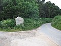
 Medieval wayside cross at Trevorry - geograph.org.uk - 2764976.jpg 640 × 480; 66 KB
-
 Minor road junction near Maudlin - geograph.org.uk - 3980379.jpg 640 × 480; 81 KB
-
 Mud in the gateway - geograph.org.uk - 1544141.jpg 640 × 427; 97 KB
-
 Newly cut grass field next to A39 - geograph.org.uk - 3982633.jpg 640 × 480; 91 KB
-

-

-
 Old farm building at Roseny Mill - geograph.org.uk - 6016880.jpg 1,600 × 1,200; 1,014 KB
-
 Pasture near Milltown - geograph.org.uk - 5156266.jpg 640 × 426; 52 KB
-
 Path beside the Fowey Consols Leat - geograph.org.uk - 4456131.jpg 4,000 × 3,000; 5.87 MB
-
 Pelyntor Cottage - geograph.org.uk - 1761057.jpg 640 × 399; 55 KB
-
 Powderham Castle caravan park - geograph.org.uk - 195947.jpg 640 × 480; 121 KB
-
 Pylon by Cornish Main Line - geograph.org.uk - 5871424.jpg 1,024 × 951; 245 KB
-
 Pylon, Milltown - geograph.org.uk - 5631424.jpg 640 × 426; 77 KB
-
 Rail bridge over Milltown Road - geograph.org.uk - 5499367.jpg 640 × 480; 272 KB
-
 Redmoor nature reserve - geograph.org.uk - 169870.jpg 640 × 480; 91 KB
-
 Redundant gate near Lanlivery - geograph.org.uk - 1760842.jpg 640 × 438; 91 KB
-
 Ridge and valley south-east of Helman Tor - geograph.org.uk - 6017640.jpg 1,600 × 1,200; 897 KB
-
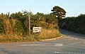
 Road junction at Redmoor - geograph.org.uk - 3980410.jpg 640 × 480; 113 KB
-
 Road junction on Cycle Route 3. - geograph.org.uk - 195975.jpg 640 × 480; 114 KB
-
 Road to Helman Tor - geograph.org.uk - 4871657.jpg 1,024 × 768; 412 KB
-
 Rock outcrop on south slope of Helman Tor - geograph.org.uk - 6017584.jpg 1,600 × 1,200; 1.02 MB
-
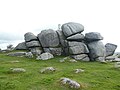
 Rocks on Helman Tor - geograph.org.uk - 4871554.jpg 800 × 531; 125 KB
-
 Rocks on Helman Tor - geograph.org.uk - 4871561.jpg 531 × 800; 131 KB
-
 Rocks on Helman Tor - geograph.org.uk - 4871602.jpg 800 × 600; 131 KB
-
 Roseny Mill - geograph.org.uk - 195972.jpg 640 × 480; 135 KB
-
 Saints' Way sign at Lanlivery - geograph.org.uk - 2764942.jpg 640 × 480; 127 KB
-
 Saints' Way sign east of Lanlivery - geograph.org.uk - 2764964.jpg 640 × 480; 123 KB
-
 Scrub on the north-east slope of Helman Tor - geograph.org.uk - 6017592.jpg 1,600 × 1,200; 1.06 MB
-

-
 Signpost by the Saints' Way near Lanlivery - geograph.org.uk - 5373386.jpg 3,456 × 4,608; 5.28 MB
-
 Signpost for the Saints' Way near Helman Tor - geograph.org.uk - 5371480.jpg 3,456 × 4,608; 5.9 MB
-
 Stile, Roselath - geograph.org.uk - 1760884.jpg 570 × 640; 128 KB
-

-
 Stream in Carmears Wood - geograph.org.uk - 2708705.jpg 480 × 640; 121 KB
-
 Sweetshouse entrance sign - geograph.org.uk - 2425416.jpg 640 × 435; 56 KB
-
 The Carmears incline - geograph.org.uk - 2708685.jpg 480 × 640; 153 KB
-
 The farmstead at Chark - geograph.org.uk - 6024018.jpg 640 × 480; 85 KB
-
 The lane to Chark Mill - geograph.org.uk - 3980398.jpg 640 × 480; 129 KB
-

-

-
 The road to Redmoor - geograph.org.uk - 6024022.jpg 640 × 480; 124 KB
-
 The Saints' Way approaching Lanlivery - geograph.org.uk - 5373379.jpg 4,608 × 3,456; 3.93 MB
-
 The Saints' Way by Crift Downs - geograph.org.uk - 5373371.jpg 4,608 × 3,456; 3.98 MB
-
 The Saints' Way by Helman Tor - geograph.org.uk - 5371484.jpg 4,608 × 3,456; 4.03 MB
-
 The Saints' Way near Bodwen Farm - geograph.org.uk - 5373365.jpg 4,608 × 3,456; 4.01 MB
-
 The Saints' Way near Trebell Green - geograph.org.uk - 5371471.jpg 4,608 × 3,456; 3.94 MB
-
 The Saints' Way on Pelyn Tor - geograph.org.uk - 5373394.jpg 4,608 × 3,456; 4 MB
-
 The south western approach to Lanlivery - geograph.org.uk - 2764949.jpg 640 × 480; 114 KB
-
 The south-east end of Treffry Viaduct - geograph.org.uk - 6016858.jpg 1,600 × 1,200; 1.09 MB
-
 The southern slope of Helman Tor - geograph.org.uk - 6017647.jpg 1,200 × 1,600; 1.01 MB
-
 The wheel pit at Carmears - geograph.org.uk - 2713777.jpg 640 × 480; 142 KB
-
 Three tracks at Trekinard - geograph.org.uk - 1969108.jpg 640 × 451; 94 KB
-
 Tree, Milltown - geograph.org.uk - 5039555.jpg 640 × 426; 60 KB
-
 Treffry Viaduct - geograph.org.uk - 6016859.jpg 1,600 × 1,200; 1.08 MB
-
 Tributary of the River Fowey - geograph.org.uk - 5039544.jpg 640 × 426; 72 KB
-
 Tributary stream of the River Fowey - geograph.org.uk - 5845978.jpg 1,024 × 681; 223 KB
-
 Trig pillar on Helman Tor - geograph.org.uk - 6017639.jpg 1,600 × 1,200; 979 KB
-
 Trig point and Helman Tor - geograph.org.uk - 4871556.jpg 800 × 531; 132 KB
-
 Trig point on Helman Tor - geograph.org.uk - 4871565.jpg 531 × 800; 96 KB
-
 View towards the Logan Stone from the Saints' Way - geograph.org.uk - 5371487.jpg 4,608 × 3,456; 3.98 MB
-
 Wood anemones - geograph.org.uk - 51207.jpg 640 × 479; 159 KB
-
 Woodland at the south of Corgee Moor - geograph.org.uk - 6016885.jpg 1,600 × 1,333; 1.11 MB
-
 Approaching Lanlivery - geograph.org.uk - 197122.jpg 640 × 480; 112 KB
-
 Entrance Road to a Farm - geograph.org.uk - 143545.jpg 640 × 427; 126 KB
-
 Higher Gready Farm Cottage - geograph.org.uk - 276751.jpg 640 × 480; 94 KB
-
 Houses near Boslymon - geograph.org.uk - 151716.jpg 640 × 396; 104 KB
-
 Pasture Land south of Redmoor - geograph.org.uk - 151709.jpg 640 × 427; 119 KB
-
 Poltip Cottage - geograph.org.uk - 195994.jpg 640 × 480; 111 KB
-
 Sheep Grazing on Marginal Pasture - geograph.org.uk - 151712.jpg 640 × 427; 118 KB
-
 The Road to Tredinnickpits - geograph.org.uk - 151722.jpg 640 × 427; 122 KB
-
 Well dressed horses - geograph.org.uk - 208371.jpg 640 × 480; 102 KB


_from_Helman_Tor_-_geograph.org.uk_-_6017644.jpg)


_-_geograph.org.uk_-_6279621.jpg)
_-_geograph.org.uk_-_6279624.jpg)
_-_geograph.org.uk_-_6279626.jpg)
_Kendall_memorial_(detail)_1_-_geograph.org.uk_-_6279632.jpg)
_Kendall_memorial_(detail)_2_-_geograph.org.uk_-_6279635.jpg)
_Kendall_memorial_-_geograph.org.uk_-_6279629.jpg)


_-_geograph.org.uk_-_6279305.jpg)


