Category:Langthorpe
Jump to navigation
Jump to search
village and civil parish in North Yorkshire, United Kingdom  | |||||
| Upload media | |||||
| Instance of | |||||
|---|---|---|---|---|---|
| Location | Harrogate, North Yorkshire, Yorkshire and the Humber, England | ||||
 | |||||
Subcategories
This category has the following 2 subcategories, out of 2 total.
B
- Borough Bridge (11 F)
G
Media in category "Langthorpe"
The following 93 files are in this category, out of 93 total.
-
 A1(M) - B6265 bridge - geograph.org.uk - 2647902.jpg 640 × 428; 74 KB
-
 A1(M) northbound - geograph.org.uk - 2647901.jpg 640 × 428; 71 KB
-
 A1(M), northbound - geograph.org.uk - 3043516.jpg 640 × 430; 35 KB
-
 A168 looking towards Boroughbridge - geograph.org.uk - 5955656.jpg 3,569 × 3,222; 3.18 MB
-
 A168 southbound at Kirby Hill - geograph.org.uk - 5395422.jpg 640 × 480; 51 KB
-
 A1M near to Langthorpe - geograph.org.uk - 6400518.jpg 800 × 533; 167 KB
-
 An aptly named road - geograph.org.uk - 4758869.jpg 4,113 × 3,085; 3.82 MB
-
 Approaching Roecliffe from the north-east - geograph.org.uk - 5872110.jpg 1,024 × 768; 201 KB
-
 B6265 toward Boroughbridge - geograph.org.uk - 5194990.jpg 1,479 × 1,074; 597 KB
-

-
 Brampton Hall - geograph.org.uk - 1046214.jpg 640 × 480; 95 KB
-
 Brampton Hall - geograph.org.uk - 1226903.jpg 640 × 480; 97 KB
-
 Brampton Hall Farm - geograph.org.uk - 3113133.jpg 2,048 × 1,536; 615 KB
-
 Brampton Hall farm - geograph.org.uk - 5610843.jpg 4,320 × 2,384; 2.67 MB
-
 Bridge over A1(M), Kirby Hill - geograph.org.uk - 5893458.jpg 1,024 × 663; 116 KB
-
 Bridge, Boroughbridge - geograph.org.uk - 4920192.jpg 640 × 483; 214 KB
-
 Bridges over Skelton Road - geograph.org.uk - 2898766.jpg 640 × 480; 74 KB
-
 Bridges over the River Ure - geograph.org.uk - 3113152.jpg 2,048 × 1,536; 573 KB
-
 Canal bridges at Milby - geograph.org.uk - 6031768.jpg 4,320 × 2,706; 2.8 MB
-
 Cottage Farm - geograph.org.uk - 4266137.jpg 5,184 × 3,456; 6.44 MB
-
 Cottage, Kirby Hill - geograph.org.uk - 2898744.jpg 640 × 480; 66 KB
-
 Cut Bridge, Milby Cut, River Ure (northbound) - geograph.org.uk - 5869280.jpg 1,024 × 768; 304 KB
-
 Cut Bridge, Milby Cut, River Ure (southbound) - geograph.org.uk - 5869277.jpg 1,024 × 768; 176 KB
-
 Entrance to Boroughbridge Marina - geograph.org.uk - 5869310.jpg 1,024 × 768; 134 KB
-
 Entrance to the Milby Cut - geograph.org.uk - 3115471.jpg 2,048 × 1,536; 661 KB
-
 Farm bridge crossing the A168 - geograph.org.uk - 3747316.jpg 640 × 415; 51 KB
-
 Farm buildings, Broom Close - geograph.org.uk - 2898771.jpg 640 × 480; 56 KB
-
 Farm Track leading to Low Fields - geograph.org.uk - 4540814.jpg 5,184 × 3,456; 6.54 MB
-
 Field West of Kirby Hill - geograph.org.uk - 4266135.jpg 5,179 × 3,451; 5.67 MB
-
 Flooding at Boroughbridge - geograph.org.uk - 3157269.jpg 3,264 × 2,448; 1.59 MB
-
 Fly Tipping near Langthorpe - geograph.org.uk - 4540818.jpg 5,184 × 3,456; 7.28 MB
-
 Footbridge over the A1(M) - geograph.org.uk - 2568782.jpg 640 × 430; 34 KB
-
 Footbridge over the A1(M) - geograph.org.uk - 3043517.jpg 640 × 430; 34 KB
-
 High water in the Milby Cut - geograph.org.uk - 4778069.jpg 800 × 600; 112 KB
-
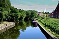
 Iced up canal, Langthorpe - geograph.org.uk - 2193957.jpg 2,919 × 1,859; 1.2 MB
-
 Keep left sign, west end of Milby Cut, River Ure - geograph.org.uk - 5869297.jpg 1,024 × 768; 219 KB
-
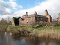
 Kiln, former brewery, Langthorpe - geograph.org.uk - 5869293.jpg 1,024 × 768; 164 KB
-
 Lane on Langthorpe Moor - geograph.org.uk - 4266141.jpg 5,184 × 3,456; 6.68 MB
-

-
-
 Looking north along A1(M) - geograph.org.uk - 5955690.jpg 4,062 × 2,747; 1.46 MB
-
 Looking north along A168 - geograph.org.uk - 5955675.jpg 3,707 × 2,680; 2.85 MB
-
 Looking south along A1(M) - geograph.org.uk - 5955683.jpg 4,223 × 3,167; 2.04 MB
-
 Milby Cut - geograph.org.uk - 4540906.jpg 5,184 × 3,456; 6.63 MB
-
 Milby Cut - geograph.org.uk - 5665301.jpg 5,067 × 2,850; 3.92 MB
-
 Milby Cut, Boroughbridge - geograph.org.uk - 5509933.jpg 1,024 × 768; 1.2 MB
-
 Milby Cut, River Ure, looking east - geograph.org.uk - 5869267.jpg 1,024 × 767; 268 KB
-
 Milby Lock - geograph.org.uk - 10255.jpg 600 × 450; 94 KB
-
 Milby Lock - geograph.org.uk - 3115478.jpg 2,048 × 1,162; 476 KB
-
 Moor Lane, Langthorpe - geograph.org.uk - 371934.jpg 640 × 480; 47 KB
-
 Moorings on the Milby Cut - geograph.org.uk - 5665291.jpg 5,343 × 3,005; 4.3 MB
-
 Moorings, River Ure, Boroughbridge - geograph.org.uk - 5869273.jpg 1,024 × 768; 171 KB
-
 Moorings, River Ure, Langthorpe - geograph.org.uk - 5869321.jpg 1,024 × 768; 158 KB
-
 Motorway crossing the River Ure - geograph.org.uk - 4540825.jpg 5,184 × 3,456; 6.84 MB
-
 Mushroom Farm near Skelton on Ure - geograph.org.uk - 371927.jpg 640 × 480; 49 KB
-
 Northbound A1M near Kirby Hill - geograph.org.uk - 6400523.jpg 800 × 533; 187 KB
-
 Oilseed rape crop, Broom Close - geograph.org.uk - 2898775.jpg 640 × 480; 82 KB
-
 On the Riverside Path at Langthorpe - geograph.org.uk - 4540809.jpg 5,184 × 3,456; 7.8 MB
-
 Path leading to Boroughbridge - geograph.org.uk - 4189669.jpg 1,600 × 1,064; 1.15 MB
-
 Providence Lodge - geograph.org.uk - 2741795.jpg 1,500 × 1,011; 1.59 MB
-
 Public footpath - geograph.org.uk - 5665310.jpg 5,343 × 3,005; 5.48 MB
-
 River Ure - geograph.org.uk - 3043511.jpg 640 × 399; 38 KB
-
 River Ure, Roecliffe - geograph.org.uk - 270848.jpg 640 × 426; 84 KB
-
 Road to Ripon B6265 with road junction ahead - geograph.org.uk - 5778873.jpg 3,825 × 2,875; 3.01 MB
-
 Sign for the Anchor Inn - geograph.org.uk - 2145013.jpg 443 × 640; 75 KB
-
 Site of Battle of Boroughbridge 1322. - geograph.org.uk - 4540903.jpg 5,012 × 3,181; 7.65 MB
-
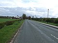
 Skelton Road heading west - geograph.org.uk - 2898762.jpg 640 × 480; 69 KB
-
 Skelton Road heading west - geograph.org.uk - 2898776.jpg 640 × 480; 71 KB
-
 Skelton Road outside Broom Close - geograph.org.uk - 4539750.jpg 5,184 × 3,456; 7.4 MB
-
 Skelton Road, Langthorpe - geograph.org.uk - 371914.jpg 640 × 480; 106 KB
-
 Skelton Road, Langthorpe - geograph.org.uk - 541216.jpg 640 × 359; 74 KB
-
 The Anchor Inn, Langthorpe - geograph.org.uk - 2145003.jpg 640 × 481; 76 KB
-
 The bridge at Boroughbridge - geograph.org.uk - 5509929.jpg 1,024 × 768; 804 KB
-
 The bridge at Boroughbridge - geograph.org.uk - 5665267.jpg 5,343 × 3,005; 4.86 MB
-
 The eastern end of Milby Cut - geograph.org.uk - 5678971.jpg 4,000 × 3,000; 2.98 MB
-
 The former brewery, Langthorpe - geograph.org.uk - 2193950.jpg 3,264 × 2,448; 1.98 MB
-
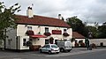 The Fox and Hounds at Langthorpe - geograph.org.uk - 541213.jpg 640 × 359; 71 KB
-
 The Fox and Hounds, Langthorpe - geograph.org.uk - 2898758.jpg 640 × 480; 80 KB
-
 The old brewery at Langthorpe.jpg 640 × 480; 95 KB
-
 The River Ure at Langthorpe - geograph.org.uk - 4540811.jpg 5,184 × 3,456; 6.79 MB
-

-
 The River Ure seen from the Borough Bridge, Boroughbridge - geograph.org.uk - 6333339.jpg 2,000 × 1,331; 2.97 MB
-
 The River Ure, looking upstream (locally south) - geograph.org.uk - 5869344.jpg 1,024 × 768; 127 KB
-
 The weir at Boroughbridge - geograph.org.uk - 5509930.jpg 800 × 600; 159 KB
-
 Too cold for a swim - geograph.org.uk - 2193927.jpg 3,252 × 1,882; 1.28 MB
-
 Two bridges over the River Ure, looking upstream - geograph.org.uk - 5869327.jpg 1,024 × 768; 105 KB
-
 Ure from the car park - geograph.org.uk - 2193751.jpg 640 × 480; 248 KB
-
 View towards Broom Close - geograph.org.uk - 371552.jpg 640 × 480; 189 KB
-
 Warwick's Anchor Brewery. - geograph.org.uk - 1580741.jpg 640 × 479; 114 KB
-
 Weeping Willow on the island - geograph.org.uk - 6251627.jpg 640 × 480; 122 KB
-
 Weeping Willow on the path - geograph.org.uk - 6251631.jpg 640 × 480; 133 KB
-
 Weir across the Ure - geograph.org.uk - 418187.jpg 640 × 480; 127 KB
-
 Welcome to Langthorpe - geograph.org.uk - 1768037.jpg 4,000 × 3,000; 4.04 MB
_-_B6265_bridge_-_geograph.org.uk_-_2647902.jpg)
_northbound_-_geograph.org.uk_-_2647901.jpg)
,_northbound_-_geograph.org.uk_-_3043516.jpg)


,_Kirby_Hill_-_geograph.org.uk_-_5893458.jpg)


_-_geograph.org.uk_-_5869280.jpg)
_-_geograph.org.uk_-_5869277.jpg)


_-_geograph.org.uk_-_2568782.jpg)
_-_geograph.org.uk_-_3043517.jpg)


_towards_Boroughbridge_-_geograph.org.uk_-_2898750.jpg)
_towards_Boroughbridge_-_geograph.org.uk_-_2898755.jpg)
_-_geograph.org.uk_-_5955690.jpg)

_-_geograph.org.uk_-_5955683.jpg)


_-_geograph.org.uk_-_5869344.jpg)


