Category:Langsett
Jump to navigation
Jump to search
English: Langsett is a village and civil parish near Penistone in South Yorkshire. It lies near the southern edge of the Metropolitan Borough of Barnsley and on the edge of the Peak District National Park. At the 2001 census it had a population of 161.
Nederlands: Langsett is een dorp (village) en civil parish in het bestuurlijke gebied Barnsley, in het Engelse graafschap South Yorkshire. De civil parish telt
village and civil parish in South Yorkshire, England  | |||||
| Upload media | |||||
| Instance of | |||||
|---|---|---|---|---|---|
| Location | Barnsley, South Yorkshire, Yorkshire and the Humber, England | ||||
| Population |
| ||||
 | |||||
Subcategories
This category has the following 2 subcategories, out of 2 total.
L
- Ladyshaw Bridge (7 F)
- Langsett Reservoir (84 F)
Media in category "Langsett"
The following 200 files are in this category, out of 591 total.
(previous page) (next page)-
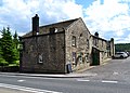 "The Waggon and Horses Inn", Langsett - geograph.org.uk - 3001679.jpg 3,999 × 2,857; 2.44 MB
-

-
 'Take Off' Stone, Sheephouse Heights, near Penistone - geograph.org.uk - 1813512.jpg 2,576 × 1,932; 1.86 MB
-

-
 3 Pines alongside the Little Don River - geograph.org.uk - 2585928.jpg 768 × 1,024; 288 KB
-
 A bike advertises the local cafe. - geograph.org.uk - 3779226.jpg 1,024 × 683; 292 KB
-
 A kissing gate, but no wall^ - geograph.org.uk - 3971773.jpg 1,024 × 768; 261 KB
-
 A misty moorland scene - geograph.org.uk - 4684310.jpg 2,304 × 1,728; 781 KB
-
 A very unusual stone protuberance - geograph.org.uk - 2142140.jpg 3,872 × 2,592; 1.82 MB
-
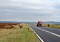
 A616 at Langsett - geograph.org.uk - 3352130.jpg 4,000 × 3,000; 2.48 MB
-
 A616 beside Hand Bank Plantation - geograph.org.uk - 6098140.jpg 800 × 600; 212 KB
-
 A616 Looking South, at Midhopestones, near Stocksbridge - geograph.org.uk - 3858504.jpg 3,623 × 2,718; 3.25 MB
-
 A616 towards Sheffield - geograph.org.uk - 6097763.jpg 800 × 600; 123 KB
-
 A616 towards Sheffield - geograph.org.uk - 6098078.jpg 800 × 600; 107 KB
-
 A616 towards Sheffield - geograph.org.uk - 6098766.jpg 640 × 480; 102 KB
-
 A628 approaching Flouch Roundabout - geograph.org.uk - 3037012.jpg 640 × 481; 58 KB
-
 A628 approaching Flouch Roundabout - geograph.org.uk - 6096643.jpg 800 × 588; 90 KB
-
 A628 at Stone Rucks - geograph.org.uk - 3037020.jpg 640 × 480; 45 KB
-

-
 A628 near Milton Lodge - geograph.org.uk - 6096631.jpg 800 × 600; 132 KB
-
 A628 north-west of Barmings - geograph.org.uk - 3037018.jpg 640 × 479; 41 KB
-
 A628 towards Barnsley - geograph.org.uk - 6096581.jpg 4,487 × 3,154; 2.33 MB
-
 A628 Woodhead Road near Bord Hill - geograph.org.uk - 2804910.jpg 3,072 × 2,304; 1,000 KB
-
 A628, Langsett - geograph.org.uk - 6096599.jpg 800 × 600; 91 KB
-
 Across Hordron Clough to Upper Hordron - geograph.org.uk - 1386993.jpg 640 × 480; 161 KB
-
 Alderman Head Cote - geograph.org.uk - 4876539.jpg 800 × 600; 151 KB
-
 Alderman's Head Farm - geograph.org.uk - 4876555.jpg 800 × 600; 104 KB
-
 Allez Langsett - geograph.org.uk - 4063475.jpg 800 × 600; 173 KB
-
 Allez,allez allez^ Le Bank View Cafe - geograph.org.uk - 4020088.jpg 3,148 × 2,306; 1.17 MB
-
 Approaching Cranberry farm. - geograph.org.uk - 2439801.jpg 640 × 480; 55 KB
-
 Approaching Langsett across the dam - geograph.org.uk - 2804948.jpg 2,640 × 1,980; 774 KB
-
 At Hordron Farm - The Sheepfold - geograph.org.uk - 4910944.jpg 5,113 × 3,623; 5.29 MB
-
 Autumn sun over the Little Don river valley - geograph.org.uk - 5124653.jpg 3,264 × 2,448; 455 KB
-
 Baaarnsley - geograph.org.uk - 4077232.jpg 1,024 × 768; 143 KB
-
 Baby rabbit in Hordron Sheepfold - geograph.org.uk - 4910967.jpg 5,184 × 3,888; 4.98 MB
-

-
 Badger Lane - geograph.org.uk - 4062752.jpg 4,000 × 2,248; 6.13 MB
-
 Badger Lane Brook - geograph.org.uk - 4543058.jpg 4,514 × 3,203; 1.86 MB
-
 Badger Lane, Langsett - geograph.org.uk - 1274905.jpg 640 × 480; 116 KB
-
 Bank View Cafe, Langsett (2) - geograph.org.uk - 1023943.jpg 502 × 640; 97 KB
-
 Bank View Cafe, Langsett - geograph.org.uk - 4032716.jpg 768 × 1,024; 182 KB
-
 Bank View cafe, Langsett - geograph.org.uk - 4801986.jpg 4,896 × 3,672; 6.88 MB
-
 Bank View Café Sign, Langsett, near Stocksbridge - geograph.org.uk - 3821067.jpg 2,646 × 3,528; 3.19 MB
-

-
 Barmings towards Bord Hill - geograph.org.uk - 1386942.jpg 640 × 480; 142 KB
-
 Barnsley Boundary Walk - geograph.org.uk - 4881969.jpg 3,072 × 1,728; 5.16 MB
-
 Barnsley boundary walk. - geograph.org.uk - 2439812.jpg 480 × 640; 158 KB
-
 Barriers close the road - geograph.org.uk - 921360.jpg 640 × 480; 82 KB
-
 Battery powering an electric fence, Langsett - geograph.org.uk - 6555196.jpg 2,000 × 1,500; 1.55 MB
-
 Birch trees lit by the sun, Langsett - geograph.org.uk - 2158483.jpg 2,000 × 1,500; 1.14 MB
-
 Bleating lamb at Upper Hordron - geograph.org.uk - 4911246.jpg 4,476 × 3,666; 5.58 MB
-
 Bordhill Lodge - geograph.org.uk - 2804925.jpg 2,640 × 1,717; 1.25 MB
-
 Boulder near Middle Small Clough Head - geograph.org.uk - 4177341.jpg 3,637 × 2,376; 2.45 MB
-
 Boundary Stone in Sheephouse Wood - geograph.org.uk - 6772822.jpg 1,024 × 803; 334 KB
-
 Boundary stone on Harden Moor - geograph.org.uk - 2252837.jpg 1,024 × 769; 233 KB
-
 Bridge at the end of Mortimer Road - geograph.org.uk - 4020071.jpg 3,802 × 2,420; 2.45 MB
-
 Bridge into Midhopestones - geograph.org.uk - 2439818.jpg 640 × 452; 78 KB
-
 Bridge on old narrow gauge railway to Langsett Reservoir - geograph.org.uk - 4881987.jpg 3,072 × 1,728; 5.54 MB
-
 Bridge on the disused Langsett Reservoir railway line - geograph.org.uk - 6554963.jpg 2,000 × 1,500; 1.11 MB
-
 Bridge over Little Don - geograph.org.uk - 942681.jpg 640 × 480; 119 KB
-
 Bridge over Mortimer Road. Langsett - geograph.org.uk - 6554966.jpg 2,000 × 1,500; 1.36 MB
-
 Bridge over the Little Don - geograph.org.uk - 6368787.jpg 1,024 × 683; 278 KB
-
 Bridleway at a wall corner, Langsett - geograph.org.uk - 6555131.jpg 2,000 × 1,500; 1.33 MB
-
 Bridleway below Brock Holes, Langsett - geograph.org.uk - 6555137.jpg 2,000 × 1,500; 1.2 MB
-
 Bridleway by Fox Clough - geograph.org.uk - 4178850.jpg 3,794 × 2,715; 1.83 MB
-
 Bridleway towards Hacking Hill - geograph.org.uk - 2931258.jpg 2,640 × 1,980; 857 KB
-
 Brock Holes Quarry, Langsett - geograph.org.uk - 6555078.jpg 2,000 × 1,500; 1.4 MB
-
 Brock Holes. - geograph.org.uk - 2439807.jpg 640 × 480; 72 KB
-
 Brook House Bridge crosses the Little Don River - geograph.org.uk - 3959416.jpg 1,102 × 1,600; 227 KB
-
 Browns Edge Lane - geograph.org.uk - 4063446.jpg 4,000 × 2,248; 5.45 MB
-
 Bus shelter at Fullshaw Cross, Langsett - geograph.org.uk - 6548397.jpg 2,000 × 1,170; 1,021 KB
-

-

-

-
 Bus Stop on the A616, Langsett, near Stocksbridge - geograph.org.uk - 3822338.jpg 2,335 × 1,768; 917 KB
-
 By Hartcliff Hill Road - geograph.org.uk - 3580392.jpg 750 × 458; 66 KB
-
 Cafe at Langsett - geograph.org.uk - 3001674.jpg 4,205 × 2,804; 2.5 MB
-
 Cafe Interior - geograph.org.uk - 4801988.jpg 4,896 × 3,672; 6.76 MB
-
 Cafe interior - geograph.org.uk - 4801991.jpg 4,896 × 3,672; 6.95 MB
-
 Cattle grazing - geograph.org.uk - 921375.jpg 640 × 480; 69 KB
-
 Circular end to a field, Mossley, Langsett - geograph.org.uk - 6572444.jpg 2,000 × 1,501; 1.12 MB
-
 Cliff View and Field House - geograph.org.uk - 4063566.jpg 800 × 600; 107 KB
-

-

-
 Corner of Lambing Field, Mossley Road - geograph.org.uk - 1976534.jpg 1,024 × 768; 218 KB
-

-
 Cottage on the A616, Langsett - geograph.org.uk - 6554967.jpg 2,000 × 1,327; 859 KB
-
 Cottages at Langsett, near Stocksbridge - 1 - geograph.org.uk - 3822382.jpg 3,331 × 2,474; 2.27 MB
-
 Cottages at Langsett, near Stocksbridge - 2 - geograph.org.uk - 3822386.jpg 3,070 × 2,147; 1.93 MB
-
 Cottages at Langsett, near Stocksbridge - 3 - geograph.org.uk - 3822388.jpg 3,494 × 2,620; 2.93 MB
-
 Cottages at Langsett, near Stocksbridge - 4 - geograph.org.uk - 3822392.jpg 2,516 × 1,780; 1.42 MB
-

-
 Cows on Swinden Lane - geograph.org.uk - 4062758.jpg 4,000 × 2,248; 4.33 MB
-

-
 Cranberry Crossroads, Sheephouse Heights - geograph.org.uk - 1813668.jpg 1,712 × 1,142; 370 KB
-
 Cranberry Farm - geograph.org.uk - 4876571.jpg 800 × 600; 138 KB
-
 Cranberry Farm - geograph.org.uk - 4883173.jpg 3,072 × 1,728; 3.81 MB
-
 Cranberry Farm - geograph.org.uk - 922509.jpg 640 × 480; 86 KB
-
 Cranberry Farm - the farmhouse - geograph.org.uk - 4201212.jpg 3,510 × 2,519; 1.74 MB
-
 Cranberry Road near Penistone - geograph.org.uk - 3146175.jpg 4,000 × 3,000; 1.38 MB
-
 Crookland Wood - geograph.org.uk - 4542629.jpg 4,783 × 3,456; 1.76 MB
-
 Crookland Wood - geograph.org.uk - 4542631.jpg 5,053 × 3,369; 1.87 MB
-
 Crookland Wood - geograph.org.uk - 4543095.jpg 5,088 × 2,978; 1.58 MB
-
 Cross in a wall at Fullshaw Farm, Langsett - geograph.org.uk - 6548390.jpg 2,000 × 1,500; 1.58 MB
-
 Cut mark on window surround at Bordhill Lodge - geograph.org.uk - 2804920.jpg 3,072 × 2,304; 1.38 MB
-

-
 Dead sheep at Hordron Farm - geograph.org.uk - 4911283.jpg 5,184 × 3,888; 6.57 MB
-
 December in the woods - geograph.org.uk - 2738956.jpg 2,448 × 3,264; 3.08 MB
-

-
 Dodgy duckboards^ - geograph.org.uk - 5127067.jpg 1,067 × 1,600; 513 KB
-
 Dog ^ Partridge Free House, Bordhill, Flouch, Yorkshire - geograph.org.uk - 2713871.jpg 1,600 × 1,200; 321 KB
-

-
 Don't worry - Mum is coming^ - geograph.org.uk - 4911015.jpg 3,204 × 3,801; 4.17 MB
-

-
 Downhill from here - geograph.org.uk - 4883148.jpg 2,737 × 1,728; 3.03 MB
-

-

-

-
 Eastern end of the Snow Road - geograph.org.uk - 2804911.jpg 3,072 × 2,304; 1.16 MB
-
 Ellerslie Lodge Folly - geograph.org.uk - 2719136.jpg 640 × 480; 120 KB
-

-
 Enough mud for one day^ - geograph.org.uk - 3219638.jpg 768 × 1,024; 162 KB
-

-

-

-
 Farm by Hartcliff Road - geograph.org.uk - 3580095.jpg 750 × 563; 82 KB
-

-
 Farmland scene - geograph.org.uk - 3580058.jpg 750 × 563; 129 KB
-
 Field above Race Common - geograph.org.uk - 3580413.jpg 750 × 563; 77 KB
-
 Field and trees above Nether House - geograph.org.uk - 3580075.jpg 563 × 750; 119 KB
-
 Fields and woodland near Langsett - geograph.org.uk - 3580068.jpg 750 × 563; 91 KB
-

-
 Flouch Cottages, Whamms Road, Hazlehead, near Sheffield - 2 - geograph.org.uk - 2764608.jpg 2,576 × 1,932; 1.29 MB
-

-
 Flush Bracket Waggon and Horses Langsett - geograph.org.uk - 4678096.jpg 640 × 480; 109 KB
-
 Following the Barnsley Boundary Walk - geograph.org.uk - 4883070.jpg 3,072 × 1,728; 5.41 MB
-
 Footbridge in Hordron Clough - geograph.org.uk - 4622830.jpg 1,600 × 1,200; 578 KB
-
 Footbridge on the disused Langsett Reservoir railway track - geograph.org.uk - 6554942.jpg 2,000 × 1,500; 1.08 MB
-
 Footpath below Nether House - geograph.org.uk - 4364476.jpg 4,000 × 3,000; 2.31 MB
-
 Footpath entering Sheephouse Wood, Langsett - geograph.org.uk - 6572495.jpg 2,000 × 1,500; 1.35 MB
-

-

-
 Footpath into woodland - geograph.org.uk - 6096633.jpg 480 × 640; 117 KB
-
 Footpath leaving Hartcliff Road, Thurlstone - Langsett - geograph.org.uk - 6548659.jpg 2,000 × 1,500; 1.33 MB
-
 Footpath near Far Swinden - geograph.org.uk - 4178546.jpg 4,000 × 3,000; 1.93 MB
-
 Footpath near Langsett - geograph.org.uk - 1764399.jpg 640 × 480; 168 KB
-

-
 Footpath on the route of the Old Lane, Langsett - geograph.org.uk - 6555189.jpg 2,000 × 1,500; 1.41 MB
-
 Footpath Overlooking Sheephouse Wood - geograph.org.uk - 3146161.jpg 3,994 × 2,992; 1.72 MB
-

-
 Footpath to Sheephouse Wood at Cranberry Road, Langsett - geograph.org.uk - 6572484.jpg 2,000 × 1,500; 955 KB
-
 Footpath towards Fullshaw - geograph.org.uk - 1764119.jpg 640 × 480; 134 KB
-
 Footpath towards Judd Field - geograph.org.uk - 2931251.jpg 2,640 × 1,980; 1.22 MB
-
 Footpath towards Langsett - geograph.org.uk - 1764403.jpg 640 × 480; 149 KB
-
 Ford on Hordron Road - geograph.org.uk - 3583079.jpg 3,872 × 2,592; 1.26 MB
-
 Ford on Hordron Road - geograph.org.uk - 3583108.jpg 3,872 × 2,592; 1.25 MB
-
 Ford on Hordron Road - geograph.org.uk - 368230.jpg 640 × 480; 135 KB
-
 Former Railway Bridge over Mortimer Road - geograph.org.uk - 4761294.jpg 4,000 × 3,000; 3.6 MB
-
 Former Samuel Fox's wire making facility - geograph.org.uk - 4881939.jpg 3,072 × 1,728; 5 MB
-
 Fox Clough - geograph.org.uk - 4705284.jpg 4,608 × 3,456; 3.89 MB
-

-
 Foxgloves in Langsett Wood - geograph.org.uk - 852093.jpg 480 × 640; 122 KB
-
 Frozen pools on Howden Edge - geograph.org.uk - 2252773.jpg 1,024 × 768; 323 KB
-
 Frozen stream on Harden Moss - geograph.org.uk - 2253525.jpg 1,024 × 769; 274 KB
-
 Fullshaw Farm - geograph.org.uk - 4513672.jpg 1,600 × 1,200; 685 KB
-
 Fullshaw Lane - geograph.org.uk - 4364463.jpg 3,640 × 2,588; 1.73 MB
-

-

-
 Grazing and stone wall, Langsett - geograph.org.uk - 6096592.jpg 800 × 600; 101 KB
-
 Grazing east of Langsett - geograph.org.uk - 6098041.jpg 800 × 600; 87 KB
-
 Grazing farmland below the moors - geograph.org.uk - 3580062.jpg 750 × 563; 79 KB
-
 Grazing Land adjoining Brock Holes Lane - geograph.org.uk - 2280259.jpg 3,296 × 2,472; 1.07 MB
-
 Grazing, Fullshaw - geograph.org.uk - 6096647.jpg 800 × 600; 134 KB
-
 Grazing, Gilbert Hill - geograph.org.uk - 6097834.jpg 800 × 600; 113 KB
-
 Grazing, Langsett - geograph.org.uk - 6097927.jpg 800 × 536; 98 KB
-
 Grouse butt below Howden Edge - geograph.org.uk - 4622785.jpg 1,600 × 1,200; 607 KB
-
 Grouse Butts near Wicken Hill - geograph.org.uk - 4705291.jpg 4,608 × 3,456; 3.99 MB
-
 Hand Bank Plantation - geograph.org.uk - 6098108.jpg 800 × 600; 199 KB
-
 Harden Clough - geograph.org.uk - 1151662.jpg 640 × 526; 81 KB
-
 Harden Clough - geograph.org.uk - 1386987.jpg 640 × 480; 151 KB
-

-
 Harden Moor - geograph.org.uk - 1386968.jpg 640 × 480; 158 KB
-
 Harden Moor - geograph.org.uk - 2252807.jpg 1,024 × 768; 227 KB
-
 Harden Moor, looking towards Royd Moor wind farm - geograph.org.uk - 2903494.jpg 1,429 × 1,024; 182 KB
-
 Harden Moss - geograph.org.uk - 4658402.jpg 3,098 × 2,116; 1.57 MB
-
 Hartcliff Road - geograph.org.uk - 3580080.jpg 750 × 563; 94 KB
-
 Hartcliff Road at Mary Knoll - geograph.org.uk - 4364469.jpg 4,000 × 3,000; 1.98 MB
-
 Hartcliff Road climbing up to Mary Knoll, Langsett - geograph.org.uk - 6548571.jpg 2,000 × 1,360; 830 KB
-

-

-
 Hay field near Swinden Lodge - geograph.org.uk - 942757.jpg 640 × 480; 87 KB
-
 Haystacks on the Moor - geograph.org.uk - 4705323.jpg 4,608 × 3,456; 3.72 MB
-
 Heading to the remains of a farm at Lady Shaw - geograph.org.uk - 5040108.jpg 5,184 × 3,888; 5.26 MB
-
 Heather burnt off on the moor - geograph.org.uk - 942646.jpg 640 × 412; 64 KB
-
 Heather Moorland at the Head of Laund Clough - geograph.org.uk - 4658390.jpg 3,543 × 2,535; 2.75 MB
-
 Heather on Langsett Moors, Yorkshire - geograph.org.uk - 2713872.jpg 1,600 × 1,200; 271 KB
-
 Hoar Stones - Howden Edge - geograph.org.uk - 3306730.jpg 1,600 × 1,200; 816 KB
-
 Hoodlands - geograph.org.uk - 4424753.jpg 5,184 × 3,007; 1.84 MB
-
 Hoodlands Farm, Langsett - geograph.org.uk - 1023927.jpg 640 × 450; 60 KB
-
 Hordron Clough - geograph.org.uk - 4622827.jpg 1,600 × 1,200; 623 KB


_-_geograph.org.uk_-_1023943.jpg)


,_Midhopestones,_near_Stocksbridge_-_geograph.org.uk_-_3858424.jpg)


_and_Mossley_Road_(right),_Langsett_-_geograph.org.uk_-_6572409.jpg)


