Category:Langley, Kent
Jump to navigation
Jump to search
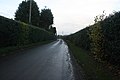
English: Langley is a village and civil parish in the Maidstone District of Kent, England. The parish is located on the A274 road leading south from Maidstone to Headcorn .
village and civil parish in Kent, UK | |||||
| Upload media | |||||
| Instance of | |||||
|---|---|---|---|---|---|
| Location | Maidstone, Kent, South East England, England | ||||
| Area |
| ||||
| Said to be the same as | Langley (Wikimedia duplicated page, civil parish) | ||||
| official website | |||||
 | |||||
Subcategories
This category has the following 3 subcategories, out of 3 total.
Media in category "Langley, Kent"
The following 75 files are in this category, out of 75 total.
-
 A biofuel crop - geograph.org.uk - 3381568.jpg 640 × 426; 48 KB
-
 A biofuel crop - geograph.org.uk - 3381569.jpg 640 × 426; 52 KB
-
 A harrowing experience - geograph.org.uk - 68160.jpg 640 × 443; 79 KB
-
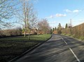
 A274 at Langley - geograph.org.uk - 3030248.jpg 640 × 428; 76 KB
-
 A274 east of Park Wood - geograph.org.uk - 2791981.jpg 3,515 × 2,488; 1.5 MB
-
 A274 north of Five Wents - geograph.org.uk - 2791969.jpg 3,515 × 2,584; 1.52 MB
-
 A274, Langley - geograph.org.uk - 3385007.jpg 640 × 426; 52 KB
-
 A274, Langley - geograph.org.uk - 3385010.jpg 640 × 426; 48 KB
-
 Avery Lane - geograph.org.uk - 3385035.jpg 640 × 426; 87 KB
-
 Bicknor Road, Park Wood, Maidstone - geograph.org.uk - 1805683.jpg 1,600 × 1,200; 754 KB
-
 Brishing Road, Chart Sutton - geograph.org.uk - 3629006.jpg 3,488 × 2,616; 2.2 MB
-
 Brishing Road, Chart Sutton - geograph.org.uk - 3629008.jpg 3,488 × 2,616; 2.2 MB
-
 Crown ^ Horseshoes - geograph.org.uk - 2791975.jpg 3,425 × 2,430; 1 MB
-
 Crown ^ Horseshoes sign - geograph.org.uk - 2176626.jpg 480 × 640; 96 KB
-
 Crown ^ Horseshoes, Langley - geograph.org.uk - 2111398.jpg 3,488 × 2,616; 2.17 MB
-
 Crown ^ Horseshoes, Langley - geograph.org.uk - 2176625.jpg 640 × 480; 69 KB
-
 Dam, Langley Loch - geograph.org.uk - 3379245.jpg 640 × 426; 93 KB
-
 Derelict Hoppers Huts - geograph.org.uk - 3381556.jpg 640 × 426; 119 KB
-
 Derelict Hoppers Huts - geograph.org.uk - 3381557.jpg 640 × 426; 104 KB
-
 Fairground At Langley Green - geograph.org.uk - 2053457.jpg 1,496 × 1,122; 532 KB
-
 Farm machinery, Langley Park Farm - geograph.org.uk - 3381572.jpg 640 × 426; 71 KB
-
 Farmland above Langley Loch - geograph.org.uk - 3381547.jpg 640 × 426; 39 KB
-
 Footpath along the field boundary - geograph.org.uk - 3381560.jpg 640 × 426; 59 KB
-
 Footpath along the field boundary - geograph.org.uk - 3381566.jpg 640 × 426; 64 KB
-
 Footpath by Langley Loch - geograph.org.uk - 3379248.jpg 640 × 426; 79 KB
-
 Footpath by Langley Loch - geograph.org.uk - 3381543.jpg 640 × 426; 71 KB
-
 Footpath by Langley Loch - geograph.org.uk - 3381555.jpg 640 × 426; 84 KB
-
 Grassy field, Pleasant Farm - geograph.org.uk - 3379234.jpg 640 × 426; 52 KB
-
 Heath Road, Langley Heath - geograph.org.uk - 3812196.jpg 3,488 × 2,616; 2.2 MB
-

-
 Horseshoes Lane leaves Langley Heath - geograph.org.uk - 3030825.jpg 640 × 428; 87 KB
-
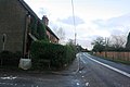
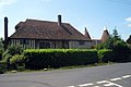
 House by the A274 - geograph.org.uk - 3385006.jpg 640 × 411; 57 KB
-
 Houses on Sutton Road - geograph.org.uk - 1109296.jpg 640 × 427; 69 KB
-
 Houses opposite bus stop - geograph.org.uk - 4848774.jpg 800 × 278; 64 KB
-
-

-
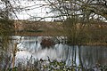
 Langley Loch - geograph.org.uk - 1130955.jpg 640 × 481; 113 KB
-
 Langley Loch - geograph.org.uk - 3379251.jpg 640 × 426; 111 KB
-
 Langley Loch - geograph.org.uk - 3379255.jpg 640 × 426; 97 KB
-
 Langley Loch - geograph.org.uk - 3381550.jpg 640 × 426; 109 KB
-
 Langley Loch - geograph.org.uk - 3381552.jpg 640 × 426; 88 KB
-
 Langley Loch - geograph.org.uk - 3629053.jpg 3,488 × 2,616; 2.21 MB
-
 Langley Loch - geograph.org.uk - 3629056.jpg 3,488 × 2,616; 2.22 MB
-
 Langley Loch - geograph.org.uk - 3629057.jpg 3,488 × 2,616; 2.17 MB
-
 Langley Loch from the Weir - geograph.org.uk - 1130966.jpg 640 × 481; 53 KB
-
 Langley Loch ^ dense vegetation - geograph.org.uk - 3381548.jpg 640 × 426; 98 KB
-
 Langley Park Rally School - geograph.org.uk - 1062375.jpg 640 × 421; 97 KB
-
 Langley Village Sign - geograph.org.uk - 1220470.jpg 480 × 640; 106 KB
-
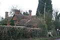 Large house of New Rd - geograph.org.uk - 3385029.jpg 640 × 426; 68 KB
-
 Leeds Road from Heath Road - geograph.org.uk - 4846344.jpg 800 × 576; 89 KB
-
 Leeds Road, Langley Heath - geograph.org.uk - 3812202.jpg 3,488 × 2,616; 2.1 MB
-
 New Rd - geograph.org.uk - 3385021.jpg 640 × 426; 71 KB
-
 New Rd - geograph.org.uk - 3385024.jpg 640 × 426; 52 KB
-
 New Rd - geograph.org.uk - 3385026.jpg 640 × 426; 59 KB
-
 New Rd, Avery Rd junction - geograph.org.uk - 3385031.jpg 640 × 426; 68 KB
-
 New Road, Langley - geograph.org.uk - 3632648.jpg 3,488 × 2,616; 2.11 MB
-
 New Road, Langley - geograph.org.uk - 3632649.jpg 3,488 × 2,616; 2.19 MB
-
 Public footpath in Abbey Wood - geograph.org.uk - 4990475.jpg 640 × 480; 200 KB
-
 Rear of Vandalised Telephone Exchange - geograph.org.uk - 1130929.jpg 640 × 481; 108 KB
-
 Reeds, Langley Loch - geograph.org.uk - 3381553.jpg 640 × 426; 76 KB
-
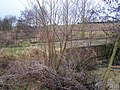 Road bridge over Langley Loch - geograph.org.uk - 1130959.jpg 640 × 481; 138 KB
-
 Road sign, A274 - geograph.org.uk - 3385008.jpg 640 × 381; 81 KB
-
 Rumwood Nursery - geograph.org.uk - 3385005.jpg 640 × 426; 40 KB
-
 Rumwoods Nursery - geograph.org.uk - 3385023.jpg 640 × 426; 49 KB
-
 Shepherds Way, Langley Heath - geograph.org.uk - 3812194.jpg 3,488 × 2,616; 1.7 MB
-
 Small woodland near Langley Loch - geograph.org.uk - 3379235.jpg 640 × 426; 49 KB
-
 Static caravans - geograph.org.uk - 3385004.jpg 640 × 426; 42 KB
-
 Stone water trough in a hedge - geograph.org.uk - 3381570.jpg 640 × 426; 125 KB
-
 Stream Shaw - geograph.org.uk - 3381564.jpg 640 × 426; 58 KB
-
 Sutton Road from Horseshoes Lane - geograph.org.uk - 4848769.jpg 800 × 424; 84 KB
-
 Sutton Road, Langley - geograph.org.uk - 3632647.jpg 3,488 × 2,616; 2.13 MB
-
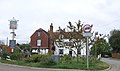 The Plough at Langley, Five Wents - geograph.org.uk - 2111384.jpg 3,488 × 2,052; 2.12 MB
-
 The Plough at Langley, Five Wents - geograph.org.uk - 3608825.jpg 3,488 × 2,616; 2.18 MB
-
 Ulcombe Road, Langley Heath - geograph.org.uk - 3812201.jpg 3,488 × 2,616; 1.54 MB
-
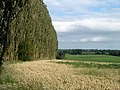 View through the windbreak trees - geograph.org.uk - 3043543.jpg 640 × 480; 131 KB


