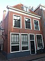
Category:Langebrug 46, Leiden
Jump to navigation
Jump to search
| Object location | | View all coordinates using: OpenStreetMap |
|---|
building in Leiden, Netherlands  | |||||
| Upload media | |||||
| Instance of | |||||
|---|---|---|---|---|---|
| Location | Leiden, South Holland, Netherlands | ||||
| Located on street |
| ||||
| Heritage designation |
| ||||
 | |||||
|
This is a category about rijksmonument number 25055
|
| Address |
|
Media in category "Langebrug 46, Leiden"
The following 4 files are in this category, out of 4 total.
-
 Gevel - Leiden - 20136385 - RCE.jpg 802 × 1,200; 232 KB
-
 Leiden - Langebrug 46.JPG 2,736 × 3,648; 4.12 MB
-
 Overzicht - Leiden - 20136387 - RCE.jpg 1,200 × 951; 262 KB
-
 Voorgevel - Leiden - 20136388 - RCE.jpg 1,200 × 957; 254 KB


