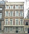
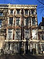
Category:Lange Voorhout 78, The Hague
Jump to navigation
Jump to search
| Object location | | View all coordinates using: OpenStreetMap |
|---|
building in The Hague, Netherlands  | |||||
| Upload media | |||||
| Instance of | |||||
|---|---|---|---|---|---|
| Location | The Hague, South Holland, Netherlands | ||||
| Located on street |
| ||||
| Heritage designation |
| ||||
 | |||||
|
This is a category about rijksmonument number 17724
|
| Address |
|
Media in category "Lange Voorhout 78, The Hague"
The following 8 files are in this category, out of 8 total.
-

-

-
 Den Haag - Lange Voorhout 78.JPG 2,736 × 3,648; 4.73 MB
-
 En hoger, voorgevels - 's-Gravenhage - 20091273 - RCE.jpg 1,200 × 956; 336 KB
-
 Lange Voorhout 78 Russenhuis.jpg 2,394 × 2,767; 1.55 MB
-
 Lange Voorhout 78, The Hague, 'Russians House' (2019).jpg 3,024 × 4,032; 3.3 MB
-

-


.jpg)

