Category:Lange Voorhout 7, The Hague
Jump to navigation
Jump to search
| Object location | | View all coordinates using: OpenStreetMap |
|---|
building in The Hague, Netherlands  | |||||
| Upload media | |||||
| Instance of | |||||
|---|---|---|---|---|---|
| Location | The Hague, South Holland, Netherlands | ||||
| Located on street |
| ||||
| Heritage designation |
| ||||
 | |||||
|
This is a category about rijksmonument number 17676
|
| Address |
|
Media in category "Lange Voorhout 7, The Hague"
The following 8 files are in this category, out of 8 total.
-
 1751, Huis van Willem Bentinck aan het Voorhout 7 te Den Haag.jpg 6,400 × 4,382; 6.5 MB
-
 Capitulatie 14 mei 1940 monument (img01).jpg 1,340 × 1,340; 2.3 MB
-
 Capitulatie 14 mei 1940 monument (img02).jpg 1,500 × 1,089; 1.75 MB
-
 Den Haag - Lange Voorhout 7.JPG 3,648 × 2,736; 5.61 MB
-
 Ingangspartij - 's-Gravenhage - 20091021 - RCE.jpg 866 × 1,200; 163 KB
-
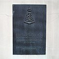
 Lange Voorhout 7 plaquette 1990.JPG 2,432 × 3,648; 3.66 MB
-
 Ministerie van Marine te Den Haag, tijdens de brand van 1844.jpg 4,307 × 3,214; 6.47 MB
-
 Of 9, ingangspartij van natuursteen met pilasters - 's-Gravenhage - 20091023 - RCE.jpg 1,197 × 1,200; 314 KB

.jpg)
.jpg)


