Category:Lange Voorhout 44, The Hague
Jump to navigation
Jump to search
| Object location | | View all coordinates using: OpenStreetMap |
|---|
building in The Hague, Netherlands  | |||||
| Upload media | |||||
| Instance of | |||||
|---|---|---|---|---|---|
| Location | The Hague, South Holland, Netherlands | ||||
| Located on street |
| ||||
| Heritage designation |
| ||||
 | |||||
|
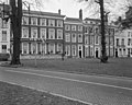
This is a category about rijksmonument number 17709
|
| Address |
|
Media in category "Lange Voorhout 44, The Hague"
The following 15 files are in this category, out of 15 total.
-
 Den Haag - Lange Voorhout 44.JPG 2,736 × 3,648; 4.1 MB
-
 Exterieur OVERZICHT VOORGEVELS - 's-Gravenhage - 20262273 - RCE.jpg 1,200 × 770; 187 KB
-
 Exterieur OVERZICHT VOORGEVELS - 's-Gravenhage - 20262274 - RCE.jpg 1,200 × 779; 188 KB
-
 Exterieur OVERZICHT VOORGEVELS - 's-Gravenhage - 20262275 - RCE.jpg 777 × 1,200; 156 KB
-
 Gevels - 's-Gravenhage - 20091205 - RCE.jpg 965 × 1,200; 277 KB
-
 Interieur - 's-Gravenhage - 20091200 - RCE.jpg 960 × 1,200; 216 KB
-
 Interieur - 's-Gravenhage - 20091201 - RCE.jpg 1,200 × 968; 235 KB
-
 Interieur - 's-Gravenhage - 20091209 - RCE.jpg 961 × 1,200; 202 KB
-
 Interieur - 's-Gravenhage - 20091211 - RCE.jpg 957 × 1,200; 231 KB
-
 Interieur met schouw - 's-Gravenhage - 20091210 - RCE.jpg 1,200 × 981; 243 KB
-
 Lange Voorhout 44 Den Haag.JPG 3,648 × 2,432; 3.6 MB
-
 Overzicht - 's-Gravenhage - 20091202 - RCE.jpg 1,200 × 957; 309 KB
-
 Overzicht - 's-Gravenhage - 20091206 - RCE.jpg 1,200 × 950; 337 KB
-
 Overzicht gevels - 's-Gravenhage - 20091203 - RCE.jpg 1,200 × 957; 336 KB
-
 Voorgevel - 's-Gravenhage - 20091207 - RCE.jpg 1,200 × 953; 323 KB


