Category:Lange Voorhout 42, The Hague
Jump to navigation
Jump to search
| Object location | | View all coordinates using: OpenStreetMap |
|---|
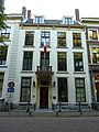
building in The Hague, Netherlands  | |||||
| Upload media | |||||
| Instance of | |||||
|---|---|---|---|---|---|
| Location | The Hague, South Holland, Netherlands | ||||
| Located on street |
| ||||
| Heritage designation |
| ||||
 | |||||
|
This is a category about rijksmonument number 17708
|
| Address |
|
Media in category "Lange Voorhout 42, The Hague"
The following 8 files are in this category, out of 8 total.
-
 Den Haag - Lange Voorhout 42.JPG 2,736 × 3,648; 4 MB
-
 Exterieur OVERZICHT VOORGEVELS - 's-Gravenhage - 20262273 - RCE.jpg 1,200 × 770; 187 KB
-
 Fiat 500 Netherlands diplomatic plate (Switzerland) (42662956900).jpg 4,656 × 3,492; 5.99 MB
-
 Fiat 500 Netherlands diplomatic plate (Switzerland) (43562280925).jpg 4,656 × 3,492; 6.87 MB
-
 Overzicht - 's-Gravenhage - 20091206 - RCE.jpg 1,200 × 950; 337 KB
-
 Voorgevel - 's-Gravenhage - 20091207 - RCE.jpg 1,200 × 953; 323 KB
-
 Voorhout, Den Haag, Netherlands - panoramio (49).jpg 4,896 × 3,264; 6.54 MB
-
 Voorhout, Den Haag, Netherlands - panoramio (59).jpg 4,896 × 3,264; 4.93 MB

_(42662956900).jpg)
_(43562280925).jpg)


.jpg)
.jpg)