Category:Lange Voorhout 4, The Hague
Jump to navigation
Jump to search
| Object location | | View all coordinates using: OpenStreetMap |
|---|
building in The Hague, Netherlands  | |||||
| Upload media | |||||
| Instance of | |||||
|---|---|---|---|---|---|
| Location | The Hague, South Holland, Netherlands | ||||
| Located on street |
| ||||
| Heritage designation |
| ||||
 | |||||
|
This is a category about rijksmonument number 17691
|
| Address |
|
Media in category "Lange Voorhout 4, The Hague"
The following 7 files are in this category, out of 7 total.
-
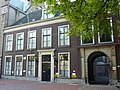 Den Haag - Lange Voorhout 4.JPG 3,089 × 2,318; 3.04 MB
-
 Ingang - 's-Gravenhage - 20091014 - RCE.jpg 848 × 1,200; 171 KB
-
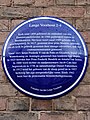 Lange Voorhout 2-4 Plaque.jpg 3,000 × 4,000; 3.7 MB
-

-
 Lange Voorhout, poort tussen nrs 4 en 6.jpg 2,432 × 3,648; 4.21 MB
-
 Voorhout, Den Haag, Netherlands - panoramio (58).jpg 4,896 × 3,264; 6.59 MB
-
 Voorhout, Den Haag, Netherlands - panoramio (62).jpg 4,896 × 3,264; 6.72 MB


,_2022_in_The_Hague,_Lange_Voorhout,_The_Hague.jpg)

.jpg)
.jpg)