Category:Lange Voorhout 38, The Hague
Jump to navigation
Jump to search
| Object location | | View all coordinates using: OpenStreetMap |
|---|
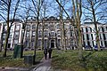
building in The Hague, Netherlands  | |||||
| Upload media | |||||
| Instance of | |||||
|---|---|---|---|---|---|
| Location | The Hague, South Holland, Netherlands | ||||
| Located on street |
| ||||
| Heritage designation |
| ||||
 | |||||
|
This is a category about rijksmonument number 17706
|
| Address |
|
Media in category "Lange Voorhout 38, The Hague"
The following 25 files are in this category, out of 25 total.
-
 BC856 HUI-1197.jpg 3,496 × 2,424; 1.52 MB
-
 BC856 HUI-1198.jpg 3,520 × 2,440; 1.62 MB
-
 Den Haag - Lange Voorhout 38.JPG 2,736 × 3,648; 4 MB
-
 Exterieur OVERZICHT VOORGEVELS - 's-Gravenhage - 20262272 - RCE.jpg 1,200 × 809; 216 KB
-
 Ingang - 's-Gravenhage - 20091190 - RCE.jpg 870 × 1,200; 180 KB
-
 Overzicht voorgevel herenhuis - 's-Gravenhage - 20343427 - RCE.jpg 785 × 1,200; 213 KB
-
 Plafond - 's-Gravenhage - 20091191 - RCE.jpg 1,200 × 868; 137 KB
-
 Plafond - 's-Gravenhage - 20091192 - RCE.jpg 1,200 × 860; 158 KB
-
 Plafond - 's-Gravenhage - 20091193 - RCE.jpg 1,200 × 861; 169 KB
-
 Spaanse Ambassade, exterieur - 's-Gravenhage - 20091189 - RCE.jpg 947 × 1,200; 305 KB
-
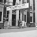
 Town-Major-Office van Den Haag aan het Lange Voorhout 38, Bestanddeelnr 900-5350.jpg 2,880 × 2,874; 1.26 MB
-
 Town-Major-Office van Den Haag aan het Lange Voorhout 38, Bestanddeelnr 900-5351.jpg 2,883 × 2,862; 1.29 MB
-
 Town-Major-Office van Den Haag aan het Lange Voorhout 38, Bestanddeelnr 900-5358.jpg 2,880 × 2,874; 966 KB
-
 Town-Major-Office van Den Haag aan het Lange Voorhout 38, Bestanddeelnr 900-5359.jpg 2,880 × 2,874; 1.24 MB
-
 Town-Major-Office van Den Haag aan het Lange Voorhout 38, Bestanddeelnr 900-5360.jpg 2,880 × 2,874; 1.26 MB
-
 Town-Major-Office van Den Haag aan het Lange Voorhout 38, Bestanddeelnr 900-5361.jpg 2,880 × 2,874; 1.21 MB
-

-

-
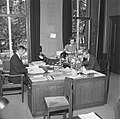 Town-Major-Office van Den Haag Kantoor met ambtenaren, Bestanddeelnr 900-5355.jpg 2,883 × 2,862; 1.07 MB
-
 Town-Major-Office van Den Haag, Balie, Bestanddeelnr 900-5356.jpg 2,883 × 2,883; 1.05 MB
-

-

-
 Voorhout, Den Haag, Netherlands - panoramio (49).jpg 4,896 × 3,264; 6.54 MB
-
 Voorhout, Den Haag, Netherlands - panoramio (53).jpg 4,896 × 3,264; 6.66 MB
-
 Voorhout, Den Haag, Netherlands - panoramio (59).jpg 4,896 × 3,264; 4.93 MB


.jpg)
.jpg)
.jpg)