Category:Lange Voorhout 29, The Hague
Jump to navigation
Jump to search
| Object location | | View all coordinates using: OpenStreetMap |
|---|
building in The Hague, Netherlands  | |||||
| Upload media | |||||
| Instance of | |||||
|---|---|---|---|---|---|
| Location | The Hague, South Holland, Netherlands | ||||
| Located on street |
| ||||
| Heritage designation |
| ||||
 | |||||
|
This is a category about rijksmonument number 17686
|
| Address |
|
Media in category "Lange Voorhout 29, The Hague"
The following 11 files are in this category, out of 11 total.
-
 Den Haag - Lange Voorhout 29.JPG 2,736 × 3,648; 4.77 MB
-
 Exterieur OVERZICHT SMEEDIJZEREN STOEPHEK - 's-Gravenhage - 20272587 - RCE.jpg 1,190 × 1,200; 381 KB
-
 Exterieur OVERZICHT SMEEDIJZEREN STOEPHEK - 's-Gravenhage - 20272588 - RCE.jpg 1,197 × 1,200; 373 KB
-
 Exterieur SMEEDIJZEREN STOEPHEK - 's-Gravenhage - 20272586 - RCE.jpg 1,200 × 1,200; 278 KB
-
 Overzicht gevels - 's-Gravenhage - 20091139 - RCE.jpg 1,200 × 952; 344 KB
-
 Overzicht gevels - 's-Gravenhage - 20091140 - RCE.jpg 1,200 × 958; 328 KB
-
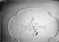
 Plafond - 's-Gravenhage - 20091160 - RCE.jpg 1,200 × 860; 102 KB
-
 Plafond - 's-Gravenhage - 20091161 - RCE.jpg 1,200 × 868; 120 KB
-
 Plafonds - 's-Gravenhage - 20091157 - RCE.jpg 1,200 × 866; 169 KB
-
 Plafonds - 's-Gravenhage - 20091158 - RCE.jpg 1,200 × 864; 189 KB
-
 Plafonds - 's-Gravenhage - 20091159 - RCE.jpg 1,200 × 866; 125 KB


