Category:Lange Voorhout 18, The Hague
Jump to navigation
Jump to search
| Object location | | View all coordinates using: OpenStreetMap |
|---|
building in The Hague, Netherlands  | |||||
| Upload media | |||||
| Instance of | |||||
|---|---|---|---|---|---|
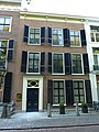
| Location | The Hague, South Holland, Netherlands | ||||
| Located on street |
| ||||
| Heritage designation |
| ||||
 | |||||
|
This is a category about rijksmonument number 17698
|
| Address |
|
Media in category "Lange Voorhout 18, The Hague"
The following 3 files are in this category, out of 3 total.
-
 Bovenlicht voordeur - 's-Gravenhage - 20091122 - RCE.jpg 1,200 × 837; 165 KB
-
 Den Haag - Lange Voorhout 18.JPG 2,736 × 3,648; 4.69 MB
-
 Voorhout, Den Haag, Netherlands - panoramio (51).jpg 4,896 × 3,264; 6.47 MB

.jpg)