Category:Lange Voorhout 13, The Hague
Jump to navigation
Jump to search
| Object location | | View all coordinates using: OpenStreetMap |
|---|
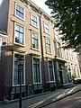
building in The Hague, Netherlands  | |||||
| Upload media | |||||
| Instance of | |||||
|---|---|---|---|---|---|
| Location | The Hague, South Holland, Netherlands | ||||
| Located on street |
| ||||
| Heritage designation |
| ||||
| Inception |
| ||||
 | |||||
|
This is a category about rijksmonument number 17679
|
| Address |
|
Media in category "Lange Voorhout 13, The Hague"
The following 24 files are in this category, out of 24 total.
-
 Achtergevel - 's-Gravenhage - 20091061 - RCE.jpg 1,200 × 887; 220 KB
-
 Den Haag - Lange Voorhout 13.JPG 2,736 × 3,648; 4.82 MB
-
 Den Haag - Lange Voorhout tussen 13 en 11.JPG 2,736 × 3,648; 4.68 MB
-
 Ingang - 's-Gravenhage - 20091062 - RCE.jpg 869 × 1,200; 131 KB
-
 Ingangspartij - 's-Gravenhage - 20091064 - RCE.jpg 959 × 1,200; 247 KB
-
 INTERIEUR, CENTRALE TRAPPENHUIS - 's-Gravenhage - 20301032 - RCE.jpg 1,195 × 1,200; 232 KB
-

-
 INTERIEUR, GROTE DEUR, DETAIL - 's-Gravenhage - 20301042 - RCE.jpg 1,192 × 1,200; 317 KB
-

-
 INTERIEUR, GROTE KAMER, RECHTS VOOR, KLEINE DEUR - 's-Gravenhage - 20301043 - RCE.jpg 1,192 × 1,200; 317 KB
-
 INTERIEUR, GROTE KAMER, RECHTS VOOR, lambrisering - 's-Gravenhage - 20301040 - RCE.jpg 1,197 × 1,200; 349 KB
-
 INTERIEUR, GROTE KAMER, RECHTS VOOR, STUCPLAFOND - 's-Gravenhage - 20301038 - RCE.jpg 1,200 × 1,200; 280 KB
-

-

-
 INTERIEUR, OVERZICHT GROTE DEUR - 's-Gravenhage - 20301041 - RCE.jpg 1,200 × 1,200; 302 KB
-
 INTERIEUR, OVERZICHT NAAR TUINKAMER - 's-Gravenhage - 20301044 - RCE.jpg 1,197 × 1,200; 244 KB
-
 INTERIEUR, OVERZICHT TUINKAMER, RECHTS ACHTER - 's-Gravenhage - 20301033 - RCE.jpg 1,190 × 1,200; 250 KB
-
 INTERIEUR, TUINKAMER, RECHTS ACHTER, KACHELNIS - 's-Gravenhage - 20301035 - RCE.jpg 1,192 × 1,200; 291 KB
-

-
 INTERIEUR, TUINKAMER, RECHTS ACHTER, lambrisering - 's-Gravenhage - 20301037 - RCE.jpg 1,192 × 1,200; 329 KB
-

-
 Lange Voorhout 13, The Hague, at night, August 2020.jpg 4,032 × 3,024; 10.74 MB
-
 Lange Voorhout 13, The Hague.jpg 3,024 × 3,024; 3.51 MB
-


