Category:Lange Houtstraat 15, The Hague
Jump to navigation
Jump to search
| Object location | | View all coordinates using: OpenStreetMap |
|---|
building in The Hague, Netherlands  | |||||
| Upload media | |||||
| Instance of | |||||
|---|---|---|---|---|---|
| Location | The Hague, South Holland, Netherlands | ||||
| Street address |
| ||||
| Located on street | |||||
| Heritage designation |
| ||||
 | |||||
|
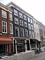
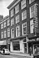
This is a category about rijksmonument number 17670
|
| Address |
|
Media in category "Lange Houtstraat 15, The Hague"
The following 3 files are in this category, out of 3 total.
-
 Den Haag - Lange Houtstraat 15.JPG 3,056 × 4,592; 4.32 MB
-
 Rm17670.JPG 2,736 × 3,648; 2.05 MB
-
 Voorgevel - 's-Gravenhage - 20088669 - RCE.jpg 806 × 1,200; 195 KB

