Category:Landulph
Jump to navigation
Jump to search
hamlet and a rural civil parish in south-east Cornwall, UK  | |||||
| Upload media | |||||
| Instance of | |||||
|---|---|---|---|---|---|
| Location | Cornwall, South West England, England | ||||
| Population |
| ||||
 | |||||
English: Landulph is a hamlet and a rural civil parish in south-east Cornwall, United Kingdom. It is situated about 3 miles (5 km) north of Saltash in the St Germans Registration District.
Media in category "Landulph"
The following 200 files are in this category, out of 222 total.
(previous page) (next page)-
 A side valley feeding into the Tamar - geograph.org.uk - 3542203.jpg 1,024 × 768; 123 KB
-
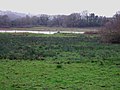 Across the Marsh - geograph.org.uk - 338195.jpg 640 × 480; 74 KB
-
 Animal feeder near Bittleford Farm - geograph.org.uk - 3572040.jpg 640 × 432; 70 KB
-
 Approaching Landulph - geograph.org.uk - 3569232.jpg 640 × 480; 85 KB
-
 Approaching Salter Mill - geograph.org.uk - 3570591.jpg 640 × 458; 90 KB
-

-
 Bales near Wayton - geograph.org.uk - 3571101.jpg 640 × 440; 68 KB
-
 Bales south of Haye - geograph.org.uk - 3571445.jpg 499 × 640; 109 KB
-
 Barn Conversion, Stockadon, near Saltash - geograph.org.uk - 89288.jpg 640 × 427; 210 KB
-
 Boat near Kingsmill Lake - geograph.org.uk - 3568671.jpg 480 × 640; 62 KB
-
 Bridleway - geograph.org.uk - 338200.jpg 640 × 480; 144 KB
-
 Bridleway past Lower Marsh Farm - geograph.org.uk - 3569304.jpg 640 × 480; 94 KB
-
 Bridleway, Landulph - geograph.org.uk - 3569265.jpg 640 × 464; 86 KB
-
 Bridleway, Lower Marsh Farm - geograph.org.uk - 3569286.jpg 640 × 480; 94 KB
-
 Calf, Clampit - geograph.org.uk - 3548968.jpg 640 × 501; 97 KB
-
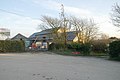
 Car and green, Cargreen - geograph.org.uk - 3570042.jpg 640 × 480; 85 KB
-
 Cargreen , Fore Street - geograph.org.uk - 5757637.jpg 6,000 × 4,000; 6.19 MB
-
 Cargreen , The River Tamar - geograph.org.uk - 5757636.jpg 6,000 × 4,000; 5.2 MB
-
 Cargreen , The River Tamar - geograph.org.uk - 5757638.jpg 6,000 × 4,000; 7.44 MB
-
 Cargreen , The River Tamar - geograph.org.uk - 5757639.jpg 6,000 × 4,000; 5.39 MB
-
 Cargreen , The River Tamar - geograph.org.uk - 5759243.jpg 6,000 × 4,000; 5.31 MB
-
 Cargreen - geograph.org.uk - 3506051.jpg 640 × 402; 52 KB
-
 Cargreen - geograph.org.uk - 3506067.jpg 640 × 480; 54 KB
-
 Cargreen - geograph.org.uk - 3570417.jpg 640 × 480; 62 KB
-
 Cargreen and the Tamar - geograph.org.uk - 1809082.jpg 640 × 442; 85 KB
-
 Cargreen Book Exchange - geograph.org.uk - 3570450.jpg 480 × 640; 82 KB
-
 Cargreen from Church Lane - geograph.org.uk - 3569907.jpg 640 × 438; 78 KB
-
 Cargreen seen from footpath in 1992 - geograph.org.uk - 2260056.jpg 1,731 × 1,155; 522 KB
-
 Cargreen seen from the Tamar - geograph.org.uk - 3541881.jpg 1,024 × 765; 99 KB
-
 Cattle at Clampit - geograph.org.uk - 3548858.jpg 640 × 422; 77 KB
-
 Cattle at Clampit - geograph.org.uk - 3548863.jpg 640 × 400; 70 KB
-
 Cattle, North Wayton - geograph.org.uk - 3571204.jpg 640 × 426; 59 KB
-

-
 Churchyard entrance, Landulph - geograph.org.uk - 3568292.jpg 480 × 640; 99 KB
-
 Clamoak seen from Tamar - geograph.org.uk - 3541950.jpg 1,024 × 768; 128 KB
-
 Cliff near Neal Point - geograph.org.uk - 3568894.jpg 480 × 640; 116 KB
-
 Clifton Farm - geograph.org.uk - 469866.jpg 640 × 427; 90 KB
-
 Clifton Farm Drive - geograph.org.uk - 338189.jpg 640 × 480; 93 KB
-
 Coombe Creek, Cargreen - geograph.org.uk - 3570462.jpg 640 × 445; 67 KB
-
 Coombe Lane - geograph.org.uk - 3570580.jpg 640 × 442; 95 KB
-
 Coombe Lane - geograph.org.uk - 469571.jpg 640 × 427; 123 KB
-
 Coombe Lane - geograph.org.uk - 469633.jpg 640 × 427; 108 KB
-
 Cornish hedges - geograph.org.uk - 469779.jpg 640 × 427; 119 KB
-
 Cornwall , Countryside Scenery - geograph.org.uk - 5757634.jpg 6,000 × 4,000; 7.4 MB
-
 Cornwall , Keeper's Cottage - geograph.org.uk - 5759056.jpg 6,000 × 4,000; 7.83 MB
-
 Cornwall , Pentillie Quay - geograph.org.uk - 5759227.jpg 6,000 × 4,000; 7.33 MB
-
 Cornwall , The River Tamar - geograph.org.uk - 5757623.jpg 6,000 × 4,000; 5.14 MB
-
 Cornwall , The River Tamar - geograph.org.uk - 5757625.jpg 6,000 × 4,000; 7.13 MB
-
 Cornwall , The River Tamar - geograph.org.uk - 5757626.jpg 6,000 × 4,000; 7.84 MB
-
 Cornwall , The River Tamar - geograph.org.uk - 5757627.jpg 6,000 × 4,000; 4.95 MB
-
 Cornwall , The River Tamar - geograph.org.uk - 5757628.jpg 6,000 × 4,000; 6.08 MB
-
 Cornwall , The River Tamar - geograph.org.uk - 5757633.jpg 6,000 × 4,000; 5.7 MB
-
 Cornwall , The River Tamar - geograph.org.uk - 5757635.jpg 6,000 × 4,000; 5.93 MB
-
 Cornwall , The River Tamar - geograph.org.uk - 5757640.jpg 6,000 × 4,000; 5.89 MB
-
 Cornwall , The River Tamar - geograph.org.uk - 5757641.jpg 6,000 × 4,000; 5.86 MB
-
 Cornwall , The River Tamar - geograph.org.uk - 5757642.jpg 6,000 × 4,000; 6.48 MB
-
 Cornwall , The River Tamar - geograph.org.uk - 5757643.jpg 6,000 × 4,000; 6.03 MB
-
 Cornwall , The River Tamar - geograph.org.uk - 5759026.jpg 6,000 × 4,000; 7.38 MB
-
 Cornwall , The River Tamar - geograph.org.uk - 5759027.jpg 6,000 × 4,000; 7.79 MB
-
 Cornwall , The River Tamar - geograph.org.uk - 5759031.jpg 6,000 × 4,000; 6.65 MB
-
 Cornwall , The River Tamar - geograph.org.uk - 5759034.jpg 6,000 × 4,000; 6.99 MB
-
 Cornwall , The River Tamar - geograph.org.uk - 5759038.jpg 6,000 × 4,000; 6.97 MB
-
 Cornwall , The River Tamar - geograph.org.uk - 5759042.jpg 6,000 × 4,000; 6.01 MB
-
 Cornwall , The River Tamar - geograph.org.uk - 5759045.jpg 6,000 × 4,000; 7.19 MB
-
 Cornwall , The River Tamar - geograph.org.uk - 5759046.jpg 6,000 × 4,000; 6.27 MB
-
 Cornwall , The River Tamar - geograph.org.uk - 5759228.jpg 6,000 × 4,000; 5.41 MB
-
 Cornwall , The River Tamar - geograph.org.uk - 5759231.jpg 4,000 × 6,000; 6.06 MB
-
 Cornwall , The River Tamar - geograph.org.uk - 5759234.jpg 6,000 × 4,000; 6.06 MB
-
 Cornwall , The River Tamar - geograph.org.uk - 5759244.jpg 6,000 × 4,000; 5.16 MB
-
 Cows and Mud - geograph.org.uk - 337357.jpg 640 × 480; 77 KB
-
 Creek by the Tamar - geograph.org.uk - 3570583.jpg 516 × 640; 92 KB
-
 Crop south of Tinnel Farm - geograph.org.uk - 3571081.jpg 640 × 374; 58 KB
-
 Cut Bench Mark - geograph.org.uk - 4890364.jpg 360 × 640; 98 KB
-
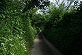
 East Cornwall lane - geograph.org.uk - 1810129.jpg 640 × 411; 65 KB
-

-
 Electricity Station, Landulph, Cornwall - geograph.org.uk - 89305.jpg 640 × 427; 250 KB
-
 Farm buildings at Stockadon - geograph.org.uk - 1616245.jpg 640 × 480; 88 KB
-
 Farmland near Clampit - geograph.org.uk - 3548703.jpg 513 × 640; 84 KB
-
 Farmland off Coombe Lane - geograph.org.uk - 469565.jpg 640 × 427; 113 KB
-
 Farmland off Coombe Lane - geograph.org.uk - 469594.jpg 640 × 427; 119 KB
-
 Farmland, Landulph - geograph.org.uk - 3568229.jpg 640 × 415; 75 KB
-
 Field above the Tamar - geograph.org.uk - 3570906.jpg 640 × 429; 62 KB
-
 Field access track, Kingsmill Farm - geograph.org.uk - 3548669.jpg 512 × 640; 96 KB
-
 Field and gate south of Haye - geograph.org.uk - 3571442.jpg 640 × 480; 92 KB
-
 Field by Coombe Lane - geograph.org.uk - 3570561.jpg 640 × 422; 69 KB
-
 Field by Coombe Lane - geograph.org.uk - 3570567.jpg 640 × 446; 52 KB
-
 Field southwest of Tinnel Farm - geograph.org.uk - 3571016.jpg 640 × 448; 78 KB
-
 Field west of Tinnel Farm - geograph.org.uk - 3571021.jpg 640 × 388; 55 KB
-
 Field, Clampit - geograph.org.uk - 3548691.jpg 640 × 409; 67 KB
-
 Football pitch, Cargreen - geograph.org.uk - 3570147.jpg 640 × 445; 71 KB
-
 Fore Street, Cargreen - geograph.org.uk - 3569974.jpg 640 × 523; 68 KB
-
 Fore Street, Cargreen - geograph.org.uk - 3570286.jpg 640 × 400; 52 KB
-
 Fore Street, Cargreen, in 1991 - geograph.org.uk - 2032005.jpg 640 × 430; 56 KB
-

-
 Foreshore by Kingsmill Lake - geograph.org.uk - 3568377.jpg 1,600 × 1,099; 1.44 MB
-
 Foreshore by Kingsmill Lake - geograph.org.uk - 3569020.jpg 640 × 425; 83 KB
-
 Foreshore, River Tamar - geograph.org.uk - 3570135.jpg 640 × 446; 62 KB
-
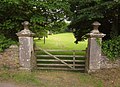
 Gate on Coombe Lane - geograph.org.uk - 469616.jpg 640 × 427; 136 KB
-
 Gated road - geograph.org.uk - 337370.jpg 640 × 480; 84 KB
-
 Gates to Stockadon Villa - geograph.org.uk - 3572943.jpg 640 × 464; 94 KB
-
 Grass triangle near Colloggett House - geograph.org.uk - 3568000.jpg 516 × 640; 57 KB
-
 Green, Cargreen - geograph.org.uk - 3570096.jpg 640 × 472; 53 KB
-
 Hay field near Haye Farm - geograph.org.uk - 3571438.jpg 640 × 439; 83 KB
-
 Haye Farm - geograph.org.uk - 3570698.jpg 640 × 451; 79 KB
-
 Horses in the road to Landulph Cross - geograph.org.uk - 1616227.jpg 640 × 480; 110 KB
-
 House in Cargreen - geograph.org.uk - 3570446.jpg 640 × 480; 41 KB
-
 Junction at Tinnel - geograph.org.uk - 338191.jpg 640 × 480; 80 KB
-
 Kingsmill Lake and River Tamar - geograph.org.uk - 4847384.jpg 1,600 × 1,200; 244 KB
-
 Landulph Cross - geograph.org.uk - 1616193.jpg 640 × 480; 80 KB
-
 Landulph Methodist Church - geograph.org.uk - 1809076.jpg 519 × 640; 77 KB
-
 Landulph Methodist Church - geograph.org.uk - 5042944.jpg 480 × 640; 73 KB
-
 Landulph Methodist Church - geograph.org.uk - 89315.jpg 640 × 427; 206 KB
-
 Lane approaching Tinnel - geograph.org.uk - 3571027.jpg 480 × 640; 116 KB
-
 Lane in Kingsmill Lake valley - geograph.org.uk - 3548651.jpg 480 × 640; 129 KB
-
 Lane near Bittleford Farm - geograph.org.uk - 3571942.jpg 640 × 480; 80 KB
-
 Lane past Penyoke Farm - geograph.org.uk - 3570056.jpg 640 × 463; 74 KB
-
 Lane past the church, Landulph - geograph.org.uk - 3568316.jpg 480 × 640; 98 KB
-
 Lane to Colloggett Hill - geograph.org.uk - 3567945.jpg 480 × 640; 58 KB
-
 Lane to Lower Marsh Farm - geograph.org.uk - 3569237.jpg 480 × 640; 81 KB
-
 Lane to Tinnel - geograph.org.uk - 3570683.jpg 480 × 640; 110 KB
-
 Lane to Tinnel Farm - geograph.org.uk - 3571111.jpg 473 × 640; 99 KB
-
 Lane to Tinnel Farm - geograph.org.uk - 3571122.jpg 640 × 455; 76 KB
-
 Liphill Quay - geograph.org.uk - 3543186.jpg 1,024 × 768; 144 KB
-
 Looking across the Marsh - geograph.org.uk - 914969.jpg 640 × 427; 72 KB
-
 Lower Marsh Farm - geograph.org.uk - 338198.jpg 640 × 480; 113 KB
-
 Lower Marsh Farm - geograph.org.uk - 3569330.jpg 640 × 463; 84 KB
-
 Marsh Farm - geograph.org.uk - 3567978.jpg 640 × 470; 62 KB
-
 Maze growing at Landulph - geograph.org.uk - 914975.jpg 640 × 426; 94 KB
-
 Pasture near Tinnel Farm - geograph.org.uk - 3570986.jpg 640 × 398; 65 KB
-
 Path approaching Coombe Creek - geograph.org.uk - 3571785.jpg 640 × 480; 133 KB
-
 Path around the Marsh - geograph.org.uk - 3569349.jpg 640 × 480; 117 KB
-
 Path to Landulph - geograph.org.uk - 3568367.jpg 640 × 463; 90 KB
-
 Path to Landulph - geograph.org.uk - 3568657.jpg 640 × 444; 75 KB
-
 Path to Landulph - geograph.org.uk - 3569082.jpg 640 × 480; 106 KB
-
 Path to Neal Point - geograph.org.uk - 3568345.jpg 480 × 640; 96 KB
-
 Playground, Cargreen - geograph.org.uk - 3569992.jpg 640 × 423; 58 KB
-
 Plymouth , The River Tamar - geograph.org.uk - 5757624.jpg 6,000 × 4,000; 7.87 MB
-
 Polytunnels south of Cargreen - geograph.org.uk - 3541889.jpg 1,024 × 679; 84 KB
-
 Postbox by Stockaden barns - geograph.org.uk - 1810112.jpg 640 × 454; 83 KB
-
 Potato field near Cargreen - geograph.org.uk - 3571723.jpg 511 × 640; 105 KB
-
 Potato field near Cargreen - geograph.org.uk - 3571728.jpg 640 × 464; 89 KB
-
 Potato field near Wayton - geograph.org.uk - 3571371.jpg 640 × 449; 74 KB
-
 Potatoes near Landulph - geograph.org.uk - 3568184.jpg 640 × 420; 85 KB
-
 Pylon near Landulph - geograph.org.uk - 3568031.jpg 480 × 640; 54 KB
-
 Pylons and fields - geograph.org.uk - 338193.jpg 640 × 480; 45 KB
-
 Pylons north of Clamoak - geograph.org.uk - 3541963.jpg 1,024 × 767; 78 KB
-
 Pylons on Bere Ferrers peninsula - geograph.org.uk - 3541870.jpg 1,024 × 768; 88 KB
-
 Quay and bathing house at Pentillie Castle - geograph.org.uk - 3542204.jpg 1,024 × 768; 180 KB
-
 Quay Cottage at Salter Mill - geograph.org.uk - 469698.jpg 640 × 427; 95 KB
-
 Quay on the River Tamar at Cargreen - geograph.org.uk - 5042950.jpg 480 × 640; 78 KB
-
 Quay, Cargreen - geograph.org.uk - 3570281.jpg 640 × 480; 77 KB
-

-
 Reed beds near Haye Farm and Salter Mill - geograph.org.uk - 469719.jpg 640 × 427; 124 KB
-
 River Tamar looping round South Hooe - geograph.org.uk - 3542202.jpg 1,024 × 512; 61 KB
-
 River Tamar, Cargreen - geograph.org.uk - 468860.jpg 640 × 427; 87 KB
-
 River Tamar, Cargreen - geograph.org.uk - 468871.jpg 640 × 427; 96 KB
-
 Road at North Wayton - geograph.org.uk - 3571220.jpg 640 × 480; 114 KB
-
 Road at Wayton - geograph.org.uk - 3506076.jpg 640 × 513; 87 KB
-
 Road dips before Landulph Cross - geograph.org.uk - 1616187.jpg 640 × 480; 85 KB
-
 Road past Wayton House - geograph.org.uk - 3571341.jpg 640 × 464; 63 KB
-
 Road to Landulph Cross - geograph.org.uk - 3571349.jpg 640 × 438; 92 KB
-
 Road to Wayton - geograph.org.uk - 3571179.jpg 1,600 × 2,133; 2.38 MB
-
 Rocks by Kingsmill Lake - geograph.org.uk - 3569060.jpg 503 × 640; 110 KB
-
-
 Salter Mill - geograph.org.uk - 3541920.jpg 1,024 × 768; 144 KB
-
 Sea plantain at Cargreen - geograph.org.uk - 3570217.jpg 480 × 640; 140 KB
-
 Shore near Neal Point - geograph.org.uk - 3568941.jpg 640 × 480; 115 KB
-
 Signpost at West Kingsmill - geograph.org.uk - 1809056.jpg 640 × 469; 95 KB
-
 Slipway, Cargreen - geograph.org.uk - 3570254.jpg 514 × 640; 70 KB
-
 Southdown Wood - geograph.org.uk - 3567970.jpg 640 × 395; 55 KB
-
 Steps to the river, Cargreen - geograph.org.uk - 3570292.jpg 493 × 640; 96 KB
-
 Stockaden barns - geograph.org.uk - 1810103.jpg 640 × 426; 57 KB
-
 Stockadon Villa - geograph.org.uk - 3572228.jpg 640 × 394; 53 KB
-
 Straight on for Cargreen - geograph.org.uk - 1809063.jpg 640 × 450; 81 KB
-
 Sundial, Landulph - geograph.org.uk - 3568303.jpg 492 × 640; 116 KB
-
 Tamar bridges from near Landulph - geograph.org.uk - 3568989.jpg 640 × 429; 41 KB
-
 Tamar Estuary Nature Reserve - geograph.org.uk - 468863.jpg 640 × 427; 101 KB
-
 Tamar foreshore at Cargreen - geograph.org.uk - 3570225.jpg 518 × 640; 101 KB
-
 Tamar shore at Cargreen - geograph.org.uk - 3570180.jpg 640 × 448; 72 KB
-
 Tamar shoreline - geograph.org.uk - 468866.jpg 640 × 427; 120 KB
-
 The bay on the Tamar at Parsons Quay - geograph.org.uk - 3540824.jpg 1,024 × 768; 107 KB
-

-
 The Marsh - geograph.org.uk - 338202.jpg 640 × 480; 106 KB
-
 The Marsh, Landulph - geograph.org.uk - 3568323.jpg 640 × 423; 84 KB
-
 The north bank of Clifton promontory - geograph.org.uk - 3542201.jpg 1,024 × 768; 131 KB
-
 The quay at Cargreen - geograph.org.uk - 3541897.jpg 1,024 × 768; 103 KB
-
 The quay at Cleave - geograph.org.uk - 3541975.jpg 1,024 × 512; 68 KB
-
 The quay at Weir Quay - geograph.org.uk - 3541979.jpg 1,024 × 512; 73 KB
-
 The Tamar estuary at Cargreen - geograph.org.uk - 1616239.jpg 640 × 480; 68 KB
-
 The Tamar Valley - geograph.org.uk - 469849.jpg 640 × 427; 99 KB
-
 Thorn Point ferry hard - geograph.org.uk - 2326432.jpg 640 × 427; 186 KB
-
 Thrift near Neal Point - geograph.org.uk - 3568926.jpg 480 × 640; 121 KB
-
 Thrift on the rocks near Neal Point - geograph.org.uk - 3568968.jpg 640 × 480; 115 KB
-
 Tinnel Farmhouse - geograph.org.uk - 338190.jpg 640 × 480; 110 KB
-
 Towards Cargreen - geograph.org.uk - 3569896.jpg 640 × 422; 78 KB
-
 Towards Kingsmill Lake - geograph.org.uk - 3567934.jpg 640 × 480; 79 KB
-
 Track to Colloggett House - geograph.org.uk - 3548964.jpg 640 × 386; 56 KB
-
 Tree-lined road, Wayton - geograph.org.uk - 3571247.jpg 480 × 640; 122 KB
-
 Trees along field boundary, Clampit - geograph.org.uk - 3548689.jpg 489 × 640; 110 KB
-
 Unfenced road to Salter Mill - geograph.org.uk - 3570573.jpg 640 × 480; 87 KB


