Category:Landsitz Rothus, Ostermundigen
Jump to navigation
Jump to search
| Object location | | View all coordinates using: OpenStreetMap |
|---|
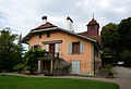
residential building in Ostermundigen in the canton of Bern, Switzerland  | |||||
| Upload media | |||||
| Instance of | |||||
|---|---|---|---|---|---|
| Part of | |||||
| Location | Ostermundigen, Bern-Mittelland administrative district, Bernese Mittelland administrative region, Bern, Switzerland | ||||
| Street address |
| ||||
| Occupant |
| ||||
| Heritage designation | |||||
 | |||||
Media in category "Landsitz Rothus, Ostermundigen"
The following 9 files are in this category, out of 9 total.
-
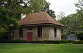
 Bern Waldau Siechenkapelle DSC00072 v2.JPG 1,140 × 1,388; 1.51 MB
-
 CH-NB - Bolligen, Rothaus - Collection Gugelmann - GS-GUGE-SPRÜNGLIN-C-2.tif 5,700 × 3,561, 2 pages; 30.93 MB
-
 Ostermundigen Landsitz Rothus DSC00139.JPG 4,642 × 3,157; 12.24 MB
-
 Ostermundigen Landsitz Rothus DSC00140.JPG 3,264 × 4,912; 9.35 MB
-
 Ostermundigen Landsitz Rothus DSC00143.JPG 4,862 × 3,014; 14.09 MB
-
 Ostermundigen Landsitz Rothus DSC00144.JPG 4,769 × 3,096; 15.45 MB
-
 Ostermundigen Landsitz Rothus DSC00151.JPG 4,652 × 3,168; 11.05 MB
-
 Ostermundigen Landsitz Rothus DSC00152.JPG 2,817 × 4,561; 10.19 MB
-
 Ostermundigen Landsitz Rothus DSC00161.JPG 4,180 × 2,673; 2.91 MB


