Category:Landshuis, Deventer
Jump to navigation
Jump to search
| Object location | | View all coordinates using: OpenStreetMap |
|---|
house in Deventer, Netherlands  | |||||
| Upload media | |||||
| Instance of | |||||
|---|---|---|---|---|---|
| Location | Deventer, Overijssel, Netherlands | ||||
| Street address |
| ||||
| Located on street | |||||
| Heritage designation |
| ||||
 | |||||
Nederlands: In 1632 opgetrokken als Landshuis voor het gewest Overijssel op de plek van een middeleeuws gebouw. Na 1800 dienst gedaan als school en van 1870 tot 1976 als politiebureau. Maakt sindsdien deel uit van het stadhuiscomplex van Deventer.
|
This is a category about rijksmonument number 12555
|
| Address |
|
Media in category "Landshuis, Deventer"
The following 34 files are in this category, out of 34 total.
-
 Achtergevel - Deventer - 20055886 - RCE.jpg 958 × 1,200; 297 KB
-
 Achtergevel - Deventer - 20325604 - RCE.jpg 733 × 1,200; 159 KB
-
 Achtergevel - Deventer - 20325779 - RCE.jpg 784 × 1,200; 181 KB
-
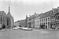
 Deventer, Netherlands - panoramio (16).jpg 1,148 × 2,048; 375 KB
-
 Deventer, view from tower of the Lebuïnuskerk to townhall and house 2 Grote Kerkhof.jpg 2,551 × 1,701; 1.05 MB
-
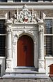 Exterieur INGANGSPARTIJ VAN VOORGEVEL - Deventer - 20261318 - RCE.jpg 776 × 1,200; 186 KB
-
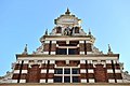
 Gable of ancient townhall Deventer. Besides it the new center is built - panoramio.jpg 2,634 × 4,092; 2.67 MB
-
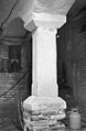
 Gotische kolom in de hal - Deventer - 20055887 - RCE.jpg 951 × 1,200; 184 KB
-
 Grote Kerkhof 2 Deventer.jpg 1,712 × 2,560; 1.27 MB
-
 Ingang - Deventer - 20055168 - RCE.jpg 894 × 1,200; 225 KB
-
 Ingang - Deventer - 20326874 - RCE.jpg 916 × 1,200; 229 KB
-
 Ingangspartij - Deventer - 20054307 - RCE.jpg 960 × 1,200; 256 KB
-
 Kerkhof 14, exterieur - Deventer - 20054298 - RCE.jpg 958 × 1,200; 173 KB
-
 Kerkhof 14, exterieur - Deventer - 20054299 - RCE.jpg 958 × 1,200; 186 KB
-
 Kerkhof 14, exterieur - Deventer - 20054300 - RCE.jpg 958 × 1,200; 165 KB
-
 Kerkhof 14, exterieur - Deventer - 20054301 - RCE.jpg 958 × 1,200; 187 KB
-
 Kerkhof 14, exterieur - Deventer - 20054302 - RCE.jpg 958 × 1,200; 174 KB
-
 Kerkhof 14, exterieur - Deventer - 20054303 - RCE.jpg 958 × 1,200; 174 KB
-
 Kerkhof 14, exterieur - Deventer - 20054304 - RCE.jpg 958 × 1,200; 177 KB
-
 Landhuis Deventer 2019.jpg 3,264 × 4,928; 6.39 MB
-
 Na de restauratie - Deventer - 20054296 - RCE.jpg 891 × 1,200; 227 KB
-
 Overzicht - Deventer - 20055879 - RCE.jpg 1,200 × 804; 165 KB
-
 Overzicht met Stadhuis - Deventer - 20055876 - RCE.jpg 1,200 × 805; 196 KB
-

-
 Overzicht rijk gedecoreerde voorgevel - Deventer - 20413975 - RCE.jpg 998 × 1,200; 204 KB
-
 Overzicht voorgevel - Deventer - 20055169 - RCE.jpg 894 × 1,200; 212 KB
-
 Overzicht voorgevel - Deventer - 20326873 - RCE.jpg 893 × 1,200; 169 KB
-
 Stadhuisgevel Deventer (4304112954).jpg 1,024 × 681; 167 KB
-
 Voor de restauratie - Deventer - 20054295 - RCE.jpg 876 × 1,200; 197 KB
-
 Voorgevel - Deventer - 20054306 - RCE.jpg 953 × 1,200; 234 KB
-
 Voorgevel - Deventer - 20054393 - RCE.jpg 885 × 1,200; 245 KB
-
 Voorgevel - Deventer - 20055167 - RCE.jpg 954 × 1,200; 240 KB
-
 Voorgevel - Deventer - 20055885 - RCE.jpg 952 × 1,200; 260 KB
-
 Zuiltje in de kelder - Deventer - 20054305 - RCE.jpg 784 × 1,200; 148 KB


.jpg)


.jpg)


