Category:Landschaftsschutzgebiet Norddeister
Jump to navigation
Jump to search
| Diese Kategorie repräsentiert ein Schutzgebiet nach Naturschutzrecht in Deutschland. |
|---|
| Diese Kategorie wurde nach einem klaren Schema angelegt, sie sollte nicht verschoben, gelöscht oder umkategorisiert werden. Sie ist unter anderem in dieser Uploadkarte hinterlegt. Beschreibung und Hintergründe auf der Seite des Wikiprojekts |
| Foto zu Wiki Loves Earth hochladen! - Seite von Wiki Loves Earth Deutschland |
This is the category of the protected area listed at WDPA under the ID 323262
|
protected landscape in Lower Saxony, Germany  | |||||
| Upload media | |||||
| Instance of | |||||
|---|---|---|---|---|---|
| Location | Hanover region, Lower Saxony, Germany | ||||
| Applies to jurisdiction | |||||
| IUCN protected areas category | |||||
| Inception |
| ||||
| Area |
| ||||
 | |||||
Norddeister ist ein Landschaftsschutzgebiet (LSG H 00023) in der Region Hannover in Niedersachsen.
Subcategories
This category has the following 15 subcategories, out of 15 total.
B
- Blanke-Teich (7 F)
D
- Dorotheenschacht (3 F)
E
- Egestorfer Stollen (6 F)
- Eisenbahn-Stollen (2 F)
- Ernst-Brauns-Denkmal (4 F)
H
- Hülsebrinkstollen (4 F)
K
- Kniggescher Kalksteinbruch (10 F)
- König-Wilhelm-Stollen (4 F)
M
- Ministerstollen (7 F)
- Mögebierstollen (4 F)
N
- Naturwald Steinbrink (7 F)
O
- Oberer Deisterstollen (2 F)
R
- Reichseiche (Wennigsen) (3 F)
Z
- Ziegeneiche (3 F)
Media in category "Landschaftsschutzgebiet Norddeister"
The following 31 files are in this category, out of 31 total.
-
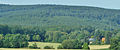
 2019-05-21 112929 Landschaftsschutzgebiet Norddeister.jpg 2,686 × 4,032; 5.58 MB
-
 Allee bei Gut Bredenbeck.jpg 2,880 × 3,496; 14.06 MB
-
 Bröhn.jpg 3,296 × 1,360; 4.37 MB
-
 Bullerbach-Hütte.jpg 1,780 × 1,390; 1.75 MB
-
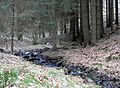 Bullerbach-Oberlauf.jpg 1,900 × 1,400; 2.88 MB
-
 Der Deister am morgen, vertreibt Kummer und Sorgen.jpg 5,312 × 2,988; 3.26 MB
-
 Ehemaliger Steinbruch beim Taternpfahl (01).JPG 4,896 × 3,264; 7.33 MB
-
 Ehemaliger Steinbruch beim Taternpfahl (02).JPG 2,810 × 3,801; 4.15 MB
-
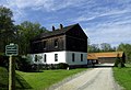 Forsthaus Kniggenbrink.jpg 1,900 × 1,300; 2.23 MB
-
 Gaussstein auf Kalenberg im Deister 2015.jpg 2,000 × 1,500; 2.42 MB
-
 Grenzstein von 1755 im Bullerbachtal.jpg 1,800 × 2,400; 1.73 MB
-
 Halde Frauenwegschacht.jpg 2,300 × 1,500; 2.18 MB
-
 Halden am Bröhn beim Georgsplatz.jpg 1,600 × 1,000; 2.25 MB
-
 Hoffmannstollen I - Einsturz.jpg 1,920 × 1,400; 1.99 MB
-
 Hoffmannstollen I - Halde.jpg 2,220 × 1,600; 3.92 MB
-
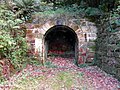 Hohe Warte Stollen-Mundloch.jpg 2,000 × 1,500; 3.34 MB
-
 Kalkbahn-Trasse im Deister.jpg 1,600 × 1,200; 1.36 MB
-
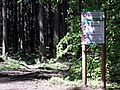 LSG Norddeister MTB-Regulierung.JPG 4,000 × 3,000; 6.07 MB
-
 LSG Norddeister Wanderverbot-MTB.JPG 3,600 × 2,700; 5.44 MB
-
 Muender Heerstraße.JPG 3,600 × 2,700; 4.99 MB
-
 Polenz-Weg.jpg 1,536 × 2,048; 2.83 MB
-
 Postillon trinkt.jpg 3,200 × 2,400; 5.31 MB
-
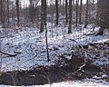
 Stockbach im Schnee.JPG 3,072 × 3,072; 3.89 MB
-
 Teich beim Forsthaus Bredenbeck.jpg 3,600 × 2,400; 5.67 MB
-
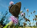 Thistles and Insects.jpg 2,280 × 1,710; 2.01 MB
-
 Wassertretstelle Bredenbeck (2015).jpg 2,000 × 1,500; 5.25 MB
-
 Wassertretstelle Wennigsen-Waldkater.jpg 2,368 × 1,600; 5.78 MB
-
 Wassertretstelle Wennigser Mark.jpg 2,400 × 1,600; 5.93 MB
-
 Wetterschacht Schnepfenflucht.jpg 1,900 × 1,300; 2.62 MB
-
 Winterlicher Buchenwald im Deister.jpg 3,648 × 2,736; 5.66 MB
-
 Wöltjestollen - Gelände.jpg 2,000 × 1,600; 4.46 MB


.JPG)
.JPG)


.jpg)


