Category:Landschaftsschutzgebiet Jungfernheide
Jump to navigation
Jump to search
| Diese Kategorie repräsentiert ein Schutzgebiet nach Naturschutzrecht in Deutschland. |
|---|
| Diese Kategorie wurde nach einem klaren Schema angelegt, sie sollte nicht verschoben, gelöscht oder umkategorisiert werden. Sie ist unter anderem in dieser Uploadkarte hinterlegt. Beschreibung und Hintergründe auf der Seite des Wikiprojekts |
| Foto zu Wiki Loves Earth hochladen! - Seite von Wiki Loves Earth Deutschland |
protected area in Germany  | |||||
| Upload media | |||||
| Instance of | |||||
|---|---|---|---|---|---|
| Named after |
| ||||
| Location | Reinickendorf, Berlin, Germany | ||||
| Applies to jurisdiction | |||||
| IUCN protected areas category | |||||
| Inception |
| ||||
| Area |
| ||||
 | |||||
Media in category "Landschaftsschutzgebiet Jungfernheide"
The following 24 files are in this category, out of 24 total.
-
 Chrysolina fastuosa on stinging nettle (14398455584).jpg 1,600 × 2,133; 1.67 MB
-
 Gedenkstein Im Saatwinkel 65 (Tegel) Darius Ekbatani.jpg 2,050 × 2,536; 4.68 MB
-
 Greenhouse Whitefly out in forest ... (14398147082).jpg 1,600 × 1,200; 987 KB
-
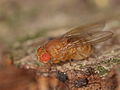 Große Essigfliege - Drosophila funebris ? (14213086147).jpg 1,828 × 1,371; 1.33 MB
-
 Mein Lieber Schwan (Swan) - geo.hlipp.de - 35182.jpg 640 × 480; 98 KB
-
 Old World Hornet - Vespa crabro (14376397056).jpg 983 × 1,311; 926 KB
-
 Rampe im Wald - panoramio (3).jpg 2,592 × 1,456; 1.07 MB
-
 Rampe im Wald - panoramio.jpg 2,592 × 1,456; 1.25 MB
-
 Saatwinkel - Badestelle (Bathing Beach) - geo.hlipp.de - 35170.jpg 640 × 480; 54 KB
-
 Saatwinkel - Maienwerderweg - geo.hlipp.de - 35169.jpg 640 × 480; 108 KB
-
 Saatwinkel - Tegeler See (Tegel Lake) - geo.hlipp.de - 35172.jpg 640 × 480; 60 KB
-
 Saatwinkel - Tegeler See (Tegel Lake) - geo.hlipp.de - 35174.jpg 640 × 480; 84 KB
-
 Sickerbecken - Jungfernheide - geo.hlipp.de - 35168.jpg 640 × 480; 95 KB
-
 Tegel - Bernauer Strasse - geo.hlipp.de - 35166.jpg 640 × 359; 75 KB
-
 Tegel Bernauer Straße Kurve.JPG 2,560 × 1,920; 2.91 MB
-
 Tegel Bernauer Straße-006.JPG 2,560 × 1,920; 2.9 MB
-
 Tegel Im Saatwinkel.JPG 2,560 × 1,920; 2.14 MB
-
 Tegel Maienwerderweg.JPG 2,560 × 1,920; 2.96 MB
-
 Tegel Saatwinkel Strand.JPG 2,560 × 1,920; 2.05 MB
-
 Tegeler See (Tegel Lake) - geo.hlipp.de - 35180.jpg 640 × 326; 51 KB
-
 Tegeler See - Ostliches Ufer (Eastern Shore) - geo.hlipp.de - 35183.jpg 640 × 480; 102 KB
-
 Tegeler See - Schilf (Reeds) - geo.hlipp.de - 35179.jpg 640 × 480; 100 KB
-

-
 Zaun am Flughafen Tegel - panoramio.jpg 1,456 × 2,592; 464 KB
.jpg)
_Darius_Ekbatani.jpg)
.jpg)
.jpg)
_-_geo.hlipp.de_-_35182.jpg)
.jpg)
.jpg)

_-_geo.hlipp.de_-_35170.jpg)

_-_geo.hlipp.de_-_35172.jpg)
_-_geo.hlipp.de_-_35174.jpg)


_-_geo.hlipp.de_-_35180.jpg)
_-_geo.hlipp.de_-_35183.jpg)
_-_geo.hlipp.de_-_35179.jpg)
_-_geo.hlipp.de_-_35176.jpg)
