Category:Landschaftsschutzgebiet Hoferkopf mit Villinger Park
Jump to navigation
Jump to search
| Diese Kategorie repräsentiert ein Schutzgebiet nach Naturschutzrecht in Deutschland. |
|---|
| Diese Kategorie wurde nach einem klaren Schema angelegt, sie sollte nicht verschoben, gelöscht oder umkategorisiert werden. Sie ist unter anderem in dieser Uploadkarte hinterlegt. Beschreibung und Hintergründe auf der Seite des Wikiprojekts |
| Foto zu Wiki Loves Earth hochladen! - Seite von Wiki Loves Earth Deutschland |
protected area in Germany  | |||||
| Upload media | |||||
| Instance of | |||||
|---|---|---|---|---|---|
| Location | Friedrichsthal, Regionalverband Saarbrücken, Saarland, Germany | ||||
| IUCN protected areas category | |||||
| Inception |
| ||||
| Area |
| ||||
 | |||||
Media in category "Landschaftsschutzgebiet Hoferkopf mit Villinger Park"
The following 11 files are in this category, out of 11 total.
-
 20220621 Hoferkopf 01.jpg 6,016 × 4,016; 7.97 MB
-
 20220621 Hoferkopf 02.jpg 6,016 × 4,016; 9.41 MB
-
 20220621 Hoferkopf 03.jpg 6,016 × 4,016; 9.09 MB
-
 20220621 Hoferkopf 04.jpg 6,016 × 4,016; 12.17 MB
-
 20220621 Hoferkopf 05.jpg 6,016 × 4,016; 7.58 MB
-
 20220621 Hoferkopf 06.jpg 6,016 × 4,016; 11.07 MB
-
 Bildstock, Parkanlage - geo.hlipp.de - 38435.jpg 480 × 640; 67 KB
-
 Bildstock, Teich im Villinger Park - geo.hlipp.de - 38433.jpg 640 × 480; 116 KB
-
 Bildstock, Villinger Park- Felswand - geo.hlipp.de - 38432.jpg 640 × 480; 119 KB
-
 Hoferkopf Sandstein DSC 0148.jpg 800 × 536; 509 KB
-
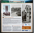 Info Hoferkopf.jpg 1,258 × 1,224; 831 KB


