
Category:Landschaftsschutzgebiet Gebiete um Bissingen und Ochsenwang
| Diese Kategorie repräsentiert ein Schutzgebiet nach Naturschutzrecht in Deutschland. |
|---|
| This category was created according to a clear scheme; it should not be moved, deleted or recategorized. It is stored in this upload map, among other places. Description and background on the Wiki project page |
| Upload photo to Wiki Loves Earth! - Wiki Loves Earth Germany page |
This is the category of the protected area listed at WDPA under the ID 555547196
|
Deutsch: Landschaftsschutzgebiet „Gebiete um Bissingen und Ochsenwang“, LSG 1.16.078 im Landkreis Esslingen, Baden-Württemberg
protected landscape area in Baden-Württemberg, Germany  | |||||
| Upload media | |||||
| Instance of | |||||
|---|---|---|---|---|---|
| Named after |
| ||||
| Location | Bissingen an der Teck, Esslingen, Stuttgart Government Region, Baden-Württemberg, Germany | ||||
| IUCN protected areas category | |||||
| Inception |
| ||||
| Area |
| ||||
 | |||||
Subcategories
This category has the following 2 subcategories, out of 2 total.
B
P
- Pferch (Bannwald) (6 F)
Media in category "Landschaftsschutzgebiet Gebiete um Bissingen und Ochsenwang"
The following 22 files are in this category, out of 22 total.
-
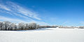
 160122-01 Albhochfläche im Winter.jpg 4,288 × 2,848; 4.34 MB
-
 160122-02 Albhochfläche im Winter.jpg 4,288 × 2,848; 4.08 MB
-
 160122-03 Albhochfläche im Winter.jpg 3,938 × 2,848; 4.91 MB
-
 160122-04 Albhochfläche im Winter.jpg 4,113 × 2,732; 1.94 MB
-
 Albtrauf bei Ochsenwang 01.jpg 1,000 × 664; 1 MB
-
 Albtrauf bei Ochsenwang 02.jpg 1,000 × 664; 1.01 MB
-
 Albtrauf bei Ochsenwang 03.jpg 1,000 × 566; 817 KB
-

-
 Albtrauf bei Ochsenwang 05.jpg 1,000 × 566; 992 KB
-
 Albtraufweg vom "Breitenstein" zum "Auchtert" (kleine Anhöhe am Bildhorizont).jpg 5,472 × 3,648; 7.84 MB
-
 Bissingen a.d.T. - Ochsenwang - Blick vom Osthang des Breitensteins zum Auchert.jpg 3,648 × 2,604; 8.05 MB
-
 Bissingen an der Teck - Schopflocher Moor altes Steinkreuz.JPG 5,203 × 2,988; 4.24 MB
-
 Bissingen an der Teck - Schopflocher Moor Tümpel 02.JPG 5,472 × 3,080; 5.59 MB
-
 Bissingen an der Teck - Schopflocher Moor Tümpel.JPG 5,472 × 3,080; 4.86 MB
-
 Blick nach oben im Pferch.jpg 2,032 × 2,816; 2.37 MB
-
 Blick nach Ochsenwang - panoramio.jpg 7,360 × 4,912; 24.9 MB
-
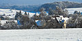 Das Dorf Ochsenwang.jpg 2,000 × 1,000; 1.65 MB
-
 Der Albtrauf bei Ochsenwang.jpg 2,000 × 1,000; 1.35 MB
-
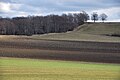 Felder am Albtrauf.jpg 2,000 × 1,328; 2.4 MB
-
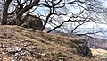
 Im "Pferch" am Albtrauf 2, Hangwald.jpg 2,813 × 2,028; 2.09 MB
-
 Papilio machaon auf dem Breitenstein.jpg 4,896 × 3,264; 6.51 MB
-
 Sonnenuntergang Heidengraben - panoramio.jpg 7,360 × 4,912; 19.73 MB


.jpg)


