Category:Landscapes of Bolivia
Jump to navigation
Jump to search
Countries of South America: Argentina · Bolivia · Brazil · Chile · Colombia · Ecuador · Paraguay · Peru · Suriname · Trinidad and Tobago‡ · Uruguay · Venezuela
Other territories: Aruba · French Guiana
‡: partly located in South America
Other territories: Aruba · French Guiana
‡: partly located in South America
Wikimedia category | |||||
| Upload media | |||||
| Instance of | |||||
|---|---|---|---|---|---|
| |||||
Subcategories
This category has the following 5 subcategories, out of 5 total.
Media in category "Landscapes of Bolivia"
The following 100 files are in this category, out of 100 total.
-
 Adentrandome a la reserva.jpg 1,080 × 1,080; 258 KB
-
 Alpaca y la isla Challeca.jpg 4,032 × 3,024; 7.96 MB
-
 Amanecer en la cordillera de sama.jpg 1,225 × 817; 59 KB
-
 Amanecer hermoso.jpg 3,648 × 2,736; 1.55 MB
-

-

-
 Bild från högslätten, Lago Titicaca. Titicacasjön. Bolivia - SMVK - 002406.tif 2,276 × 3,230; 42.09 MB
-
 Bolivia - Laguna Ramaditas -WikiCommons.jpg 4,466 × 3,354; 2.97 MB
-
 Bolivia - Salar de Uyuni - Wiki Commons.jpg 3,923 × 2,946; 2.99 MB
-
 Bolivia 19.jpg 6,000 × 4,000; 4.9 MB
-
 Camino a Incallajta.jpg 4,032 × 3,024; 5.65 MB
-
 CAMINO DEL INCA.jpg 4,000 × 3,000; 2.66 MB
-
 Cayara.jpg 1,909 × 1,264; 1.56 MB
-
 Chirimoyas,Santa Cruz, Bolivia.jpg 3,052 × 1,717; 103 KB
-
 Colores del altiplano.jpg 642 × 642; 132 KB
-
 Comunidad Challapampa, Bolivia - panoramio.jpg 2,592 × 1,936; 2.69 MB
-
 Copacabana, Bolivia.jpg 6,335 × 2,138; 10.19 MB
-
 Cordillera del Tunari Cochabamba.jpg 3,088 × 2,056; 1.53 MB
-
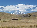 Countryside and Snow-Capped Mountain en route to La Paz - Bolivia (3776994800).jpg 2,272 × 1,704; 1.69 MB
-
 Countryside en route to Tarabuco (cropped).jpg 2,272 × 325; 341 KB
-
 Countryside en route to Tarabuco - Bolivia (3777135144).jpg 2,272 × 1,704; 1.65 MB
-
 Den så kallade Tapirlagunen vid Tatarenda. Gran Chaco. Bolivia - SMVK - 003619.tif 2,938 × 2,357; 39.65 MB
-
 Desierto de Dalí, Bolivia, 2016-02-02, DD 107.JPG 5,236 × 2,267; 8.46 MB
-
 Dragon Dormido.jpg 600 × 458; 50 KB
-
 Dunas de Arena y cerros.jpg 2,592 × 1,936; 1.61 MB
-
 Dunas de Arena.jpg 2,592 × 1,936; 1.92 MB
-
 Dunas de tajzara reserva de sama.jpg 4,096 × 3,072; 3.22 MB
-
 Dunas y nubes.jpg 2,592 × 1,936; 1.61 MB
-
 Efecto Seda.jpg 1,667 × 2,500; 2.25 MB
-
 Fauna y flora en Laguna Colorada.jpg 4,653 × 3,082; 9.63 MB
-
 Flodövergång med indianska bärare. Rio Cocos, Sydamerika. Bolivia - SMVK - 002363.tif 2,220 × 2,528; 32.14 MB
-
 Flora y fauna en la Laguna Colorada.jpg 4,928 × 3,264; 9.53 MB
-
 Formations- och vegetationsbild. La Paz-dalen, Sydamerika. Bolivia - SMVK - 002427.tif 2,255 × 3,257; 42.05 MB
-
 Formationsbild i La Pazdalen. La Paz-dalen, Sydamerika. Bolivia - SMVK - 002332.tif 2,305 × 3,331; 43.96 MB
-
 Formationsbild. Lokal, Ulloma, Bolivia. Ulloma - SMVK - 002694.tif 2,319 × 3,003; 39.87 MB
-
 Foto av bergsformationen vid stranden av sjön. Titicacasjön. Bolivia - SMVK - 002364.tif 2,736 × 2,222; 34.81 MB
-
 Foto av fyndplats för fossil. Lokal, Ulloma, Bolivia. Ulloma - SMVK - 002695.tif 2,836 × 2,310; 37.51 MB
-
 FotootjevanBolivia.JPG 613 × 457; 58 KB
-
 Géiseres Sol de Mañana, Bolivia, 2016-02-02, DD 56.JPG 8,211 × 5,474; 8.46 MB
-
 Hexágonos casi perfectos tapizan el suelo del Salar de Uyuni, Bolivia - panoramio.jpg 2,103 × 1,312; 300 KB
-
 Hot Spring at Salar de Chalvari - panoramio.jpg 2,048 × 1,536; 663 KB
-
 Inicio del Fin.jpg 4,000 × 2,000; 2.45 MB
-
 Intenso azul en sama.jpg 1,280 × 1,280; 189 KB
-
 Jallupacha.jpg 1,600 × 1,200; 363 KB
-
 Laguna colorada - panoramio (1).jpg 1,023 × 768; 257 KB
-
 Laguna Colorada MC.jpg 7,000 × 2,099; 6.61 MB
-
 Lama glama Laguna Colorada 1.jpg 5,942 × 3,940; 3.52 MB
-
 Landskaps- och bebyggelsebild. Lokal, Holguin, Bolivia. Holguin - SMVK - 005806.tif 2,416 × 3,168; 43.82 MB
-
 Landskapsbild. Lokal, Batanes vid Saipinafloden, Bolivia. Rio Saipina - SMVK - 005805.tif 3,196 × 2,413; 44.15 MB
-
 Landskapsbild. Lokal, Curicha, vid Rio Guaporé, Bolivia. Rio Guaporé - SMVK - 005893.tif 3,683 × 2,759; 58.17 MB
-

-
 Landskapsvy. Från vägen mellan S-a Rosa och Cochabamba - SMVK - 005568.tif 2,208 × 2,760; 17.46 MB
-
 Landskapsvy. Gran Chaco. Bolivia - SMVK - 003621.tif 3,000 × 2,328; 39.99 MB
-
 Laripata 2.jpg 1,600 × 1,200; 250 KB
-
 Laripata 3.jpg 1,200 × 1,600; 283 KB
-
 Laripata q.jpg 1,600 × 1,200; 325 KB
-
 Laripata.jpg 1,200 × 1,600; 264 KB
-
 Liriuni Cochabamba Bolivia.jpg 2,592 × 1,936; 1.58 MB
-
 Modos de vida en el altiplano.jpg 817 × 1,225; 85 KB
-
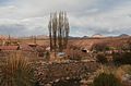
 Monumento Natural Turístico Cañón de Chuwaqueri.jpg 5,099 × 3,900; 4.86 MB
-
 Mountain in Comarapa Municipality.jpg 2,048 × 1,536; 1.16 MB
-
 Museo a cielo abierto de Toro Toro.jpg 4,128 × 3,096; 16.9 MB
-
 Myrtaceae- Eugenia punicifolia.jpg 3,264 × 2,448; 5.08 MB
-
 North of Santa Rosa del Yacuma, Bolivia.jpg 1,590 × 1,359; 1.29 MB
-
 On the way to Tiwanaku (Bolivia) (36765799772).jpg 3,264 × 2,448; 1.5 MB
-
 On the way to Tiwanaku (Bolivia) (36936745895).jpg 3,264 × 2,448; 1.58 MB
-
 Paisaje San Jose de Chiquitos.jpg 3,264 × 1,836; 1.66 MB
-
 Paisaje torotoro.jpg 4,608 × 3,456; 1.67 MB
-
 Palmdunge vid Tatarenda. Gran Chaco. Bolivia - SMVK - 003620.tif 2,320 × 2,967; 39.41 MB
-
 Pelarkaktus c, 8 m.hög. Tarija. Bolivia - SMVK - 003607.tif 2,323 × 3,050; 40.57 MB
-
 Pelechucodalen. Pelechuco. Bolivia - SMVK - 002410.tif 3,055 × 2,361; 41.3 MB
-
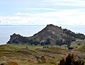
 Pueblo Titicaca.jpg 2,144 × 1,424; 2.6 MB
-
 Quichuaby. Moxos Province. Bolivia - SMVK - 002376.tif 3,272 × 2,363; 44.27 MB
-
 Ruta 8, Bolivia1.JPG 2,048 × 1,536; 1.27 MB
-
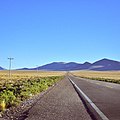
 Ruta25, Bolivia.jpg 2,540 × 1,264; 1.86 MB
-
 Río Tahuamanu aus der Luft.JPG 2,560 × 1,920; 1.44 MB
-
 Salix-Snår vid foldstranden vid San Luis. 2 foton. Tarija. Bolivia - SMVK - 003609.tif 2,296 × 2,953; 38.82 MB
-

-
 Surat'a.jpg 1,600 × 1,200; 314 KB
-

-
 Traslado de una colmena de abejas melíponas, de la trampa a su lugar definitivo.jpg 5,838 × 3,892; 17.12 MB
-
-
 Utsikt från en triangelpunkt. Franz Tamayo Province. Bolivia - SMVK - 002404.tif 2,237 × 3,149; 40.33 MB
-

-
 Valle de la Luna (Bolivia).jpg 3,769 × 2,707; 1.24 MB
-
 VALLE DE LA LUNA 1 Foto Rodny Montoya.jpg 3,808 × 2,549; 1.34 MB
-
 VALLE DE LA LUNA 2 Foto Rodny Montoya.jpg 3,872 × 2,592; 713 KB
-
 VALLE DE LA LUNA 3 Foto Rodny Montoya.jpg 3,727 × 2,495; 925 KB
-
 Valle de Samaipata, Santa Cruz, Bolivia.jpg 5,184 × 3,456; 8.07 MB
-
 Vegetations- och formationsbild. Moxos Province. Bolivia - SMVK - 002441.tif 3,231 × 2,304; 42.62 MB
-

-

-
 Vegetationsbild med pilgräs. Sydamerika, Rio Tuiche. Bolivia - SMVK - 002365.tif 2,817 × 1,789; 28.86 MB
-
 Vegetationsbild med pilgräs. Sydamerika, Rio Tuiche. Bolivia - SMVK - 002366.tif 2,799 × 2,209; 35.4 MB
-

-

-
 Vista de Irupana desde la comunidad Yuni Grande.jpg 5,773 × 3,849; 10.3 MB
-
 Vista panoramica de Tiraque.jpg 3,088 × 2,056; 2.28 MB
-
 Volcán de Ollagüe, Bolivia, 2016-02-03, DD 80-88 PAN.JPG 39,653 × 4,407; 27.79 MB
-
 Vy av Titicacasjön. Titicacasjön. Bolivia - SMVK - 002362.tif 2,720 × 2,216; 34.51 MB


.jpg)
.jpg)


.jpg)


_(36765799772).jpg)
_(36936745895).jpg)


.jpg)


.jpg)