Category:Landsat images of France
Jump to navigation
Jump to search
Media in category "Landsat images of France"
The following 37 files are in this category, out of 37 total.
-
 Alsace satellite.png 700 × 950; 3.82 MB
-
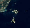 Archipel des Lavezzi.png 655 × 619; 463 KB
-
 Borabora Tahaa Raiatea.jpg 455 × 786; 57 KB
-
 Chamonix, France 1924 (12350245095).jpg 5,000 × 5,000; 5.52 MB
-
 Clipperton Island.png 631 × 634; 328 KB
-
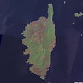 Corse sat.jpg 2,000 × 2,000; 466 KB
-
 Corsica (Landsat 7) - high definition.png 6,394 × 13,030; 90.92 MB
-
 Corsica (Landsat 7).png 2,689 × 4,359; 15.96 MB
-
 Dijon Landsat.png 901 × 901; 1.31 MB
-
 Eiao Landsat 2006.jpg 753 × 831; 274 KB
-
 Fatu Huku - image satellite Landsat7 - 2000.jpg 634 × 634; 108 KB
-
 Forecasting D-Day.jpeg 9,407 × 8,547; 29.86 MB
-
 France carcassonne landsat7.png 344 × 295; 291 KB
-
 France, Hautes-Pyrénées- lake Port-Bielh 2017 1.jpg 1,427 × 861; 679 KB
-
 France, Hautes-Pyrénées- lake Port-Bielh 2017 2.jpg 1,255 × 925; 646 KB
-
 IleDeRé=NASA.jpg 800 × 461; 91 KB
-
 Istres BA125 Landsat.png 301 × 301; 188 KB
-
 Lagoons and Reefs of New Caledonia May 10, 2001.jpg 4,000 × 3,000; 5.58 MB
-
 Landsat image of Northern Basque Country, France, March 2008.jpg 934 × 866; 306 KB
-
 Marotiri Landsat.jpg 508 × 348; 56 KB
-
 MohoTani Landsat7 2000.jpg 450 × 600; 51 KB
-
 Paris and vicinities, LandSat-5 false color satellite image, 2006-07-16.jpg 3,413 × 3,598; 4.7 MB
-
 Paris Le Bourget Landsat.png 129 × 97; 24 KB
-
 Paris Orly Landsat.png 341 × 125; 78 KB
-
 Paris suburbs Landsat.jpg 2,401 × 2,401; 1.29 MB
-
 Paris, France 48.867,2.310.jpg 1,000 × 1,000; 382 KB
-
 Paris.landsat.arp.750pix.jpg 750 × 536; 114 KB
-
 Roissy CDG Landsat.png 461 × 190; 159 KB
-
 Saint Barts.png 680 × 557; 400 KB
-
 Saintpaul Landsat.jpg 1,000 × 628; 91 KB
-
 Strasbourg Nasa.jpg 990 × 609; 200 KB
-
 Tahaa raiatea.jpg 375 × 536; 185 KB
-
 The Mountainous Spine of Corsica.jpeg 3,000 × 5,000; 11.04 MB
-
 Toulon 5.91420E 43.10085 Landsat7 pseudo.png 992 × 653; 866 KB
-
 Toulon 5.91420E 43.10085 Landsat7.png 992 × 653; 915 KB
-
 Tsar Bomba Paris.png 750 × 536; 993 KB
-
 Îles Gambier image satellite.jpg 540 × 540; 34 KB


.jpg)


_-_high_definition.png)
.png)


