Category:Landmuseum Ransel
Jump to navigation
Jump to search
Deutsch: Landmuseum Ransel. Eröffnung 1996. Ransel, Rheingau-Taunus-Kreis
| Object location | | View all coordinates using: OpenStreetMap |
|---|
| NO WIKIDATA ID FOUND! Search for Landmuseum Ransel on Wikidata | |
| Upload media |
Media in category "Landmuseum Ransel"
The following 4 files are in this category, out of 4 total.
-
 Clemens M Strugalla Landmuseum Ransel (1).JPG 3,456 × 5,184; 1.84 MB
-
 Clemens M Strugalla Landmuseum Ransel (2).JPG 3,097 × 4,903; 1.75 MB
-
 Clemens M Strugalla Landmuseum Ransel (3).JPG 4,571 × 3,061; 2.76 MB
-
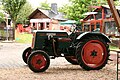 Landmuseum Ransel Lanz Traktor.JPG 3,888 × 2,592; 8.31 MB
.JPG)
.JPG)
.JPG)
