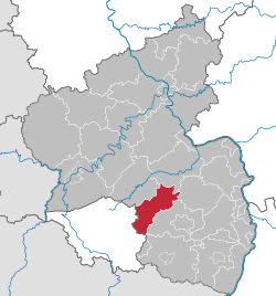
Category:Landkreis Kusel
Appearance
Urban districts (cities): Frankenthal · Kaiserslautern · Coblenz · Landau · Ludwigshafen · Mainz · Neustadt an der Weinstrasse · Pirmasens · Speyer · Trier · Worms · Zweibrücken
district of Rhineland-Palatinate, Germany | |||||
| Upload media | |||||
| Instance of |
| ||||
|---|---|---|---|---|---|
| Location | Rhineland-Palatinate, Germany | ||||
| Capital | |||||
| Head of government | |||||
| Population |
| ||||
| Area |
| ||||
| Elevation above sea level |
| ||||
| official website | |||||
 | |||||
Subcategories
This category has the following 25 subcategories, out of 25 total.
Media in category "Landkreis Kusel"
The following 14 files are in this category, out of 14 total.
-
Ausblick auf dem Weg von Jeckenbach nach Lauterecken 10.jpg 4,160 × 3,120; 4.61 MB
-
Ausblick auf dem Weg von Jeckenbach nach Lauterecken 11.jpg 3,120 × 4,160; 3.8 MB
-
Ausblick auf dem Weg von Jeckenbach nach Lauterecken 6.jpg 4,160 × 3,120; 3.1 MB
-
Ausblick auf dem Weg von Jeckenbach nach Lauterecken 7.jpg 4,160 × 3,120; 3.65 MB
-
Ausblick auf dem Weg von Jeckenbach nach Lauterecken 8.jpg 4,160 × 3,120; 3.33 MB
-
Ausblick auf dem Weg von Jeckenbach nach Lauterecken 9.jpg 4,160 × 3,120; 1.84 MB
-
Dhkilian002.jpg 400 × 240; 32 KB
-
KUS in Rheinland-Pfalz.svg 574 × 744; 133 KB
-
Kusel, KUS - Trierer Str - LRA v O.jpg 4,000 × 2,248; 3.8 MB
-
Lage des Landkreises Kusel in Deutschland.png 197 × 235; 3 KB
-
Locator map KUS in Germany.svg 1,075 × 1,273; 513 KB
-
Locator map KUS in Rhineland-Palatinate.svg 708 × 913; 627 KB
-
Rhineland p kus.png 419 × 503; 13 KB


