Category:Landhof am Kemnader See
Jump to navigation
Jump to search
| Object location | | View all coordinates using: OpenStreetMap |
|---|
Media in category "Landhof am Kemnader See"
The following 6 files are in this category, out of 6 total.
-
 Bochum - Auf dem Kalwes - Landhof am Kemnader See 01 ies.jpg 5,616 × 3,744; 8.6 MB
-
 Bochum - Auf dem Kalwes - Landhof am Kemnader See 02 ies.jpg 5,616 × 3,744; 6.94 MB
-
 Bochum - Auf dem Kalwes - Landhof am Kemnader See 03 ies.jpg 5,616 × 3,744; 5.55 MB
-
 Bochum - Auf dem Kalwes - Landhof am Kemnader See 04 ies.jpg 5,616 × 3,744; 6.34 MB
-
 Bochum - Auf dem Kalwes - Landhof am Kemnader See 05 ies.jpg 5,616 × 3,744; 8.44 MB
-
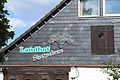
 Landhof mit Hofladen am Kemnader See.jpg 2,560 × 1,920; 2.28 MB


