Category:Landgoed Coelhorst
Jump to navigation
Jump to search
| Object location | | View all coordinates using: OpenStreetMap |
|---|
Nederlands: Landgoed Coelhorst ligt aan de rand van Amersfoort, ten westen van de bebouwde kom van Hoogland.
 | |||||
| Upload media | |||||
| Instance of | |||||
|---|---|---|---|---|---|
| Location | Amersfoort, Utrecht, Netherlands | ||||
| Heritage designation |
| ||||
 | |||||
Subcategories
This category has the following 3 subcategories, out of 3 total.
H
- Hoogerhorst (Hoogland) (37 F)
K
- Kapel van Coelhorst (23 F)
- Kasteel Coelhorst (Hoogland) (6 F)
Media in category "Landgoed Coelhorst"
The following 8 files are in this category, out of 8 total.
-
 Boomgaard.Coelhorst.jpg 1,600 × 1,200; 554 KB
-
 Coelhorst plattegrond.jpg 1,181 × 883; 287 KB
-
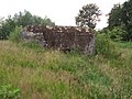 Grebbelinie Coelhorst E04.JPG 4,320 × 3,240; 2.22 MB
-
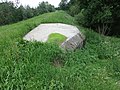 Grebbelinie Coelhorst E06.JPG 4,320 × 3,240; 2.87 MB
-
 Grebbelinie Coelhorst E13.JPG 4,320 × 3,240; 2.01 MB
-
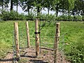 Jonge boom.jpg 1,600 × 1,200; 547 KB
-

-
 Rustgebied.jpg 1,600 × 1,200; 610 KB


