Category:Lampferding
Jump to navigation
Jump to search
human settlement in Germany  | |||||
| Upload media | |||||
| Instance of | |||||
|---|---|---|---|---|---|
| Location | Tuntenhausen, Rosenheim, Upper Bavaria, Bavaria, Germany | ||||
 | |||||
Subcategories
This category has the following 2 subcategories, out of 2 total.
F
- Feldkapelle (Lampferding) (4 F)
M
Media in category "Lampferding"
The following 2 files are in this category, out of 2 total.
-
 Lampferding 18.jpg 3,000 × 4,000; 5.08 MB
-
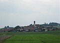 Lampferding Tuntenhausen-1.jpg 2,500 × 1,800; 420 KB
