Category:Lambertuskerk (Oirsbeek)
Jump to navigation
Jump to search
| Object location | | View all coordinates using: OpenStreetMap |
|---|
church in Oirsbeek, Netherlands .JPG) | |||||
| Upload media | |||||
| Instance of | |||||
|---|---|---|---|---|---|
| Dedicated to | |||||
| Location | Oirsbeek, Beekdaelen, Limburg, Netherlands | ||||
| Street address |
| ||||
| Located on street |
| ||||
| Diocese | |||||
| Architect | |||||
| Heritage designation |
| ||||
| Religion or worldview | |||||
 | |||||
Nederlands: Lambertus - anno 1514 (toren) - anno 1954 (schip)
|
This is a category about rijksmonument number 33349
|
| Address |
|
Media in category "Lambertuskerk (Oirsbeek)"
The following 19 files are in this category, out of 19 total.
-
 Detail hoofdaltaar - Oirsbeek - 20171424 - RCE.jpg 943 × 1,200; 199 KB
-
 Exterieur WESTGEVEL TOREN - Oirsbeek - 20303729 - RCE.jpg 788 × 1,200; 251 KB
-
 Exterieur ZUID, WESTGEVEL TOREN - Oirsbeek - 20303730 - RCE.jpg 788 × 1,200; 321 KB
-
 Exterieur ZUIDGEVEL TOREN - Oirsbeek - 20303731 - RCE.jpg 788 × 1,200; 235 KB
-
 Grafkruis op kerkhof - Oirsbeek - 20171421 - RCE.jpg 960 × 1,200; 404 KB
-
 Habet.JPG 768 × 1,024; 420 KB
-
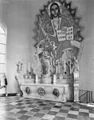 Hoofdaltaar - Oirsbeek - 20171420 - RCE.jpg 937 × 1,200; 223 KB
-
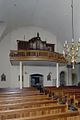 Interieur, aanzicht orgel - Oirsbeek - 20349240 - RCE.jpg 800 × 1,200; 134 KB
-
 Kerk Oirsbeek.jpg 640 × 480; 57 KB
-
 Kerktoren gezien naar het oosten - Oirsbeek - 20404168 - RCE.jpg 952 × 1,200; 287 KB
-
 Lambertuskerk oirsbeek.jpg 1,944 × 2,592; 2.02 MB
-
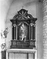
 Madonnabeeld op zijaltaar - Oirsbeek - 20171423 - RCE.jpg 950 × 1,200; 235 KB
-
 Offerblok - Oirsbeek - 20171425 - RCE.jpg 952 × 1,200; 213 KB
-
 Offerblok - Oirsbeek - 20171426 - RCE.jpg 963 × 1,200; 199 KB
-
 Oirsbeek, kerk foto1 2011-03-16 15.21.JPG 4,416 × 3,312; 7.33 MB
-
 Oirsbeek-Kerk (1).JPG 2,560 × 1,920; 1.03 MB
-
 Oirsbeek-Kerk (2).JPG 1,920 × 2,560; 1.04 MB
-
 Oirsbeekkerkwkped06.JPG 1,024 × 768; 104 KB
-
 Zijaltaar - Oirsbeek - 20171422 - RCE.jpg 961 × 1,200; 238 KB


.JPG)

