Category:Lakenheath
Jump to navigation
Jump to search
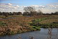
English: Lakenheath is a village in Suffolk, England. It has around 8,200 residents, and is situated in the Forest Heath district of Suffolk, close to the county boundaries of both Norfolk and Cambridgeshire, and at the meeting point of the The Fens and the Breckland natural environments.
village in Suffolk, England, UK  | |||||
| Upload media | |||||
| Instance of | |||||
|---|---|---|---|---|---|
| Location | Lakenheath, West Suffolk, Suffolk, East of England, England | ||||
 | |||||
Subcategories
This category has the following 3 subcategories, out of 3 total.
L
- Lakenheath railway station (16 F)
R
Media in category "Lakenheath"
The following 200 files are in this category, out of 471 total.
(previous page) (next page)-
 150911-D-NI589-1206 (21140443059).jpg 4,628 × 2,964; 2.55 MB
-
 31 metres above sea level - geograph.org.uk - 4752393.jpg 1,024 × 768; 330 KB
-
 A gate on the Hereward Way - geograph.org.uk - 1998616.jpg 640 × 480; 134 KB
-
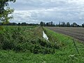
 A thundery sky over Lakenheath Fen - geograph.org.uk - 1998553.jpg 640 × 487; 148 KB
-
 A young crop - geograph.org.uk - 5566608.jpg 640 × 426; 54 KB
-
 A1065 - geograph.org.uk - 3826979.jpg 640 × 430; 40 KB
-
 A1065 Brandon Road heading south - geograph.org.uk - 6410084.jpg 1,024 × 684; 211 KB
-
 A1065 Brandon Road, RAF Lakenheath - geograph.org.uk - 6410103.jpg 1,024 × 684; 206 KB
-
 A1065 past Lakenheath Airfield - geograph.org.uk - 3036611.jpg 1,600 × 1,200; 751 KB
-
 A1065, northbound - geograph.org.uk - 3826983.jpg 640 × 430; 67 KB
-
 Albion Farm - geograph.org.uk - 4746712.jpg 1,024 × 768; 186 KB
-
 Albion Farm - geograph.org.uk - 5563499.jpg 640 × 426; 36 KB
-
 Albion Farm - geograph.org.uk - 5563500.jpg 640 × 426; 37 KB
-
 Alder Fen - geograph.org.uk - 5563501.jpg 640 × 426; 53 KB
-
 Alder Fen - geograph.org.uk - 5563502.jpg 640 × 426; 47 KB
-
 Alder Fen - geograph.org.uk - 5577514.jpg 640 × 426; 49 KB
-
 Ant's Eye View - geograph.org.uk - 4746726.jpg 1,024 × 768; 193 KB
-

-
 Avenue Road, Lakenheath - geograph.org.uk - 5111563.jpg 1,600 × 1,200; 538 KB
-
 Awaiting Development - geograph.org.uk - 4752356.jpg 1,024 × 768; 204 KB
-
 B1112 Eriswell Road - geograph.org.uk - 6536022.jpg 1,024 × 684; 346 KB
-
 B1112 Eriswell Road, Lakenheath - geograph.org.uk - 6536028.jpg 1,024 × 684; 331 KB
-
 B1112 High Street, Lakenheath - geograph.org.uk - 6536042.jpg 1,024 × 684; 396 KB
-
 B1112 Station Road - geograph.org.uk - 6536051.jpg 1,024 × 684; 450 KB
-
 B1112 Station Road - geograph.org.uk - 6536053.jpg 1,024 × 684; 315 KB
-
 B1112 Station Road, Brandon - geograph.org.uk - 6489241.jpg 4,608 × 3,456; 4.21 MB
-
 B1112 Station Road, Lakenheath - geograph.org.uk - 6536048.jpg 1,024 × 684; 424 KB
-
 B1112 through Lakenheath - geograph.org.uk - 5301841.jpg 1,600 × 1,200; 679 KB
-
 B1112, Lakenheath - geograph.org.uk - 5516742.jpg 640 × 480; 59 KB
-
 Below sea level - geograph.org.uk - 5563488.jpg 640 × 426; 50 KB
-
 Bend in Station Road (B1112) - geograph.org.uk - 5516750.jpg 640 × 480; 67 KB
-
 Birdwatching at Lakenheath - geograph.org.uk - 5447481.jpg 640 × 462; 103 KB
-
 Black soils - geograph.org.uk - 5563520.jpg 640 × 426; 70 KB
-
 Black soils - geograph.org.uk - 5563521.jpg 640 × 425; 60 KB
-
 Black soils - geograph.org.uk - 5586739.jpg 640 × 426; 48 KB
-
 Botany Bay - geograph.org.uk - 494410.jpg 640 × 480; 86 KB
-
 Botany Bay - geograph.org.uk - 617728.jpg 640 × 427; 84 KB
-
 Botany Bay by Little Ouse River - geograph.org.uk - 2936566.jpg 1,600 × 1,200; 724 KB
-
 Brandon Fen - geograph.org.uk - 5563518.jpg 640 × 426; 62 KB
-
 Brandon Fen - geograph.org.uk - 5566433.jpg 640 × 426; 67 KB
-
 Brandon Fen - geograph.org.uk - 5566609.jpg 640 × 426; 51 KB
-
 Brandon Road by Lakenheath Warren - geograph.org.uk - 6574329.jpg 1,920 × 1,280; 1.22 MB
-
 Bridge - geograph.org.uk - 5335038.jpg 1,024 × 768; 190 KB
-
 Bridges - geograph.org.uk - 4746662.jpg 1,024 × 768; 261 KB
-
 Bridleway along Shakers' Road - geograph.org.uk - 2706027.jpg 1,600 × 1,200; 732 KB
-
 Bridleway to A1065 - geograph.org.uk - 2705962.jpg 1,600 × 1,200; 1,021 KB
-
 Broken Bridge - geograph.org.uk - 4752403.jpg 1,024 × 768; 259 KB
-

-
 Bungalows about to go - geograph.org.uk - 5301839.jpg 1,600 × 1,200; 753 KB
-
 Bungalows, Lakenheath - geograph.org.uk - 5301846.jpg 1,600 × 1,200; 631 KB
-
 Burnt Fen - geograph.org.uk - 5563485.jpg 640 × 426; 43 KB
-
 Burnt Fen - geograph.org.uk - 5563487.jpg 640 × 426; 53 KB
-
 Burnt Out Car - geograph.org.uk - 4746655.jpg 1,024 × 768; 339 KB
-
 Cattle grazing near Lakenheath - geograph.org.uk - 3500062.jpg 4,320 × 3,240; 3.47 MB
-
 CJ's Sandwich Bar - geograph.org.uk - 5301860.jpg 1,600 × 1,200; 479 KB
-
 Crop field near Chestnuts - geograph.org.uk - 5516708.jpg 640 × 480; 93 KB
-
 Crop field near Flack's Farm - geograph.org.uk - 4622089.jpg 640 × 409; 57 KB
-

-
 Crop field, Sedge Fen - geograph.org.uk - 5516700.jpg 640 × 480; 90 KB
-
 Crop harvesting, Decoy Fen - geograph.org.uk - 4618724.jpg 640 × 390; 53 KB
-
 Cross Bank - geograph.org.uk - 4746674.jpg 768 × 1,024; 341 KB
-
 Cut off Channel - geograph.org.uk - 5566610.jpg 640 × 347; 51 KB
-
 Cut Off Channel near White Fen - geograph.org.uk - 3500067.jpg 4,320 × 3,240; 2.89 MB
-
 Cut-off Channel - geograph.org.uk - 3169986.jpg 1,600 × 1,200; 584 KB
-
 Cut-off Channel - geograph.org.uk - 3761335.jpg 1,600 × 1,200; 775 KB
-
 Cut-Off Channel - geograph.org.uk - 463767.jpg 640 × 427; 62 KB
-
 Cut-off Channel - geograph.org.uk - 5516754.jpg 640 × 480; 69 KB
-
 Cut-off channel - geograph.org.uk - 5577403.jpg 640 × 376; 43 KB
-
 Cut-off Channel near Hockwold - geograph.org.uk - 467942.jpg 640 × 427; 80 KB
-
 Cut-off Channel near Hockwold - geograph.org.uk - 467945.jpg 640 × 427; 115 KB
-
 Cut-off Channel near Lakenheath - geograph.org.uk - 467900.jpg 640 × 427; 75 KB
-
 Cut-off Channel near Lakenheath - geograph.org.uk - 467902.jpg 427 × 640; 65 KB
-
 Cut-Off Channel near Lakenheath - geograph.org.uk - 5058739.jpg 1,600 × 1,200; 796 KB
-
 Cut-off Channel near Lakenheath - geograph.org.uk - 5111553.jpg 1,600 × 1,200; 759 KB
-
 Cut-off Channel near Lakenheath - geograph.org.uk - 5111554.jpg 1,600 × 1,200; 653 KB
-
 Cut-Off Channel near Lakenheath - geograph.org.uk - 5516739.jpg 640 × 480; 57 KB
-
 Cut-off Channel, near Lakenheath - geograph.org.uk - 1438666.jpg 427 × 640; 105 KB
-
 Cut-off Channel, near Lakenheath - geograph.org.uk - 216100.jpg 640 × 427; 83 KB
-
 Dark soils - geograph.org.uk - 5563510.jpg 640 × 425; 49 KB
-
 Dead Cars - geograph.org.uk - 5290031.jpg 1,024 × 768; 269 KB
-
 Dead End Road - geograph.org.uk - 4752380.jpg 1,024 × 768; 311 KB
-
 Decoy Fen - geograph.org.uk - 4618721.jpg 640 × 409; 49 KB
-
 Decoy Fen - geograph.org.uk - 5577531.jpg 640 × 426; 51 KB
-
 Decoy Road - geograph.org.uk - 5577534.jpg 640 × 426; 47 KB
-
 Decoy Road crossing - geograph.org.uk - 5563491.jpg 640 × 425; 60 KB
-
 Drain near Russell Farm - geograph.org.uk - 5516712.jpg 640 × 480; 96 KB
-
 Drainage Ditch - geograph.org.uk - 4746718.jpg 768 × 1,024; 252 KB
-
 Drainage ditch - geograph.org.uk - 5563484.jpg 554 × 640; 59 KB
-
 Drainage ditch - geograph.org.uk - 5563517.jpg 640 × 426; 86 KB
-
 Dry ditch - geograph.org.uk - 5577545.jpg 640 × 426; 42 KB
-
 Dumpling Bridge Lane - geograph.org.uk - 4746802.jpg 1,024 × 768; 276 KB
-
 East of Lakenheath Station - geograph.org.uk - 5577411.jpg 640 × 426; 50 KB
-

-
 End of the bridleway - geograph.org.uk - 3036577.jpg 1,600 × 1,200; 839 KB
-
 Engineering company at Lakenheath - geograph.org.uk - 4493854.jpg 1,024 × 768; 290 KB
-
 Entering Sedge Fen on Farthing Drove - geograph.org.uk - 6319409.jpg 4,608 × 3,456; 4.02 MB
-
 Eriswell Road from Eriswell Drive - geograph.org.uk - 4493839.jpg 1,024 × 768; 251 KB
-
 Eriswell Road near Smeeth Drove - geograph.org.uk - 4493844.jpg 1,024 × 768; 256 KB
-
 Ex-military buildings next to Wangford Road - geograph.org.uk - 4493868.jpg 1,024 × 768; 245 KB
-
 Factory, Lakenheath - geograph.org.uk - 5577420.jpg 640 × 426; 50 KB
-
 Factory, Lakenheath - geograph.org.uk - 5577427.jpg 640 × 345; 51 KB
-
 Farm buildings, Hiss Farm - geograph.org.uk - 5519144.jpg 640 × 379; 42 KB
-
 Farm buildings, Russell Farm - geograph.org.uk - 5516718.jpg 640 × 480; 55 KB
-

-
 Farm Track And Footpath - geograph.org.uk - 4746743.jpg 1,024 × 768; 276 KB
-

-
 Farming - geograph.org.uk - 4746701.jpg 1,024 × 768; 195 KB
-
 Farmland at Undley Common - geograph.org.uk - 924954.jpg 640 × 427; 108 KB
-
 Farmland near Russell Farm - geograph.org.uk - 5516713.jpg 640 × 480; 77 KB
-
 Farmland off Farthing Drove - geograph.org.uk - 6320440.jpg 4,608 × 3,456; 4.03 MB
-
 Farmland south of Newmans Drove - geograph.org.uk - 2318283.jpg 1,280 × 858; 186 KB
-
 Farthing Drove - geograph.org.uk - 5335123.jpg 1,024 × 768; 118 KB
-
 Farthing Drove - geograph.org.uk - 5516697.jpg 640 × 480; 71 KB
-
 Farthing Drove, Sedge Fen - geograph.org.uk - 6319412.jpg 4,608 × 3,456; 3.99 MB
-
 Farthing Drove, Sedge Fen - geograph.org.uk - 6320405.jpg 4,608 × 3,456; 4.24 MB
-
 Farthing Drove, Sedge Fen - geograph.org.uk - 6320407.jpg 4,608 × 3,456; 3.95 MB
-
 Fen and woodland near Flack's Farm - geograph.org.uk - 4620296.jpg 640 × 390; 60 KB
-

-
 Fen House Postbox - geograph.org.uk - 6319773.jpg 3,456 × 4,608; 4.01 MB
-
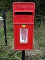 Fen House Postbox - geograph.org.uk - 6319774.jpg 3,456 × 4,608; 3.98 MB
-
 Fence around Lakenheath Warren - geograph.org.uk - 2705970.jpg 1,600 × 1,200; 967 KB
-
 Fencing - geograph.org.uk - 4752495.jpg 1,024 × 768; 357 KB
-
 Fenland road near Orchard View - geograph.org.uk - 5516706.jpg 640 × 480; 64 KB
-
 Fenland road near Russell Farm - geograph.org.uk - 5516716.jpg 640 × 480; 73 KB
-

-
 Field ditch - geograph.org.uk - 5577550.jpg 640 × 426; 50 KB
-
 Field drain - geograph.org.uk - 5563507.jpg 640 × 426; 69 KB
-
 Field drain - geograph.org.uk - 5563509.jpg 640 × 426; 55 KB
-
 Field drain, Sedge Fen - geograph.org.uk - 5563494.jpg 640 × 426; 58 KB
-
 First Drove - geograph.org.uk - 5563515.jpg 640 × 426; 59 KB
-
 Flack's Farm - geograph.org.uk - 5563498.jpg 640 × 426; 46 KB
-
 Flat field - geograph.org.uk - 5577541.jpg 640 × 426; 45 KB
-
 Flat grass field near High Fen Farm - geograph.org.uk - 5519135.jpg 640 × 480; 61 KB
-
 Flat grassland - geograph.org.uk - 5577518.jpg 640 × 426; 41 KB
-
 Flat turf - geograph.org.uk - 5566438.jpg 640 × 426; 33 KB
-
 Flat turf - geograph.org.uk - 5566442.jpg 640 × 426; 36 KB
-
 Flush Bracket OSBM 11145 Maids Cross Hill - geograph.org.uk - 5695597.jpg 2,382 × 2,764; 4.3 MB
-
 Footpath - geograph.org.uk - 4746652.jpg 768 × 1,024; 278 KB
-
 Footpath - geograph.org.uk - 4746656.jpg 768 × 1,024; 275 KB
-
 Footpath - geograph.org.uk - 4746695.jpg 1,024 × 768; 261 KB
-
 Footpath - geograph.org.uk - 4752363.jpg 1,024 × 768; 241 KB
-
 Footpath - geograph.org.uk - 4752492.jpg 1,024 × 768; 186 KB
-
 Footpath along river bank - geograph.org.uk - 5406880.jpg 1,600 × 1,200; 528 KB
-
 Footpath And Marker - geograph.org.uk - 4746667.jpg 768 × 1,024; 280 KB
-
 Footpath Crossing - geograph.org.uk - 4746724.jpg 1,024 × 768; 243 KB
-
 Footpath from Station Road - geograph.org.uk - 5301759.jpg 1,600 × 1,200; 638 KB
-
 Footpath Looking South West - geograph.org.uk - 4746659.jpg 1,024 × 768; 283 KB
-
 Footpath On Cross Bank - geograph.org.uk - 4746679.jpg 768 × 1,024; 400 KB
-
 Footpath on Undley Common - geograph.org.uk - 3761294.jpg 1,600 × 1,200; 871 KB
-
 Footpath Sign - geograph.org.uk - 4746690.jpg 1,024 × 768; 208 KB
-
 Footpath Sign - geograph.org.uk - 4746714.jpg 1,024 × 768; 317 KB
-
 Footpath Sign On The Hereward Way - geograph.org.uk - 4746738.jpg 1,024 × 768; 272 KB
-
 Footpath Steps - geograph.org.uk - 4746686.jpg 768 × 1,024; 421 KB
-
 Footpath to Lakenheath - geograph.org.uk - 216101.jpg 640 × 427; 82 KB
-
 Footpath To Lakenheath - geograph.org.uk - 4746787.jpg 1,024 × 768; 195 KB
-
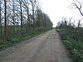
 Forest Track - geograph.org.uk - 341438.jpg 480 × 640; 143 KB
-
 Forestry off the B1112 Station Road - geograph.org.uk - 6489992.jpg 4,608 × 3,456; 4.07 MB
-
 Former clay pit at Undley - geograph.org.uk - 924942.jpg 640 × 427; 127 KB
-
 Gate And Footbridge - geograph.org.uk - 4746654.jpg 768 × 1,024; 237 KB
-
 Gate on the Hereward Way - geograph.org.uk - 1998549.jpg 640 × 480; 141 KB
-
 Grassy area of Lakenheath cemetery - geograph.org.uk - 5274954.jpg 651 × 480; 197 KB
-
 Green Drainage Ditch - geograph.org.uk - 4746698.jpg 1,024 × 768; 342 KB
-
 Green Fields And Blue Sky - geograph.org.uk - 5220587.jpg 1,024 × 768; 224 KB
-
 Green Footpath - geograph.org.uk - 4746732.jpg 1,024 × 768; 306 KB
-
 Green Track And Footpath - geograph.org.uk - 4752408.jpg 1,024 × 768; 270 KB
-
 Greylag Geese. - Flickr - gailhampshire.jpg 1,824 × 1,356; 705 KB
-
 Grime Fen - geograph.org.uk - 5335090.jpg 1,024 × 768; 247 KB
-
 Hallfields, Lakenheath - geograph.org.uk - 5301849.jpg 1,600 × 1,200; 636 KB
-
 Headstone of Walter Harding in Lakenheath cemetery - geograph.org.uk - 5274651.jpg 3,363 × 2,472; 3.03 MB
-
 Hedge and ditch - geograph.org.uk - 5566435.jpg 640 × 426; 80 KB
-
 Hedgerow beside farm track - geograph.org.uk - 1517203.jpg 640 × 480; 96 KB
-
 High Street, Lakenheath - geograph.org.uk - 6536033.jpg 1,024 × 684; 322 KB
-
 Highbridge Gravel Drove - geograph.org.uk - 5058740.jpg 1,600 × 1,200; 692 KB
-

-
 Hiss Farm - geograph.org.uk - 5566606.jpg 640 × 341; 41 KB
-
 Hiss Farm - geograph.org.uk - 5566607.jpg 640 × 426; 47 KB
-

-
 House on Station Road, Lakenheath - geograph.org.uk - 5516743.jpg 640 × 480; 69 KB
-

-
 In Lakenheath RSPB Reserve - geograph.org.uk - 5447487.jpg 640 × 455; 119 KB
-
 Joist Fen - geograph.org.uk - 3761276.jpg 1,600 × 1,200; 930 KB
-
 Joist Fen - geograph.org.uk - 4620291.jpg 640 × 427; 50 KB
-
 Joist Fen - geograph.org.uk - 4622081.jpg 640 × 429; 59 KB
-
 Joist Fen - geograph.org.uk - 5563508.jpg 640 × 425; 52 KB
-
 Joist Fen - geograph.org.uk - 801711.jpg 640 × 456; 72 KB
-
 Kingfisher (27715118534).jpg 1,933 × 2,320; 2.71 MB
-
 Kingfisher (27715136184).jpg 1,817 × 2,069; 2.14 MB
-
 Kingfisher (27715610703).jpg 1,490 × 1,818; 1.61 MB
-
 Kingfisher (27715617013).jpg 1,510 × 1,983; 2.14 MB
-
 Kingfisher (27715646453).jpg 2,260 × 2,050; 3.2 MB
-
 Kingfisher (27715651263).jpg 1,067 × 1,126; 1.01 MB
-
 Kingfisher (28227672362).jpg 1,490 × 1,838; 2.01 MB
-
 Kingfisher (28227690462).jpg 2,106 × 1,973; 2.63 MB
-
 Kingfisher (28227705992).jpg 1,471 × 1,973; 1.87 MB
-
 Kingfisher (28227720992).jpg 3,664 × 2,801; 3.74 MB
-
 Kingfisher (28227724692).jpg 1,914 × 1,954; 3.01 MB
-
 Kingfisher (28227727672).jpg 2,144 × 2,204; 3.27 MB
-
 Kingfisher (28227732172).jpg 1,510 × 1,742; 2.01 MB
-
 Kingfisher (28253130211).jpg 1,241 × 1,338; 1.16 MB
-
 Kingfisher (28253146091).jpg 1,106 × 1,492; 1.22 MB
.jpg)


_-_geograph.org.uk_-_5516750.jpg)


_and_trees_off_Station_Road_-_geograph.org.uk_-_5516747.jpg)


.jpg)
.jpg)
.jpg)
.jpg)
.jpg)
.jpg)
.jpg)
.jpg)
.jpg)
.jpg)
.jpg)
.jpg)
.jpg)
.jpg)
.jpg)