Category:Lake O' the Pines
Jump to navigation
Jump to search
reservoir in Texas, United States  | |||||
| Upload media | |||||
| Instance of | |||||
|---|---|---|---|---|---|
| Location |
| ||||
| Inception |
| ||||
| Area |
| ||||
| Elevation above sea level |
| ||||
| Basin country | |||||
 | |||||
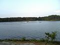
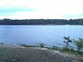
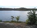
English: Media related to Lake O' the Pines, a reservoir on Big Cypress Bayou in eastern Texas, United States.
Media in category "Lake O' the Pines"
The following 13 files are in this category, out of 13 total.
-
 Johnson's Creek Day Area - panoramio (1).jpg 1,280 × 960; 460 KB
-
 Johnson's Creek Day Area - panoramio (2).jpg 1,280 × 960; 407 KB
-
 Johnson's Creek Day Area - panoramio (3).jpg 1,280 × 960; 419 KB
-
 Johnson's Creek Day Area - panoramio (4).jpg 1,280 × 960; 467 KB
-
 Johnson's Creek Day Area - panoramio (5).jpg 1,280 × 960; 489 KB
-
 Johnson's Creek Day Area - panoramio (6).jpg 1,280 × 960; 364 KB
-
 Johnson's Creek Day Area - panoramio (7).jpg 1,280 × 960; 401 KB
-
 Johnson's Creek Day Area - panoramio (8).jpg 960 × 1,280; 350 KB
-
 Johnson's Creek Day Area - panoramio (9).jpg 1,280 × 960; 406 KB
-
 Johnson's Creek Day Area - panoramio.jpg 1,280 × 960; 712 KB
-
 Lake O the Pines Texas.jpg 1,500 × 1,000; 268 KB
-
 Sunset on Lake O'the Pines - panoramio.jpg 1,936 × 2,592; 1.48 MB
-
 USACE Ferrells Bridge Dam spillway.jpg 1,500 × 1,000; 275 KB
.jpg)
.jpg)
.jpg)
.jpg)
.jpg)
.jpg)
.jpg)
.jpg)
.jpg)


Categories:
- Reservoirs in Texas
- Geography of Marion County, Texas
- Geography of Camp County, Texas
- Geography of Upshur County, Texas
- Geography of Morris County, Texas
- Big Cypress Bayou
- Big Cypress Creek
- Reservoirs in the United States by name
- Locations along U.S. Route 259 in Texas
- Locations along Texas State Highway 155
- Locations along Farm to Market Road 726
- Locations along Farm to Market Road 729