Category:Laithe houses
Jump to navigation
Jump to search
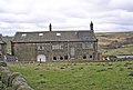
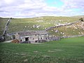
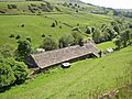
English: Laithe is Yorkshire dialect for barn, a laithe house is a type of longhouse, literally a barn house
Media in category "Laithe houses"
The following 22 files are in this category, out of 22 total.
-
 Agill House - geograph.org.uk - 1391807.jpg 640 × 480; 108 KB
-
 Broadstone, Colden.jpg 1,597 × 1,083; 352 KB
-
 Calton - geograph.org.uk - 802258.jpg 640 × 436; 128 KB
-
 Corn Close, Laneshawbridge - geograph.org.uk - 93491.jpg 640 × 480; 78 KB
-
 East Whirlaw Farm - geograph.org.uk - 488500.jpg 640 × 426; 72 KB
-
 Former barn, Gawthorpe Green Lane, Lepton - geograph.org.uk - 558882.jpg 640 × 476; 152 KB
-
 Height Laithe - geograph.org.uk - 405655.jpg 640 × 480; 125 KB
-
 Height Laithe - geograph.org.uk - 471725.jpg 640 × 480; 140 KB
-
 Hill Top Farm - geograph.org.uk - 40032.jpg 640 × 427; 91 KB
-
 Hollin Park near Denholme - geograph.org.uk - 372450.jpg 623 × 640; 114 KB
-
-
 Howden Park Farm - geograph.org.uk - 1499115.jpg 640 × 480; 87 KB
-
 Intake Farm - geograph.org.uk - 260306.jpg 640 × 359; 103 KB
-
 Lower Moss Hall, Blackshaw Head - geograph.org.uk - 102092.jpg 640 × 460; 124 KB
-
 Netherton - geograph.org.uk - 70761.jpg 640 × 480; 170 KB
-
 New Edge Farm - geograph.org.uk - 2793635.jpg 3,072 × 2,304; 1.2 MB
-
 New Edge Farm.jpg 5,002 × 2,978; 1.73 MB
-
 New High Laithe.jpg 5,012 × 2,838; 2.37 MB
-
 Park House - geograph.org.uk - 373467.jpg 640 × 453; 148 KB
-
 Sykes Gate Bottom - geograph.org.uk - 366547.jpg 640 × 480; 121 KB
-
 Turley Cote Farm - geograph.org.uk - 52836.jpg 640 × 480; 131 KB
-
 Calm Slate - geograph.org.uk - 629136.jpg 640 × 480; 67 KB


