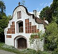
Category:Lain (Taufkirchen)
Jump to navigation
Jump to search
| Upload media | |||||
| Instance of |
| ||||
|---|---|---|---|---|---|
| Location | Taufkirchen (Vils), Erding, Upper Bavaria, Bavaria, Germany | ||||
| Population |
| ||||
 | |||||
Subcategories
This category has only the following subcategory.
E
Media in category "Lain (Taufkirchen)"
The following 13 files are in this category, out of 13 total.
-
Kapelle Lain (Taufkirchen) 1.jpg 7,943 × 10,183; 21.17 MB
-
Kapelle Lain (Taufkirchen) 2.jpg 9,637 × 12,495; 23.69 MB
-
Kapelle Lain (Taufkirchen) 3.jpg 12,778 × 12,240; 13.68 MB
-
Lain 1 (1.1).jpg 16,320 × 7,049; 24.69 MB
-
Lain 1 (1.2).jpg 16,320 × 8,167; 21.93 MB
-
Lain 1 (2).jpg 12,240 × 8,311; 15.04 MB
-
Lain 1 (3).jpg 11,040 × 7,486; 13.36 MB
-
Lain 1 (6).jpg 12,240 × 9,399; 20.58 MB
-
Lain 1 - Taufkirchen (Vils).jpg 4,160 × 3,120; 6.58 MB
-
Lain 1 Backhaus 1.jpg 12,240 × 11,197; 28.84 MB
-
Lain 1 Backhaus 2.jpg 13,560 × 9,073; 25.75 MB
-
Lain 1 Backhaus 3.jpg 12,155 × 12,261; 28.06 MB
-
Lain 1 Backhaus 4.jpg 15,486 × 7,896; 22.26 MB


