Category:Lach Dennis and Lostock Green
Jump to navigation
Jump to search
English: Lach Dennis and Lostock Green is a civil parish in the Cheshire West and Chester district, in the ceremonial county of Cheshire, England.
civil parish in Cheshire West and Chester, Cheshire, England  | |||||
| Upload media | |||||
| Instance of | |||||
|---|---|---|---|---|---|
| Location | Cheshire West and Chester, Cheshire, North West England, England | ||||
| Population |
| ||||
| official website | |||||
| |||||
Media in category "Lach Dennis and Lostock Green"
The following 73 files are in this category, out of 73 total.
-
 32 metre spot height, on Common Lane - geograph.org.uk - 2945184.jpg 1,024 × 768; 135 KB
-
 A530-Davenham Road junction - geograph.org.uk - 3097975.jpg 640 × 480; 58 KB
-
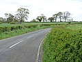
 A556 at former Lostock Green crossroads - geograph.org.uk - 2723733.jpg 640 × 480; 156 KB
-
 A556 at Wade Brook bridge - geograph.org.uk - 4441037.jpg 640 × 404; 36 KB
-
 A556 crossing the railway - geograph.org.uk - 4441042.jpg 640 × 270; 30 KB
-
 A556 east of Broken Cross - geograph.org.uk - 2723729.jpg 640 × 480; 158 KB
-
 A556 looking west - geograph.org.uk - 3097946.jpg 640 × 479; 49 KB
-
 A556 near Lostock Graham - geograph.org.uk - 3097956.jpg 640 × 481; 48 KB
-
 A556-Birches Lane junction - geograph.org.uk - 3097960.jpg 640 × 480; 55 KB
-
 Bend East - geograph.org.uk - 2175213.jpg 3,402 × 2,400; 6.44 MB
-
 Brine pump, south of Crowder's Lane - geograph.org.uk - 4316818.jpg 1,024 × 768; 137 KB
-
 Brown Bin - geograph.org.uk - 2175228.jpg 4,000 × 3,000; 5.19 MB
-

-
 Brunner Mond Works - geograph.org.uk - 2424491.jpg 640 × 480; 69 KB
-
-

-
 Cape of Good Hope Farm - geograph.org.uk - 2945194.jpg 1,024 × 768; 168 KB
-
 Cattle Gridded - geograph.org.uk - 2175218.jpg 4,000 × 3,000; 5.65 MB
-
 CCTV Surveillance - geograph.org.uk - 2175214.jpg 4,000 × 3,000; 6 MB
-
 Cereal crop north of the B5082 - geograph.org.uk - 2945301.jpg 1,024 × 768; 149 KB
-
 Cereal crop on the north bank of Crow Brook - geograph.org.uk - 2945188.jpg 1,024 × 768; 144 KB
-
 Cereal crop south of the B5082 - geograph.org.uk - 2945323.jpg 1,024 × 768; 153 KB
-
 Common Lane - geograph.org.uk - 2945214.jpg 1,024 × 768; 130 KB
-
 Common Lane - geograph.org.uk - 2945220.jpg 1,024 × 768; 183 KB
-
 Common Road - geograph.org.uk - 2175220.jpg 4,000 × 3,000; 5.85 MB
-
 Country road at Lach Dennis - geograph.org.uk - 2624609.jpg 640 × 480; 86 KB
-
 Crow Brook - geograph.org.uk - 2945168.jpg 768 × 1,024; 504 KB
-
 Crowder's Lane - geograph.org.uk - 2624590.jpg 640 × 480; 78 KB
-
 Crowder's Lane - geograph.org.uk - 4316806.jpg 1,024 × 768; 114 KB
-
 Edge of large cereal field - geograph.org.uk - 2945313.jpg 1,024 × 768; 134 KB
-
 Embankment of waste lime beds - geograph.org.uk - 2697020.jpg 3,072 × 2,304; 3.97 MB
-
 Entrance to INEOS Enterprise's Hulme Hall estate - geograph.org.uk - 2945231.jpg 1,024 × 768; 132 KB
-
 Farmland east of Common Lane - geograph.org.uk - 2945252.jpg 1,024 × 768; 133 KB
-
 Farmland east of Common Lane - geograph.org.uk - 2945259.jpg 1,024 × 768; 159 KB
-
 Farmland north of Crowder's Lane (1) - geograph.org.uk - 4316821.jpg 1,024 × 768; 132 KB
-
 Farmland north of Crowder's Lane (2) - geograph.org.uk - 4316822.jpg 1,024 × 768; 124 KB
-
 Farmland north of Crowder's Lane (3) - geograph.org.uk - 4316823.jpg 1,024 × 768; 135 KB
-
 Farmland on the south bank of Crow Brook - geograph.org.uk - 2945201.jpg 1,024 × 768; 142 KB
-
 Farmland south of Crowder's Lane - geograph.org.uk - 4316815.jpg 1,022 × 614; 119 KB
-
 Footpath on Moss Lane - geograph.org.uk - 3710026.jpg 3,264 × 2,448; 4.58 MB
-
 Grazing field beside Langford Farm buildings - geograph.org.uk - 3710060.jpg 1,600 × 1,200; 424 KB
-
 Hame Farm buildings - geograph.org.uk - 3710046.jpg 1,600 × 1,200; 417 KB
-
 Hedged In - geograph.org.uk - 2175227.jpg 4,000 × 3,000; 5.62 MB
-
 Heron on the Trent ^ Mersey Canal - geograph.org.uk - 4817723.jpg 800 × 771; 218 KB
-
 Holmes Chapel Road (B5082) - geograph.org.uk - 2945290.jpg 1,024 × 768; 134 KB
-
 House on Common Lane - geograph.org.uk - 2945264.jpg 981 × 736; 175 KB
-
 Hulme Hall estate track - geograph.org.uk - 2945246.jpg 1,024 × 768; 123 KB
-

-
 Hulse Lane - geograph.org.uk - 2175224.jpg 4,000 × 3,000; 5.98 MB
-
 Industrial pipe work - geograph.org.uk - 4021974.jpg 3,648 × 2,736; 3.74 MB
-

-

-
 Ineos Enterprises - geograph.org.uk - 2175225.jpg 4,000 × 3,000; 4.78 MB
-
 Kingstreet Farm - geograph.org.uk - 3473562.jpg 3,541 × 2,740; 1.82 MB
-
 Large cereal field in springtime - geograph.org.uk - 2945308.jpg 1,024 × 768; 122 KB
-
 Looking along Crowder's Lane - geograph.org.uk - 2624583.jpg 640 × 480; 101 KB
-
 Lostock Gralam - Station - geograph.org.uk - 3688097.jpg 640 × 480; 139 KB
-
 Lostock Gralam railway station - geograph.org.uk - 4267497.jpg 1,600 × 1,200; 548 KB
-
 Marsh Junction - geograph.org.uk - 2175215.jpg 4,000 × 3,000; 5.87 MB
-

-

-
 Pipes and conveyors from the Tata Chemical Works - geograph.org.uk - 3474260.jpg 4,608 × 3,456; 3.4 MB
-
 Pond ^ sheep grazing beside A556 layby - geograph.org.uk - 2697024.jpg 3,072 × 2,304; 4.15 MB
-
 Portford Bridge - geograph.org.uk - 2945157.jpg 942 × 707; 119 KB
-
 Road junction at Lostock Green - geograph.org.uk - 4441031.jpg 640 × 322; 38 KB
-
 Tree Bend - geograph.org.uk - 2175212.jpg 3,402 × 2,400; 5.67 MB
-
 Trees on the boundary of a cereal field - geograph.org.uk - 2945326.jpg 1,024 × 768; 147 KB
-
 Vr lachdennis.png 591 × 443; 63 KB
-

-
 White Gable - geograph.org.uk - 2175226.jpg 4,000 × 3,000; 5.91 MB
-

-

-
 Looking NE from Crowder's Lane - geograph.org.uk - 87426.jpg 640 × 480; 113 KB


_-_geograph.org.uk_-_4316821.jpg)
_-_geograph.org.uk_-_4316822.jpg)
_-_geograph.org.uk_-_4316823.jpg)


_-_geograph.org.uk_-_2945290.jpg)


