Category:Laceby Road, Grimsby
Jump to navigation
Jump to search
Subcategories
This category has the following 2 subcategories, out of 2 total.
S
- St Mark's church, Nunsthorpe (3 F)
Media in category "Laceby Road, Grimsby"
The following 14 files are in this category, out of 14 total.
-
 Bradley Cross Roads - geograph.org.uk - 392704.jpg 640 × 480; 75 KB
-
 Bradley Roundabout - geograph.org.uk - 189857.jpg 640 × 427; 55 KB
-
 Grimsby Town sign on Grimsby Road, Laceby - geograph.org.uk - 6139170.jpg 1,600 × 1,065; 693 KB
-
 Laceby Road at Norwich Avenue - geograph.org.uk - 3525009.jpg 640 × 376; 43 KB
-

-
 Laceby Road Methodist Church, Grimsby - geograph.org.uk - 147971.jpg 640 × 480; 81 KB
-
 Laceby Road towards Bradley Roundabout - geograph.org.uk - 2241783.jpg 800 × 600; 244 KB
-
 Methodist church, Laceby Road - geograph.org.uk - 3193323.jpg 1,024 × 768; 151 KB
-
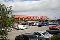 Morrison's Supermarket - geograph.org.uk - 186594.jpg 640 × 427; 74 KB
-
 Raj Medical Centre, Laceby Road - geograph.org.uk - 3193344.jpg 1,024 × 768; 109 KB
-

-
 St. Mark's, Laceby Road - geograph.org.uk - 3193332.jpg 1,024 × 569; 89 KB
-
 The A46 Laceby Road, Grimsby - geograph.org.uk - 2034810.jpg 800 × 600; 282 KB
-
 Traffic lights on A46 Laceby Road, Grimsby - geograph.org.uk - 4751760.jpg 4,272 × 2,848; 5.02 MB


