Category:Lac Rond (col de la Vanoise)
Jump to navigation
Jump to search
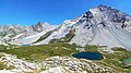
.jpg) Vue depuis le sud-ouest du lac Rond en {{date|juillet 2022}}. | |||||
| Upload media | |||||
| Instance of | |||||
|---|---|---|---|---|---|
| Located in protected area | |||||
| Location | |||||
| Mountain range | |||||
| Elevation above sea level |
| ||||
| Outflows | |||||
| Drainage basin |
| ||||
 | |||||
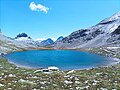
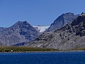
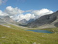
Media in category "Lac Rond (col de la Vanoise)"
The following 22 files are in this category, out of 22 total.
-
 Col de la Vanoise et Lac Rond rive ouest en été (août 2022).JPG 3,216 × 2,412; 4.76 MB
-
 Col de la Vanoise, ete 2022 (2).jpg 3,264 × 1,836; 1.6 MB
-
 Col de la Vanoise, ete 2022 (3).jpg 3,264 × 1,836; 1.68 MB
-
 Col de la Vanoise, ete 2022 (6).jpg 4,896 × 2,752; 4.18 MB
-
 L Rond et lcv C Vanoise.JPG 2,592 × 1,944; 2.18 MB
-
 Lac Rond 1.jpg 4,000 × 2,992; 6.18 MB
-
 Lac Rond en direction de l'est en Vanoise (août 2022) 1.JPG 3,264 × 2,448; 4.32 MB
-
 Lac Rond en direction de l'est en Vanoise (août 2022) 2.JPG 3,264 × 2,448; 4.47 MB
-
 Lac Rond en direction de l'est en été (août 2022).JPG 3,264 × 2,448; 5.51 MB
-
 Lac Rond en direction Pierre Brune en Vanoise (août 2022).JPG 3,264 × 2,448; 4.6 MB
-
 Lac Rond et Glacier du Vallonnet en été (août 2022) 1.JPG 3,204 × 2,380; 5.34 MB
-
 Lac Rond et Glacier du Vallonnet en été (août 2022) 2.JPG 3,264 × 2,448; 3.94 MB
-
 Lac Rond et Lac du Col de la Vanoise en été (août 2022).JPG 3,264 × 2,448; 5.3 MB
-
 Lac rond next C Vanoise.JPG 2,592 × 1,944; 2.19 MB
-
 Lac rond près du col de la Vanoise.JPG 1,952 × 2,608; 1.48 MB
-
 Lac Rond, Pralognan.jpg 2,261 × 1,256; 977 KB
-
 Pointe Mathews et rive nord du Lac Rond en été (août 2022).JPG 3,168 × 2,376; 4.23 MB
-
 Rive ouest du Lac Rond côté Termignon (août 2022).JPG 3,264 × 2,448; 4.7 MB
-
 Rive sud Lac Rond en Vanoise en été (août 2022).JPG 3,224 × 2,396; 5.55 MB
-
 Sentier de randonnée et Lac Rond côté Termignon (août 2022).JPG 3,264 × 2,448; 5.12 MB
-
 Vanoise National Park - Pralo Area 2.jpg 2,772 × 1,141; 1.2 MB
-
 VLacRond01.jpg 2,464 × 1,619; 562 KB
.JPG)
.jpg)
.jpg)


_1.JPG)
_2.JPG)
.JPG)
.JPG)
_1.JPG)
_2.JPG)
.JPG)


.JPG)
.JPG)
.JPG)
.JPG)
