Category:Labelled administrative maps of Italy
Jump to navigation
Jump to search
Media in category "Labelled administrative maps of Italy"
The following 14 files are in this category, out of 14 total.
-
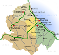
Regione Abruzzo mappa2.png 800 × 738; 222 KB
-
Map of region of Emilia-Romagna, Italy, with provinces-it.svg 4,800 × 2,530; 186 KB
-
Map of region of Friuli-Venezia Giulia, Italy, with provinces-it.svg 4,316 × 3,831; 102 KB
-
Unioni territoriali intercomunali del Friuli-Venezia Giulia.png 1,300 × 1,300; 102 KB
-
Italien Regionen Metropolitanstädte.png 1,830 × 2,177; 135 KB
-
Map of region of Lombardy, Italy, with provinces-it.svg 5,930 × 5,262; 237 KB
-
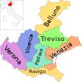
Map of region of Veneto, Italy, with provinces-it.svg 3,346 × 3,385; 170 KB
-
Map of region of Marche, Italy, with provinces-it.svg 3,504 × 3,450; 114 KB
-
Map of region of Piedmont, Italy, with provinces-it.svg 3,493 × 4,314; 216 KB
-
Map of region of Apulia, Italy, with provinces-it.svg 4,170 × 3,287; 84 KB
-
Map of region of Sicily, Italy, with provinces-de.svg 8,803 × 6,748; 137 KB
-
Map of region of Sicily, Italy, with provinces-it.svg 8,803 × 6,748; 137 KB
-
Map of region of Tuscany, Italy, with provinces-it.svg 3,624 × 4,010; 228 KB
-
Map of region of Umbria, Italy, with provinces-it.svg 3,705 × 4,496; 89 KB


