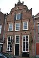
Category:Laarstraat 48, Zutphen
Jump to navigation
Jump to search
| Object location | | View all coordinates using: OpenStreetMap |
|---|
building in Zutphen, Netherlands  | |||||
| Upload media | |||||
| Instance of | |||||
|---|---|---|---|---|---|
| Location | Zutphen, Gelderland, Netherlands | ||||
| Street address |
| ||||
| Located on street |
| ||||
| Heritage designation |
| ||||
 | |||||
|
This is a category about rijksmonument number 41243
|
| Address |
|
Media in category "Laarstraat 48, Zutphen"
The following 5 files are in this category, out of 5 total.
-
 Overzicht - Zutphen - 20227490 - RCE.jpg 1,200 × 802; 155 KB
-
 Voorgevel - Zutphen - 20227493 - RCE.jpg 867 × 1,200; 200 KB
-
 Zutphen - Laarstraat 48.JPG 2,304 × 3,072; 3.49 MB
-
 Zutphen, Netherlands - panoramio (32).jpg 2,048 × 1,375; 403 KB
-
 Zutphen, Netherlands - panoramio (37).jpg 1,375 × 2,048; 537 KB


.jpg)
.jpg)