Category:La Chambotte
Jump to navigation
Jump to search
.JPG) | |||||
| Upload media | |||||
| Instance of | |||||
|---|---|---|---|---|---|
| Location | Entrelacs, Savoie, Auvergne-Rhône-Alpes, Metropolitan France, France | ||||
| Mountain range | |||||
| Elevation above sea level |
| ||||
 | |||||
Media in category "La Chambotte"
The following 53 files are in this category, out of 53 total.
-
 Belvédère de la Chambotte (51043084503).jpg 6,240 × 4,160; 9.11 MB
-
 Belvédère de la Chambotte (51043903307).jpg 5,472 × 3,648; 7.46 MB
-
 Belvédère de la Chambotte @ Lac du Bourget @ Mont Laval (51043742041).jpg 5,472 × 3,648; 5.87 MB
-
 Col de la Chambotte (51043005328).jpg 6,240 × 4,160; 9.79 MB
-
 Col de la Chambotte (51043078733).jpg 6,240 × 4,160; 10.1 MB
-
 Col de la Chambotte (51043737301).jpg 6,240 × 4,160; 9.76 MB
-
 Col de la Chambotte (51043902127).jpg 6,240 × 4,160; 8.7 MB
-
 Col de la Chambotte (51043903027).jpg 6,240 × 4,160; 8.88 MB
-
 Col de la Chambotte (51043903107).jpg 6,240 × 4,160; 8.35 MB
-
 Col de la Chambotte (51043907197).jpg 6,240 × 4,160; 9.43 MB
-
 Col de la Chambotte - Panneau (mai 2023).jpg 4,032 × 3,024; 4.24 MB
-
 Col de la Chambotte @ Entrelacs (51025077156).jpg 4,864 × 3,648; 4.7 MB
-
 Col de la Chambotte @ Entrelacs (51025078096).jpg 4,864 × 3,648; 5.28 MB
-
 Col de la Chambotte @ Entrelacs (51025078191).jpg 4,864 × 3,648; 6.86 MB
-
 Croix @ Col de la Chambotte (51043078918).jpg 4,160 × 6,240; 8.19 MB
-
 Hameau et col de la Chambotte en été (août 2020).JPG 1,930 × 1,449; 2.42 MB
-
 Hameau et col de la Chambotte un matin d'été (août 2020).JPG 3,264 × 2,448; 5.64 MB
-
 La Chambotte (51043125258).jpg 6,240 × 4,160; 10.63 MB
-
 La Chambotte (51043856766).jpg 6,240 × 4,160; 12.28 MB
-
 La Chambotte (51043857271).jpg 6,240 × 4,160; 13.24 MB
-
 La Chambotte (51043946302).jpg 6,240 × 4,160; 13.03 MB
-
 La Chambotte (51043948507).jpg 6,240 × 4,160; 12.98 MB
-
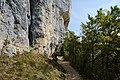
 La Chambotte - Passage hameau et col (mai 2023).jpg 4,032 × 3,024; 3.62 MB
-
 Mont Laval (51043827647).jpg 6,240 × 4,160; 5.35 MB
-
 Restaurant @ Belvédère de la Chambotte (51043081763).jpg 6,240 × 4,160; 9.47 MB
-
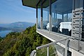 Restaurant @ Belvédère de la Chambotte (51043082003).jpg 6,240 × 4,160; 8.58 MB
-
 Restaurant @ Belvédère de la Chambotte (51043814946).jpg 6,240 × 4,160; 9 MB
-
 Restaurant @ Belvédère de la Chambotte (51043815161).jpg 6,240 × 4,160; 8.45 MB
-
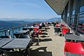 Restaurant @ Belvédère de la Chambotte (51043904787).jpg 6,240 × 4,160; 8.12 MB
-
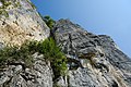
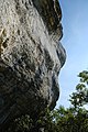
 Rocher d'escalade @ La Chambotte (51043123368).jpg 6,240 × 4,160; 11.76 MB
-
 Rocher d'escalade @ La Chambotte (51043123938).jpg 6,240 × 4,160; 10.35 MB
-
 Rocher d'escalade @ La Chambotte (51043124508).jpg 6,240 × 4,160; 9.11 MB
-
 Rocher d'escalade @ La Chambotte (51043857366).jpg 6,240 × 4,160; 6.78 MB
-
 Rocher d'escalade @ La Chambotte (51043857841).jpg 4,160 × 6,240; 9.45 MB
-
 Rocher d'escalade @ La Chambotte (51043858011).jpg 6,240 × 4,160; 10.62 MB
-
 Rocher d'escalade @ La Chambotte (51043858321).jpg 4,160 × 6,240; 10.48 MB
-
 Rocher d'escalade @ La Chambotte (51043859381).jpg 6,240 × 4,160; 12.78 MB
-
 Rocher d'escalade @ La Chambotte (51043947492).jpg 4,160 × 6,240; 9.84 MB
-
 Rocher d'escalade @ La Chambotte (51043947607).jpg 6,240 × 4,160; 12.39 MB
-
 Rocher d'escalade @ La Chambotte (51043947947).jpg 4,160 × 6,240; 8.94 MB
-
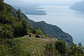
 Sous le sommet @ Mont Laval (51042785413).jpg 5,472 × 3,648; 12.01 MB
-
 Sous le sommet @ Mont Laval (51042786163).jpg 5,472 × 3,648; 6.58 MB
-
 Sous le sommet @ Mont Laval (51043516676).jpg 6,240 × 4,160; 7.41 MB
-
 Sous le sommet @ Mont Laval (51043516956).jpg 5,472 × 3,648; 4.34 MB
-
 Sous le sommet @ Mont Laval (51043517201).jpg 6,240 × 4,160; 7.86 MB
-
 Sous le sommet @ Mont Laval (51043517281).jpg 6,240 × 4,160; 4.18 MB
-
 Sous le sommet @ Mont Laval (51043517646).jpg 6,240 × 4,160; 7.42 MB
-
 Sous le sommet @ Mont Laval (51043606522).jpg 6,240 × 4,160; 6.94 MB
-
 Sous le sommet @ Mont Laval (51043606782).jpg 5,472 × 3,648; 4.85 MB
-
 Sous le sommet @ Mont Laval (51043607442).jpg 4,160 × 6,240; 5.43 MB
-
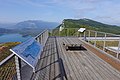
 Tour panoramique @ Belvédère de la Chambotte (51043084313).jpg 6,240 × 4,160; 8.01 MB
-
 Tour panoramique @ Belvédère de la Chambotte (51043815696).jpg 5,472 × 3,648; 7.89 MB
-
 Tour panoramique @ Belvédère de la Chambotte (51043906597).jpg 6,240 × 4,160; 8.54 MB
.jpg)
.jpg)
.jpg)
.jpg)
.jpg)
.jpg)
.jpg)
.jpg)
.jpg)
.jpg)
.jpg)
.jpg)
.jpg)
.jpg)
.jpg)
.JPG)
.jpg)
.jpg)
.jpg)
.jpg)
.jpg)
.jpg)
.jpg)
.jpg)
.jpg)
.jpg)
.jpg)
.jpg)
.jpg)
.jpg)
.jpg)
.jpg)
.jpg)
.jpg)
.jpg)
.jpg)
.jpg)
.jpg)
.jpg)
.jpg)
.jpg)
.jpg)
.jpg)
.jpg)
.jpg)
.jpg)
.jpg)
.jpg)
.jpg)
.jpg)
.jpg)
.jpg)